The Arizona Monsoon Season has officially started as of today, June 15th. It is starting in the Southeast Arizona zones and is quite nominal, however no sign of relief for the fires in sight.
Many people are grateful for the rain Southeast Arizona is getting today, however these are not the types of storms you want. These have little rainfall with them, but a ton of lightning and strong winds. These are the types that spread and create wildfires in Arizona and the very reason June is the most dangerous month for dry thunderstorms and high fire risks in the state. Well when is the monsoon going to ramp up?
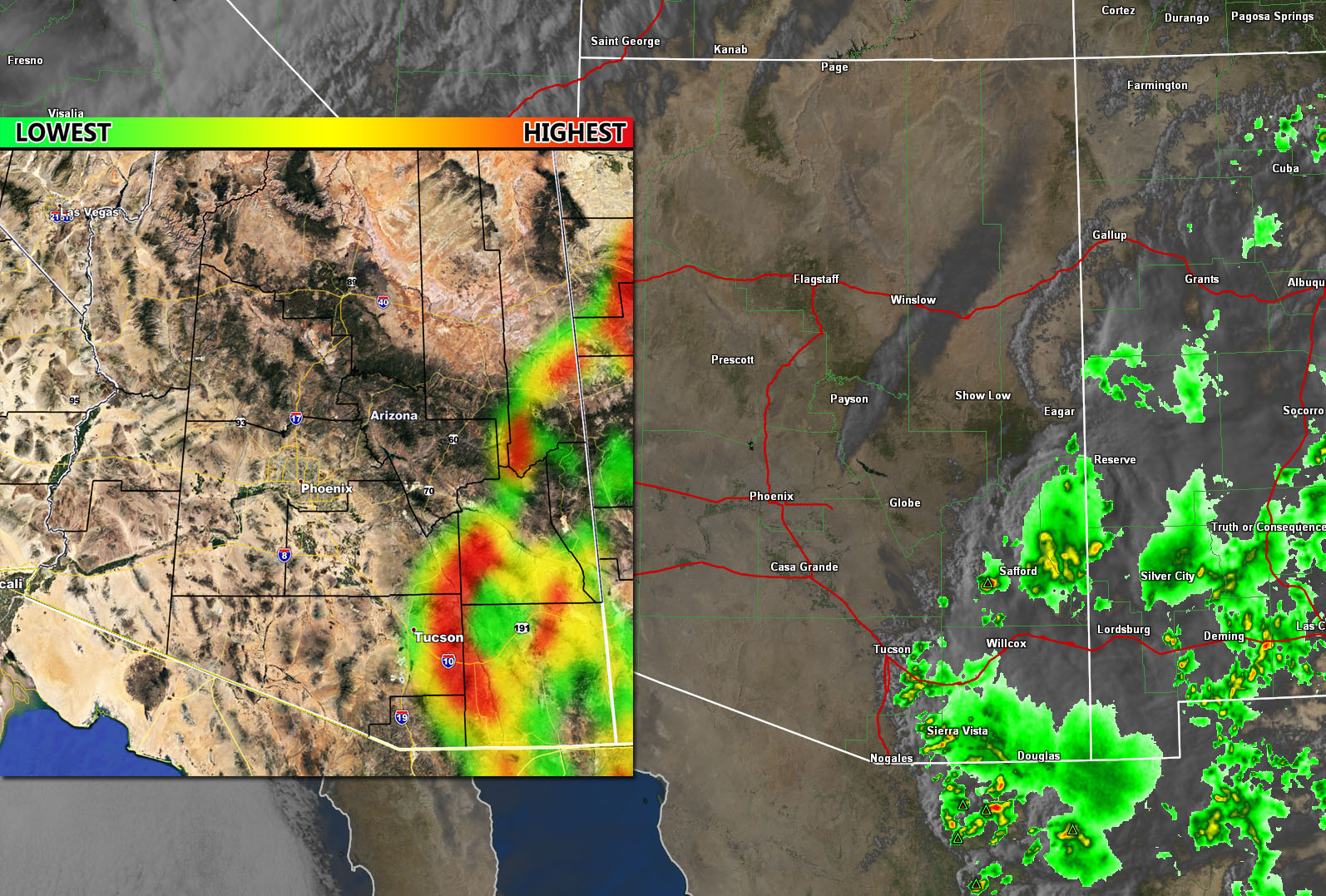
Tucson is sitting at a dewpoint of 38 today, with Sierra Vista at 57. A trough along the west coast will shove the moisture east of Arizona after Tuesday, ending any chance of return moisture for quite some time. The monsoon forecast model worked flawlessly today in showing most of the activity would be east of Tucson, with none northwest of the city and especially nothing in Phoenix. Here at Arizona Weather Force, I created a new group for those model postings each morning for you. You can join the group by CLICKING HERE.
It is my hope that this new model will continue to get better and serve the people of Arizona a forecast they have always wanted.
MONSOON START DATE: Projections here at Arizona Weather Forecast are showing the monsoon rushing to develop with the four corners ridge finally setting up shop by July 4th. This is pretty nominal and as stated in previous updates (click here) I do think this season will be average to above average for rainfall across the state, especially the southern half.