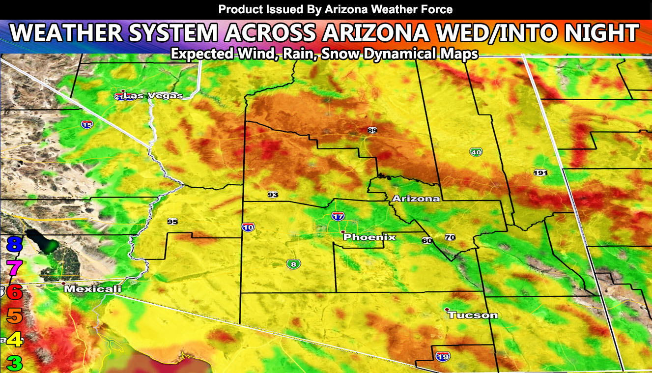
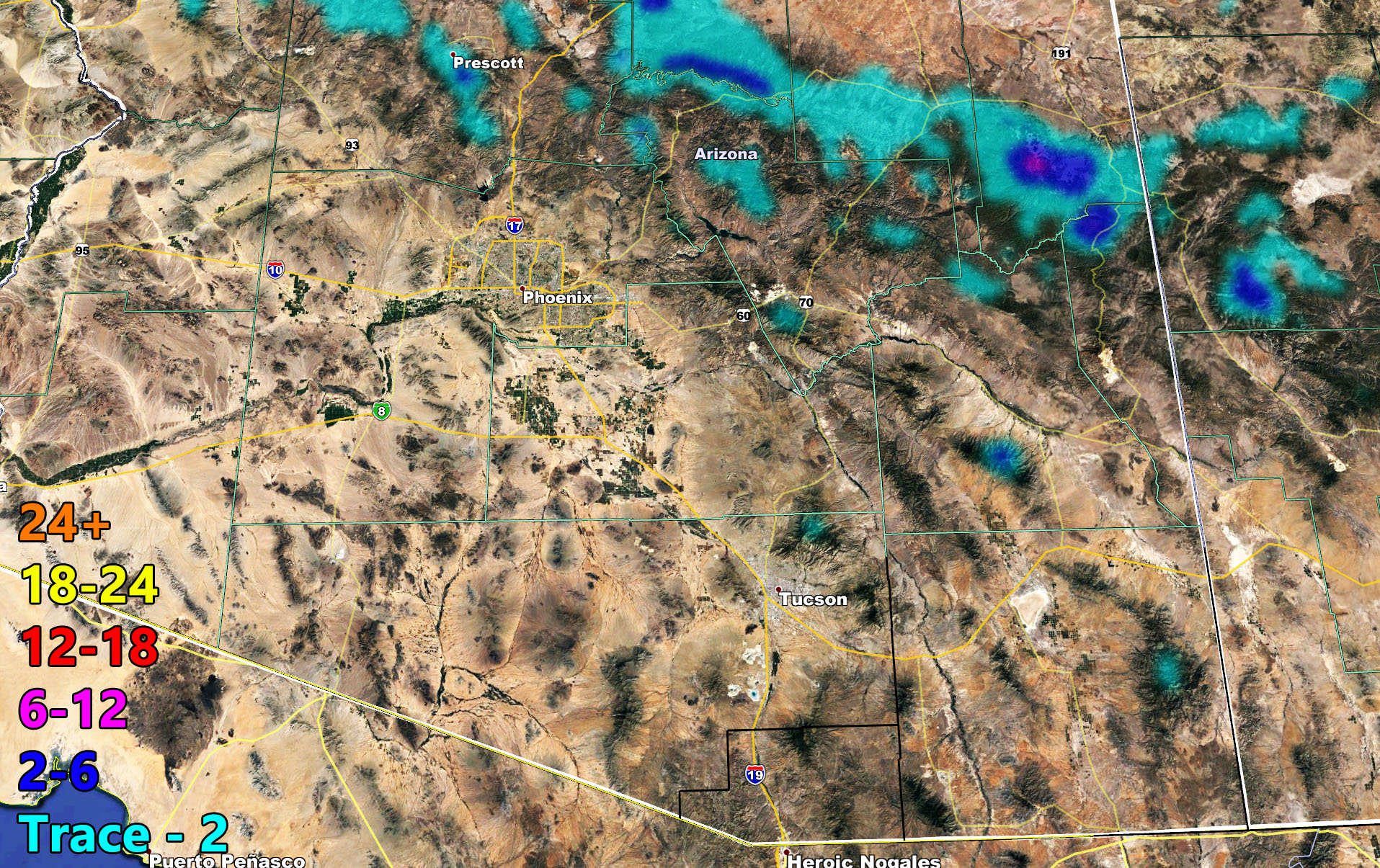
A weather system will move into Arizona on Wednesday, producing a statewide wind gust event. The wind model inside this article has what your intensity levels will be. Some areas will see blowing sand/dust so travel caution should be exercised. Inside you will find rain, snow, and wind models here from AZWF. The only note I can give is the light blue trace blurbs in Maricopa County on Wednesday night. This could be thunderstorm dynamics, isolated form, showing up, especially northern county. Read on for details and see the maps …
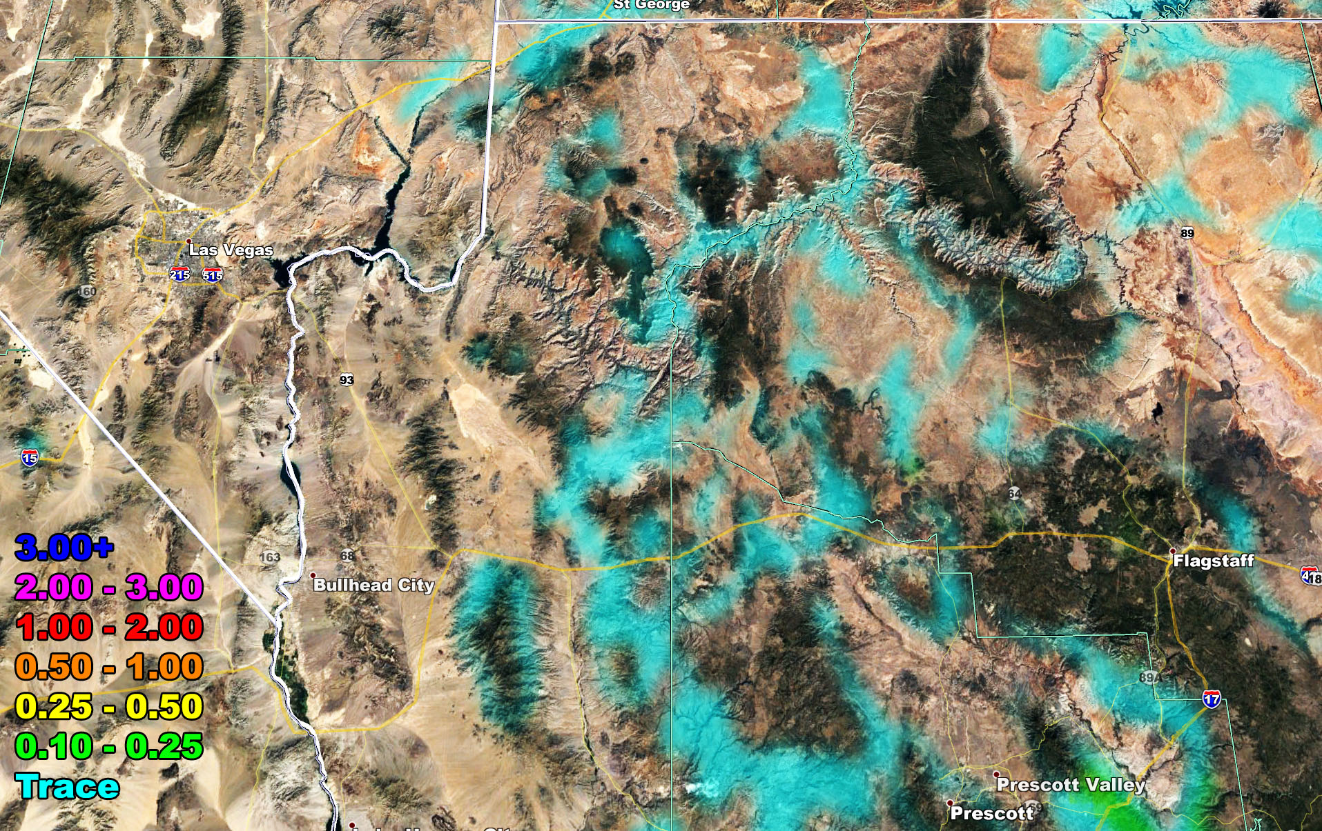
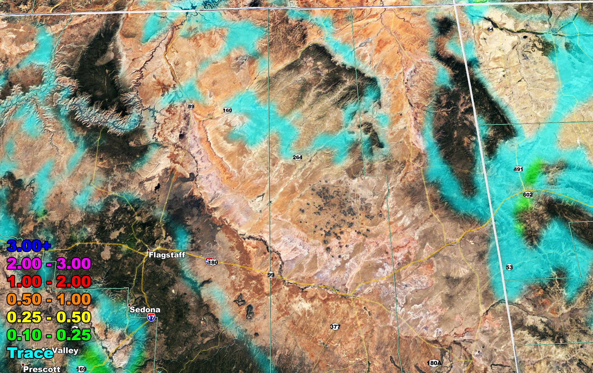
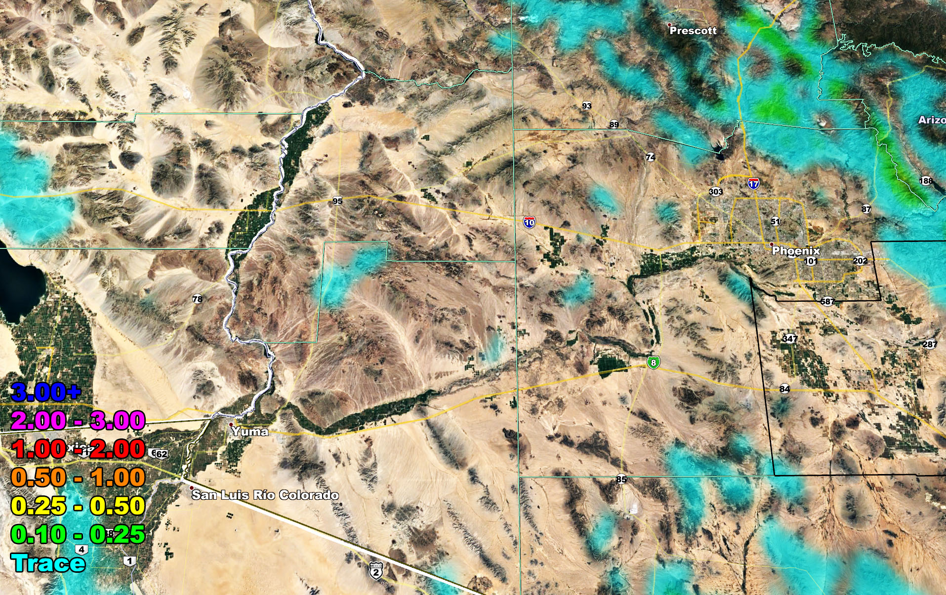
The AZWF model image suite below is so you can see your zone region covered. Keep in mind that these are the most comprehensive images around. They are touchy to the micro-climate and in the rain and flood risk model, you will only see the expected risk or amount. Those models actually cancel out the snow so before you saw flood risks covering the mountains? The new models remove that and make it easier to know what to expect.
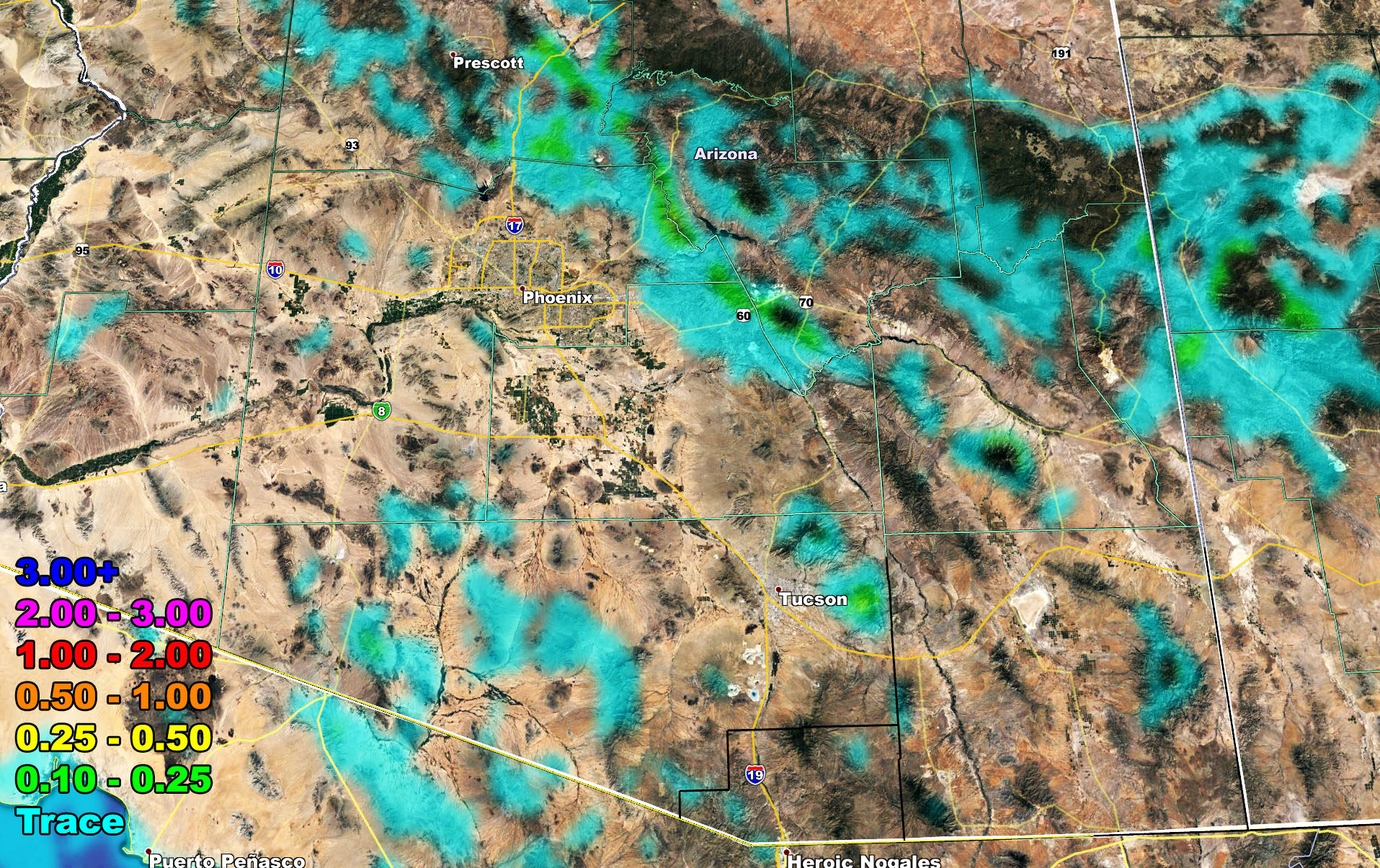
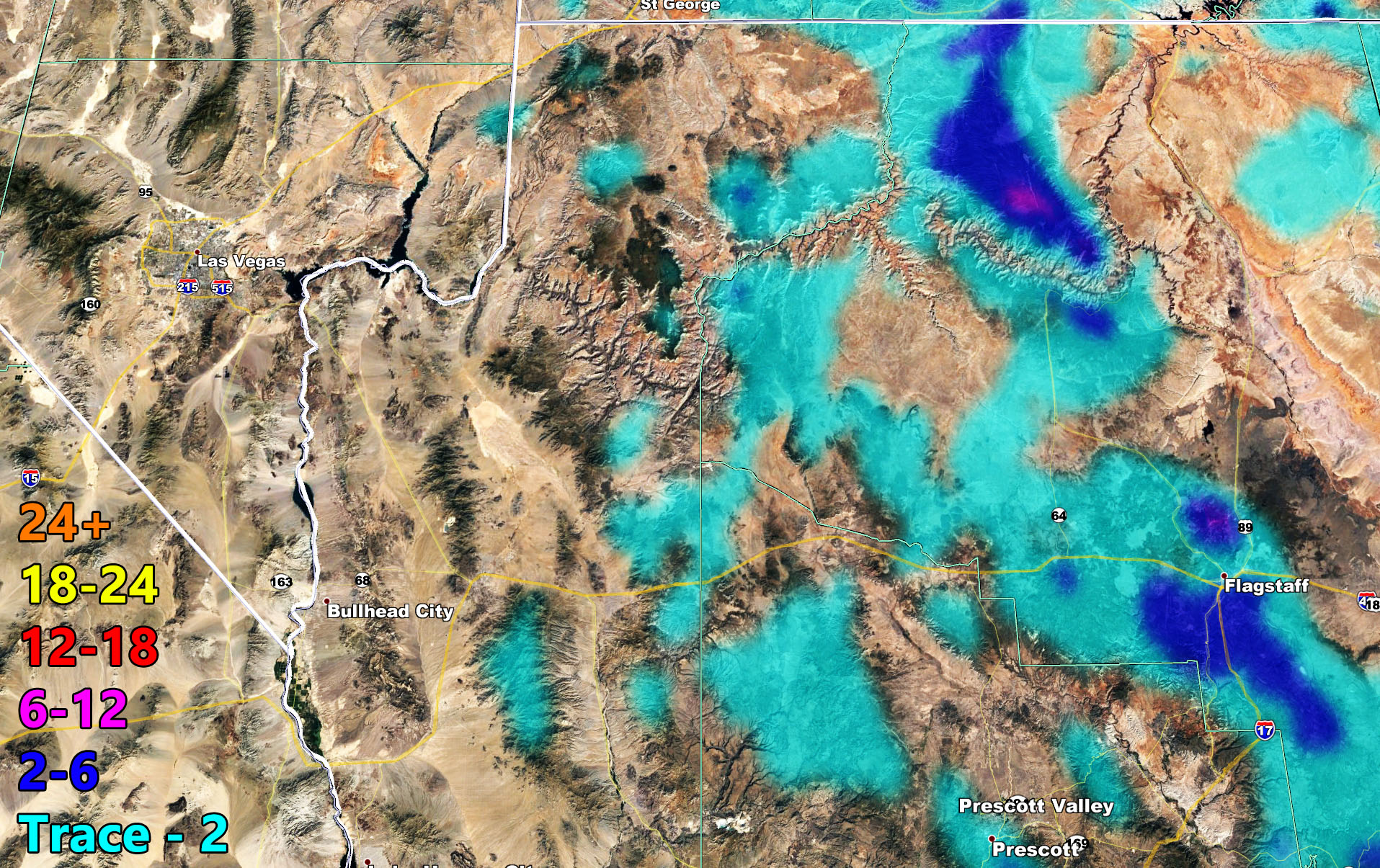
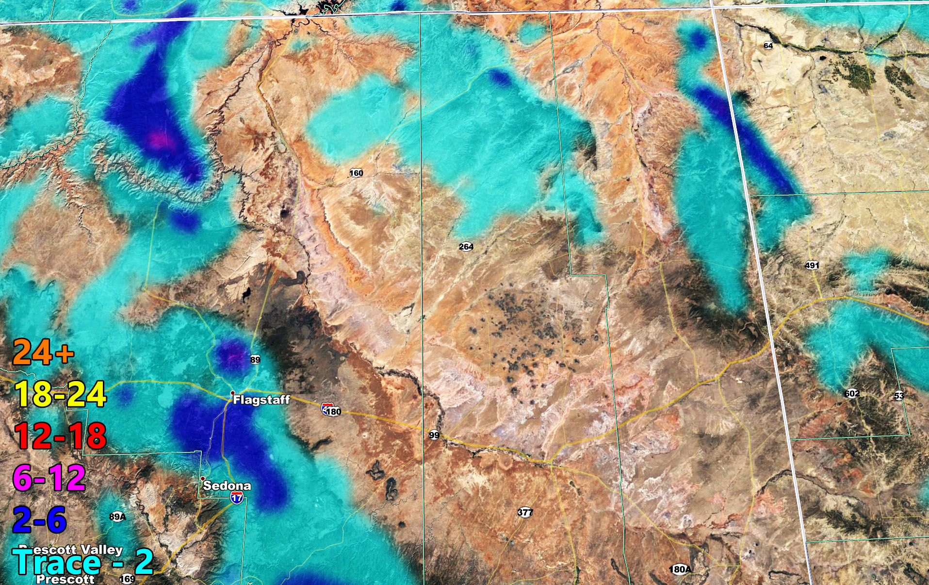
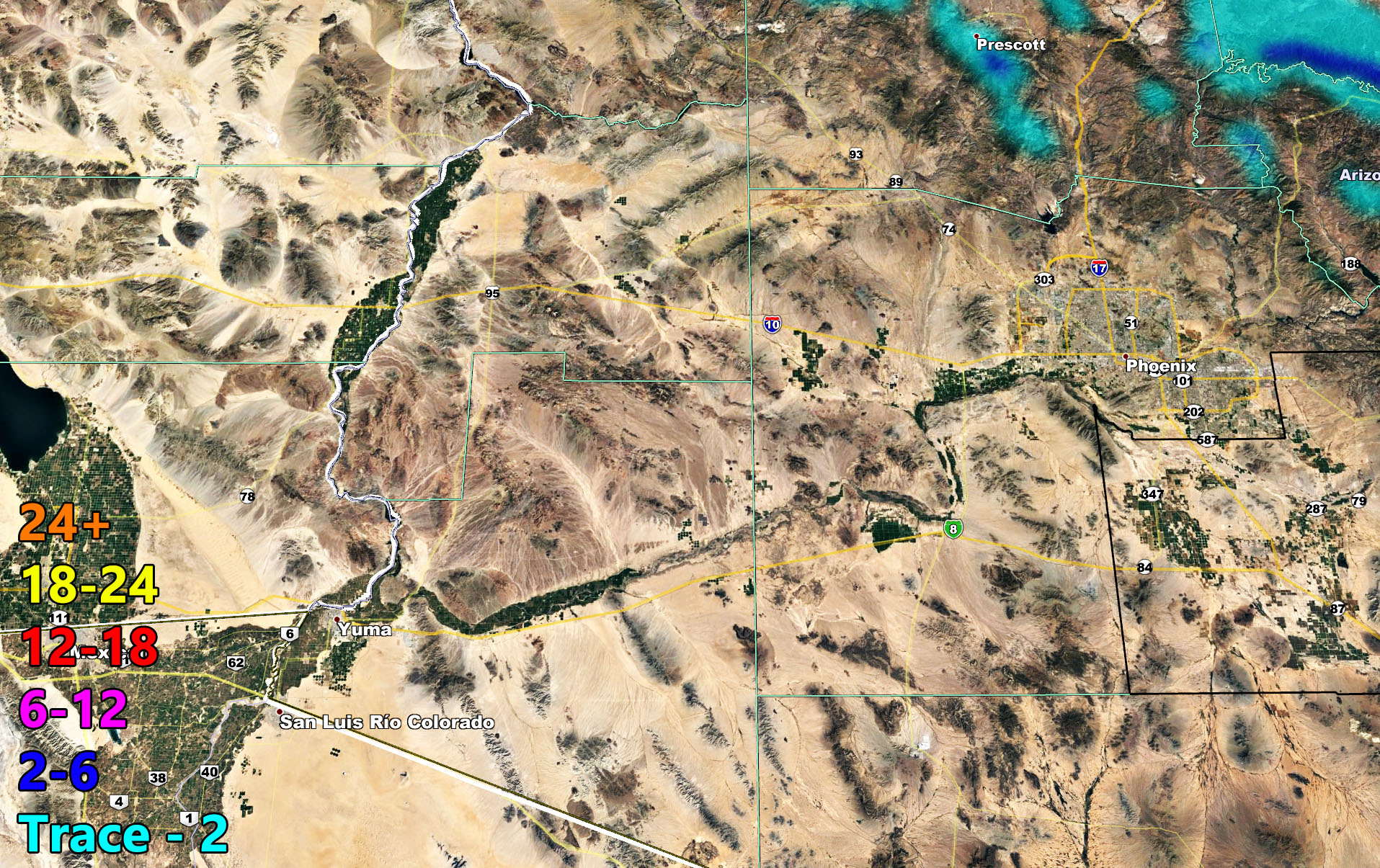
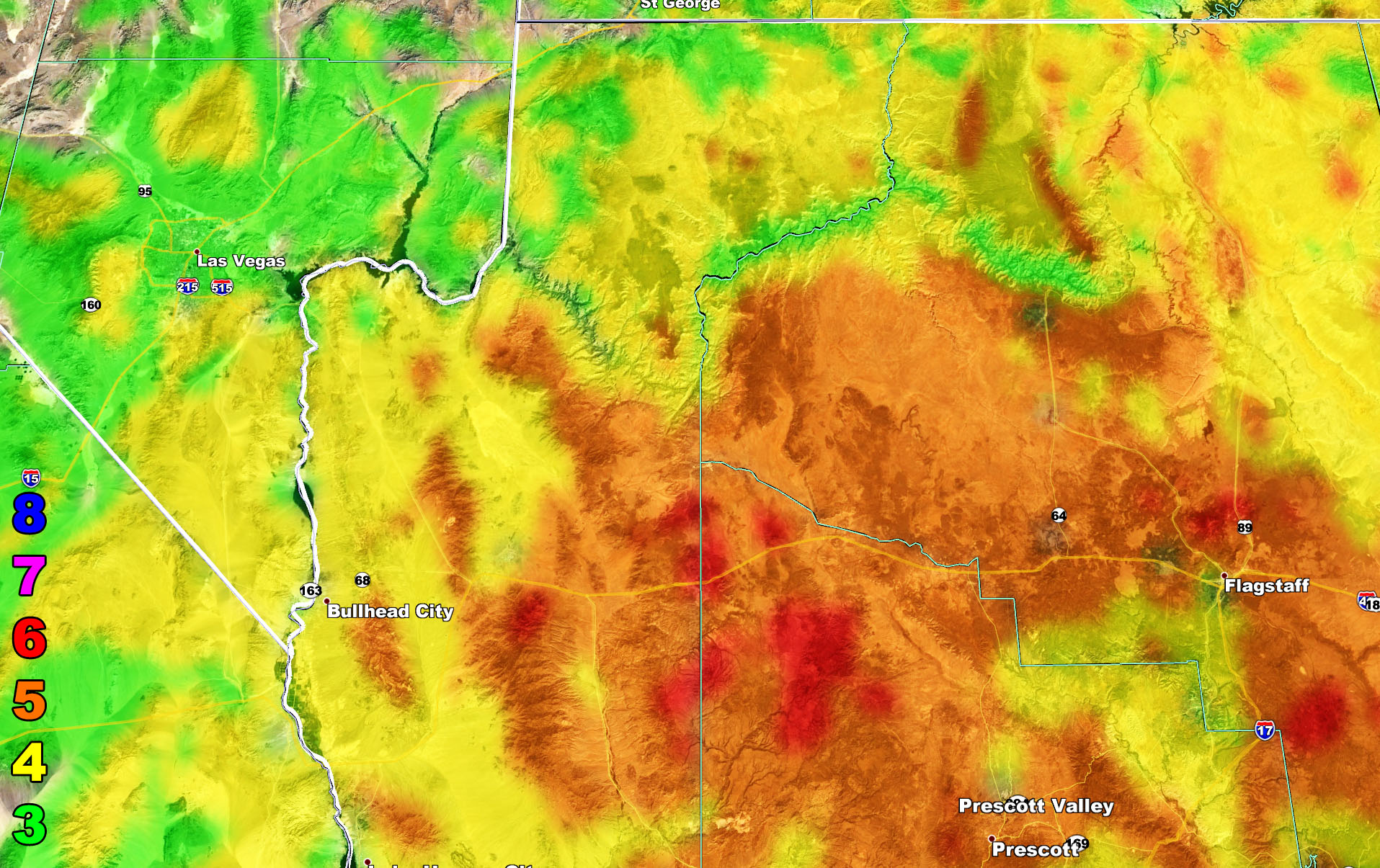
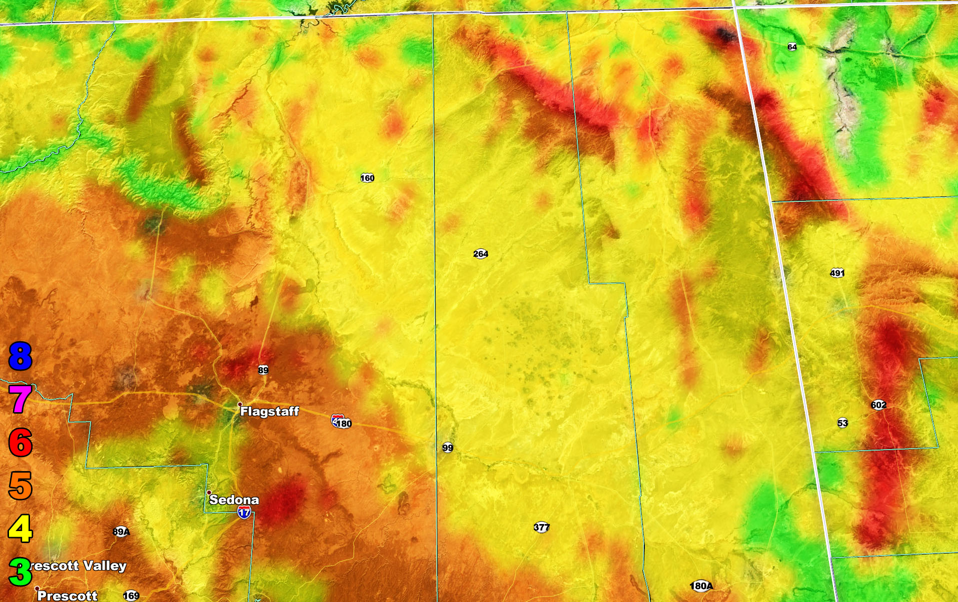
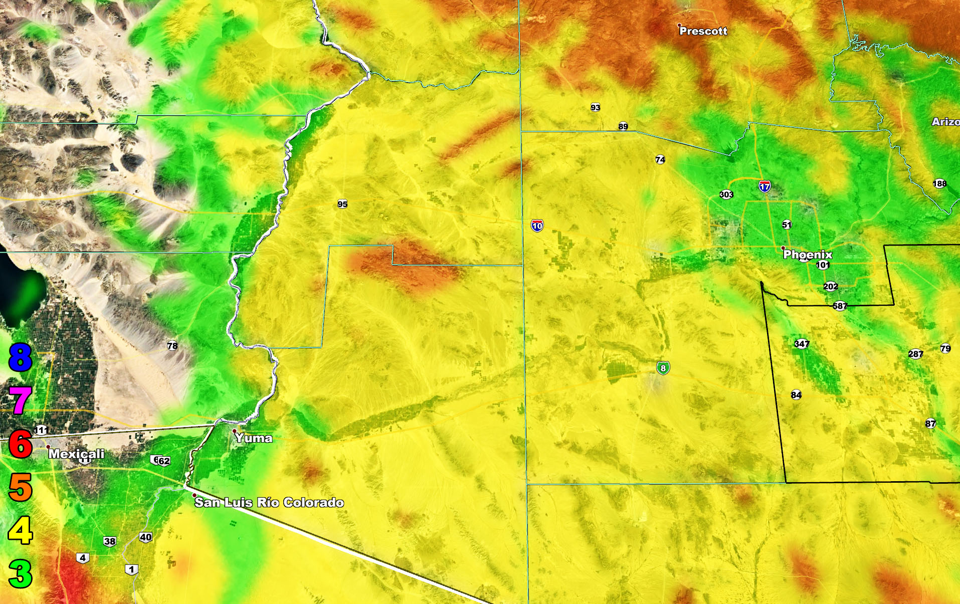
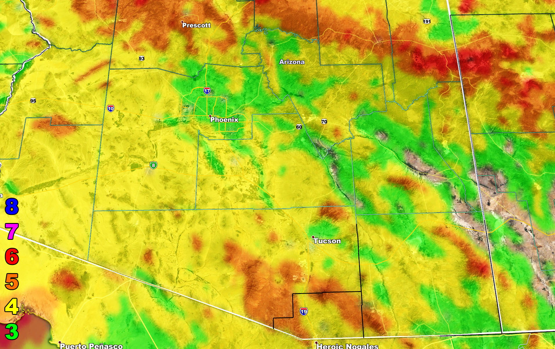
I control all the counties in Arizona so there is a lot to say for various areas. The best I can do is let the images below speak for themselves. They are separated into three rows of four. Four zones that I control. If you are in Arizona, you are in one of these. Each is identical so zone 1 is the same on all the rows and so on. Here is the key to the rows below. They are extremely detailed. Zone 1 is NW AZ, 2 is NE AZ, 3 is SW AZ including Phoenix, and 4 is SE AZ including Tucson.
Row 1 – Rain Risk
Row 2 – Snow Risk
Row 3 – Wind Risk
NOTE: You also can get e-mailed alerts/articles because if you do not want to miss my social media posts, and/or I issue a product not on my social media accounts, being a supporting website member is the way to go. Click here if you are interested in reading more.
Row 1 – Rain Risk
Row 2 – Snow Risk
Row 3 – Wind Risk
Martin Wind Gust Intensity Scale –
8. Extensive widespread damage.
7. Trees are broken or uprooted, building damage is considerable. – High Profile Vehicle Roll-Over CERTAIN.
6. SOME Trees are broken or uprooted, building damage is possible. – High Profile Vehicle Roll-Over Likely, Do NOT recommend Traveling in this zone
5. Slight damage occurs to buildings, shingles are blown off of roofs. HIGH WIND WARNING CRITERIA – High Profile Vehicle Roll-Over Possible if weight is not corrected.
4. Twigs and small branches are broken from trees, walking is difficult.
3. Large trees sway, becoming difficult to walk. WIND ADVISORY CRITERIA
MAIN WEBSITE: Don’t forget. If you hear rain or anything is coming to the area. BOOKMARK THE MAIN WEBSITE BY CLICKING HERE. The stream has the latest alert links, a map of alerts and where, and articles. That is 100% free to view. There should be no reason you shouldn’t be informed.
Arizona Weather Force is now on MeWe – Link – https://mewe.com/p/arizonaweatherforce
As always, stay tuned to Arizona Weather Force for official forecasts and updates on weather across Arizona and if it says ‘like page’ below, hit the button and get future updates.
Remember: Micro-climate alerts will be issued over the premium email alert system. FB groups have been shut down from posting because FB sees my multi-posting as spamming and their ‘robot’ is preventing me from continuing. emailed custom weather alerts can be signed up for on the AZWF website if you need them – https://arizonaweatherforce.com/azwf-supporter-monthly-bundle-member-sign-up-form/