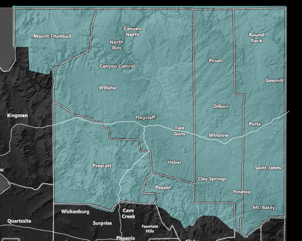
Issued Zones: Arizona Mountain Rim Cities To The North Rim Of The Grand Canyon
Site: Arizona Weather Force has issued a Winter Weather Watch effective now for Tuesday morning into Thursday …
Date: 1/16/21 at 12:10pm PT
Forecast: A powerful inside slider will drop out of the north overnight on Monday. As it moves south of Southern California the wrap-around dynamics will bring strong lifting across the entire winter weather watch area through Wednesday.
The snowfall will effect these zones by early Tuesday morning. A median sticking snow-level of around 5,500 FT with snow possible down through the 4,500 ft mark. This places the heaviest in Flagstaff and Prescott with lesser amounts in the Payson areas. Still, along the hardest hitting spots, 4-8″ of snow for a margin seems about right. Some areas are indeed isolated winter storm warning criteria zones like in the Flagstaff areas.
The upper system will move over the area on Wednesday, which will up the snow-levels with the southerly flow warm air advection dynamic moving in. Snow-levels will move to 7,000 FT by that time so in some spots it’ll snow on Tuesday and rain on Wednesday.
More storm systems are lining up for the Rim for later on for the 24th and after. A winter weather watch means conditions are favorable for any type of snowfall. It is below the higher risk winter storm watch criteria, however as mentioned… some areas have that potential.
Snowfall risk maps will be issued with the final forecast alert.
Join The Main Arizona Weather Force Facebook Page (50 percent delivery time)
Click Here To Join The Page Today!
Arizona Weather Force MeWe Link – https://mewe.com/p/arizonaweatherforce
10 mile rule: These alerts issued on this site
means that within your zone and 10 miles from you will see the event
forecast for. You may or may not see the event but it means you are in
the zone or 10 miles from where someone will.
Forecaster: KM