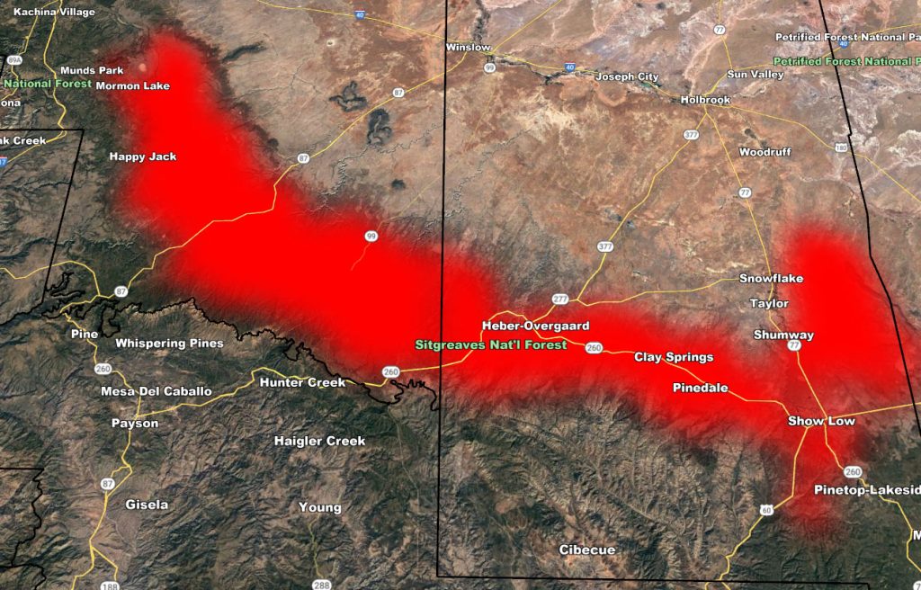
Issued Zones: Along the north Rim from Show Low, Pinedale, Clay Springs, Heber-Overgaard and over to Happy Jack, Highway 260 and 87 impacted …
Site: Arizona Weather Force has issued a Dense Fog Advisory effective overnight tonight, after midnight, until 9am Monday morning …
Date: 10/16/22 at 5:00pm PT
Forecast: An upper-level low that has brought thunderstorms to the forecast area will move into New Mexico tonight. The northeast flow around it will make low clouds develop in the advisory area. Out of this, the high surface humidity, calm wind, and recent rains at the surface will bring visibility to near or at zero.
Travels especially along the rim on Highway 260 will have a prolonged period of dense fog that will be dangerous to the unaware so drive safe or seek other options. The AZWF Fog model above shows the roads you can use to avoid longer drives within the dense fog predicted.
WANT THESE DELIVERED VIA THE APP? JOIN THE PATREON COMMUNITY TODAY FOR ALL THOSE PERKS INCLUDING BEING ON THE MICRO-CLIMATE ALERT SYSTEM BECAUSE NOT EVERY ALERT IS POSTED ON SOCIAL MEDIA FROM THIS WEATHER OFFICE – https://www.patreon.com/weatherforce
Join the Facebook Page for Further Updates If You Have Not Yet!
ARIZONA WEATHER FORCE MAIN:
Join The Main Arizona Weather Force Facebook Group (50 percent delivery time) – You can join the main AZWF page as well through that group.
Click Here To Join The Page Today
10 mile rule: These alerts issued on this site
means that within your zone and 10 miles from you will see the event
forecast for. You may or may not see the event but it means you are in
the zone or 10 miles from where someone will.
Master Meteorologist: Raiden Storm