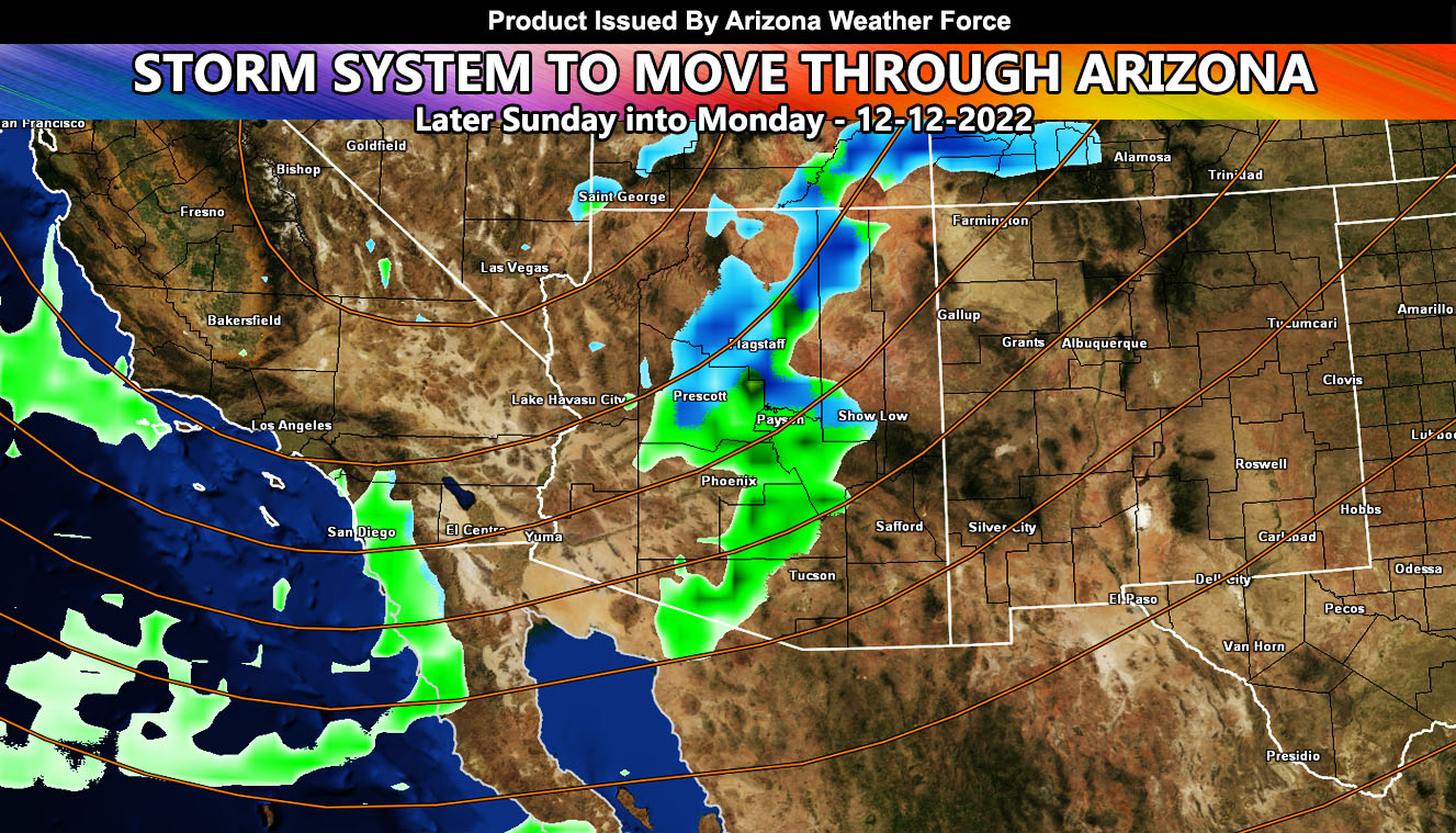
A storm system will move through the state of Arizona Sunday evening through Monday. It will deliver mountain snow and low elevation rainfall to the metros. There is even that hint of snow in the southeast part of the state, within Cochise County so for the main AZWF model images and forecast, read on …
WANT THESE DELIVERED VIA THE APP? JOIN THE PATREON COMMUNITY TODAY FOR ALL THOSE PERKS INCLUDING BEING ON THE MICRO-CLIMATE ALERT SYSTEM BECAUSE NOT EVERY ALERT IS POSTED ON SOCIAL MEDIA FROM THIS WEATHER OFFICE – https://www.patreon.com/weatherforce
Join the Facebook Page for Further Updates If You Have Not Yet!
ARIZONA WEATHER FORCE MAIN:
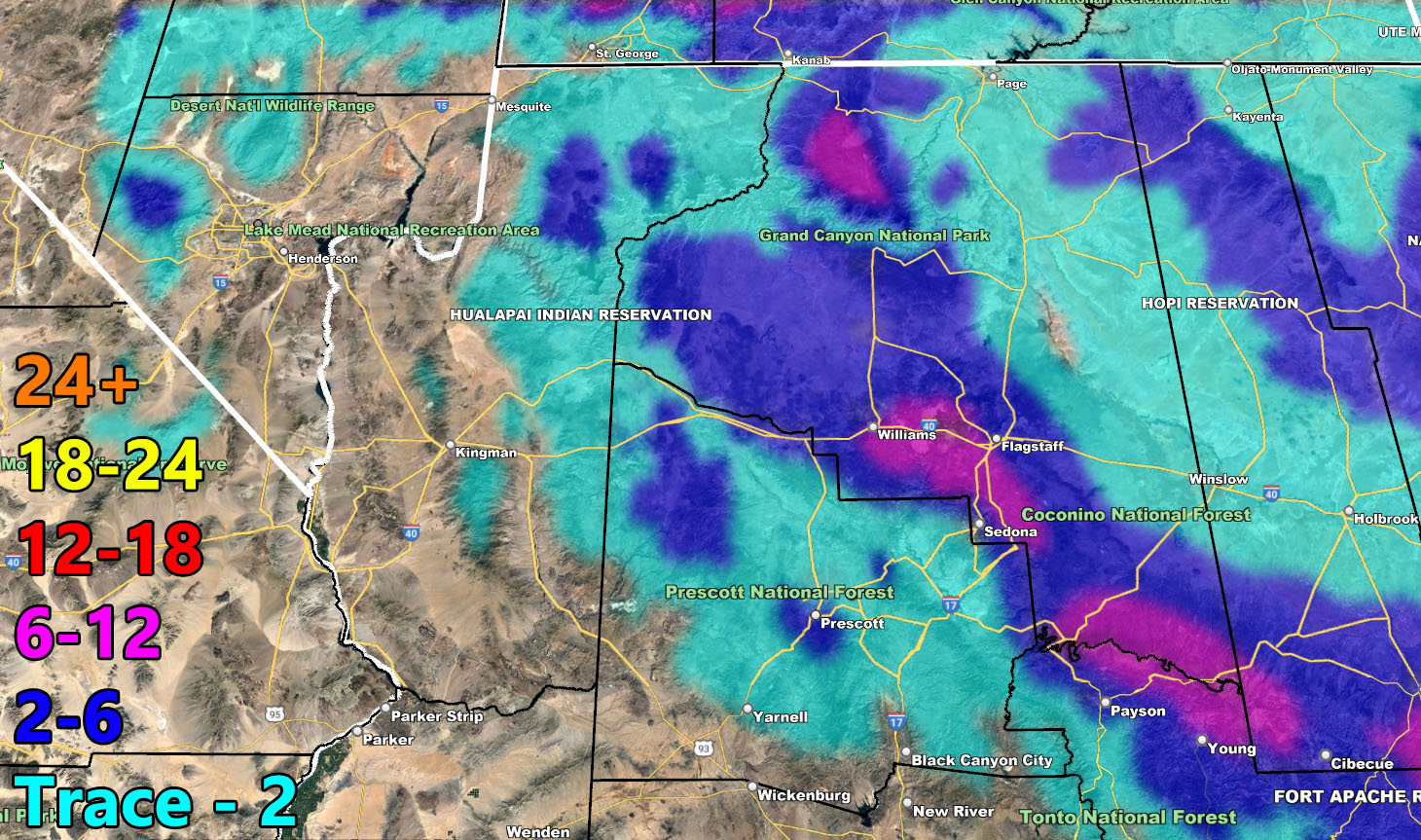
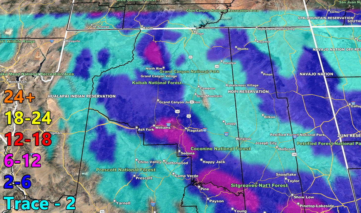
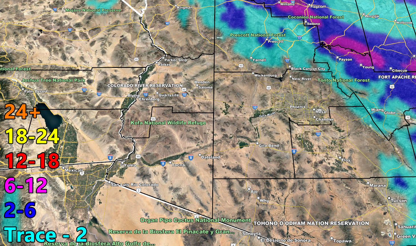
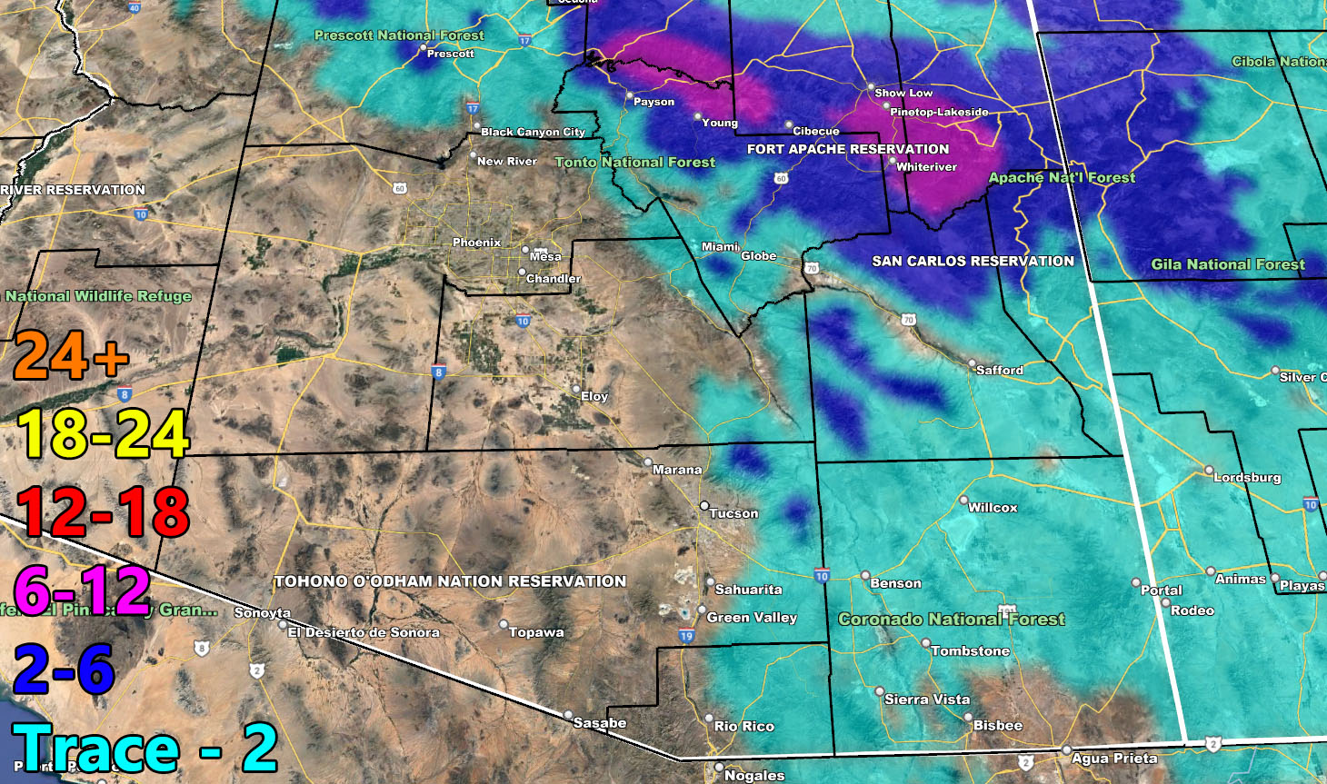
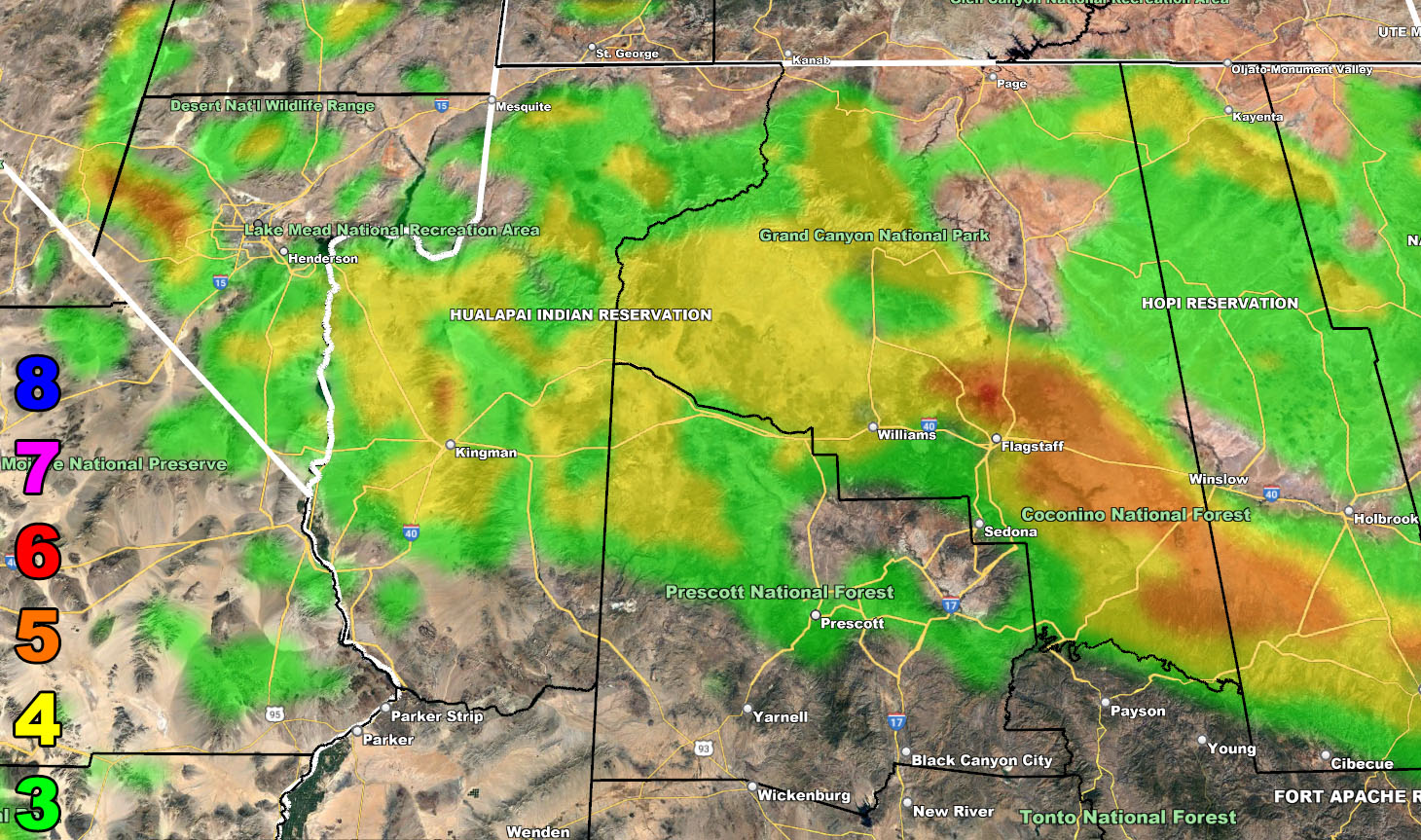
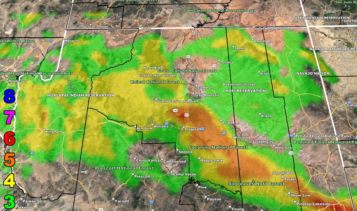
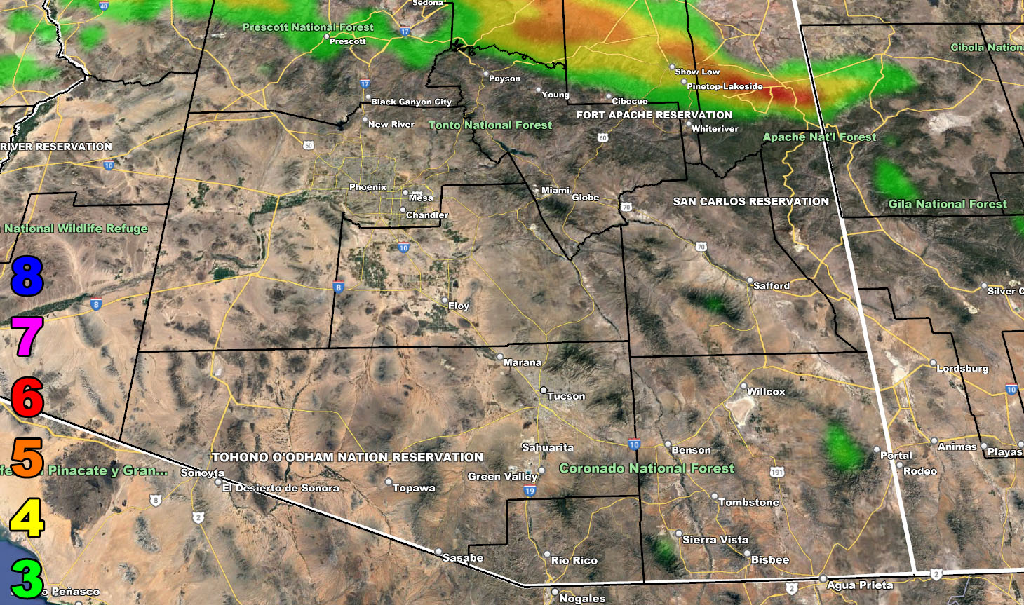
The system will have a cold front moving through Southern California as Saturday night and Sunday moves along. With the upper-level lift along it, I expect it to redevelop along the Northern half of the Colorado River Valley on Sunday evening. We could see some thunderstorms out there with it as well, talking from Kingman through to the Hoover Dam and the cities between. This will move eastward, impacting Flagstaff with heavy snowfall over the night on Sunday and move eastward through the Mogollon Rim as Monday morning moves along.
This front will also extend southward through to the Phoenix forecast areas, and even further south from there into Tucson’s forecast zone and do so mainly through Monday morning.
As Monday afternoon/evening moves along, we will see a secondary impulse move in with the colder air. This colder air will drop the snow-levels to 4,000 FT, and that means areas at that and above will see snowfall in Cochise County. It is not a major thing, but I do see a dusting to 2″ across the county then.
Maps are below for this event with rain, snow, and wind.
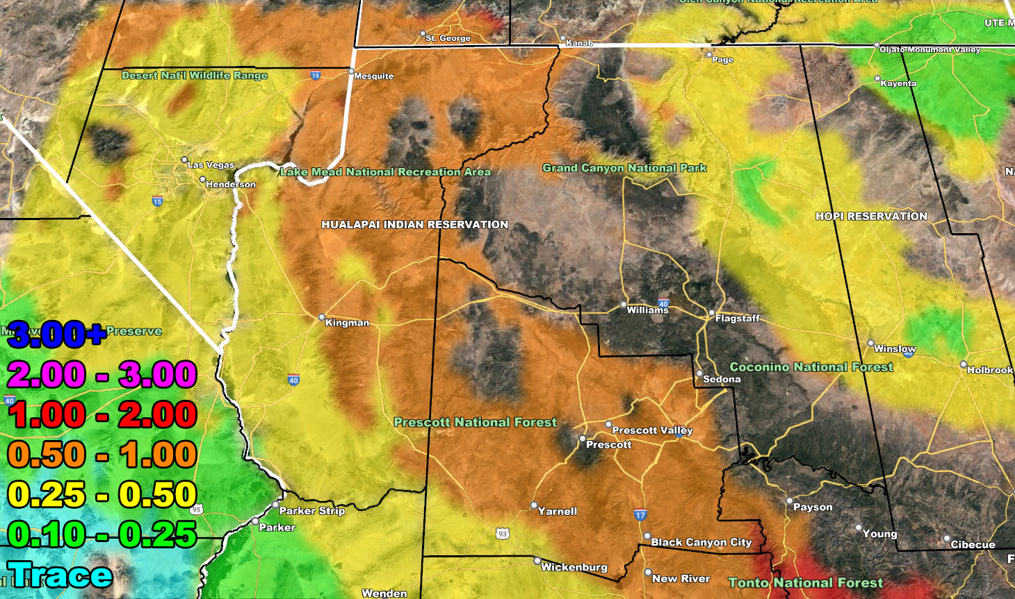
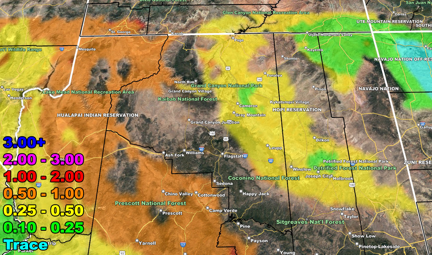
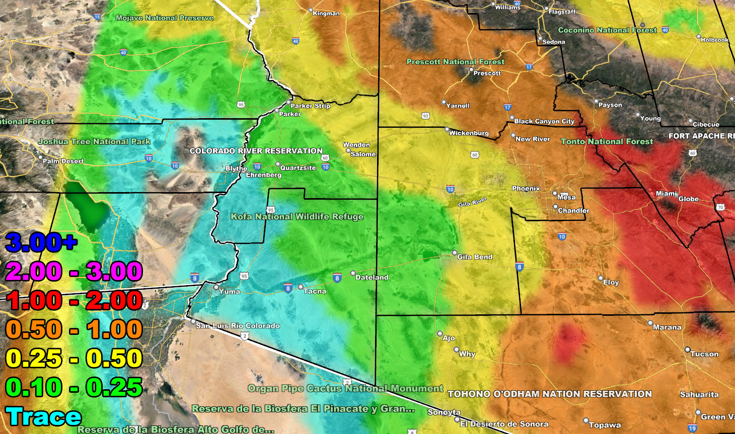
Rain Model – VALID SUNDAY THROUGH MONDAY 12-12-2022
SUPPORTING MEMBERS: Click Here To See The GPS Version Of This Model In Your Member Section Tab.

Snow Model – VALID SUNDAY THROUGH MONDAY 12-12-2022
SUPPORTING MEMBERS: Click Here To See The GPS Version Of This Model In Your Member Section Tab.
Wind Model – VALID SUNDAY THROUGH MONDAY 12-12-2022
SUPPORTING MEMBERS: Click Here To See The GPS Version Of This Model In Your Member Section Tab.
Raiden Storm Wind Gust Intensity Scale –
8. Extensive widespread damage.
7. Trees are broken or uprooted, building damage is considerable. – High Profile Vehicle Roll-Over CERTAIN.
6. SOME Trees are broken or uprooted, building damage is possible. – High Profile Vehicle Roll-Over Likely, Do NOT recommend Traveling in this zone. This zone also is the starting zone where trees and powerlines will fall and damage cars and even kill people near or in them!
5. Slight damage occurs to buildings, shingles are blown off of roofs. HIGH WIND WARNING CRITERIA – High Profile Vehicle Roll-Over Possible if weight is not corrected.
4. Twigs and small branches are broken from trees, walking is difficult.
3. Large trees sway, becoming difficult to walk. POWER SHUTDOWN THRESHOLD DURING FIRE WEATHER / WIND ADVISORY CRITERIA

WANT THESE DELIVERED VIA THE APP? JOIN THE PATREON COMMUNITY TODAY FOR ALL THOSE PERKS INCLUDING BEING ON THE MICRO-CLIMATE ALERT SYSTEM BECAUSE NOT EVERY ALERT IS POSTED ON SOCIAL MEDIA FROM THIS WEATHER OFFICE – https://www.patreon.com/weatherforce
TWITTER: Join the AZWF Twitter For Articles By Clicking Here
Join The Main Arizona Weather Force Facebook Group (50 percent delivery time of micro-climate alerts not posted on the main AZWF page) – You can join the main AZWF page as well through that group.
Click Here To Join The Page Today