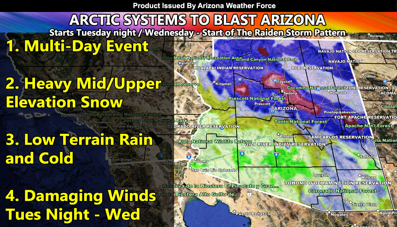
A multi-day storm event is on tap for Arizona as a powerful arctic jet stream dips down into the region within the Raiden Storm Pattern so read on for details in your area on how much wind, rain, and snow you will get along with the important maps within …
WANT THESE DELIVERED VIA THE APP? JOIN THE PATREON COMMUNITY TODAY FOR ALL THOSE PERKS INCLUDING BEING ON THE MICRO-CLIMATE ALERT SYSTEM BECAUSE NOT EVERY ALERT IS POSTED ON SOCIAL MEDIA FROM THIS WEATHER OFFICE – https://www.patreon.com/weatherforce
Join the Facebook Page for Further Updates If You Have Not Yet!
ARIZONA WEATHER FORCE MAIN:
A widespread wind event is going to slam Arizona starting Tuesday night and going into Wednesday. This arctic blast will be due to a 150-mph upper-level jet stream moving over the region. This will cause damage in many areas, including the metros. Prescott stands a chance at having wind gusts over 70+ mph, or hurricane force. Damage is sure to happen up there.
In addition to that, this will bring a round of mid/upper elevation snowfall through Wednesday, some of Thursday, with a break on Friday. After Friday, a secondary system will move through over the weekend.
Key points about this storm system are as followed.
- Widespread damaging wind event Tuesday night into Wednesday.
- Prescott will see the most snow so far this season from this pattern along with hurricane force wind gusts.
- Heavy Mogollon Zone Snowfall
- Friday will be the calmest day of this event, in-between storm systems.
Use the AZWF model information below for the grid zones in your section of the state.
DO NOT FORGET TO LOOK AT THE VALID TIMING IT IS FOR
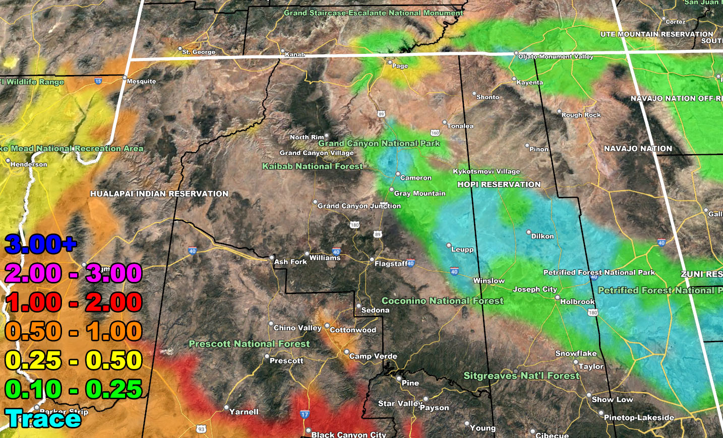
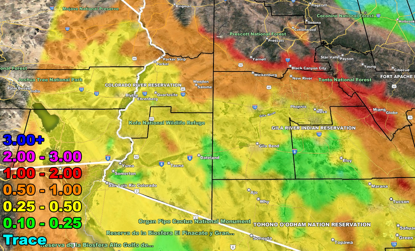
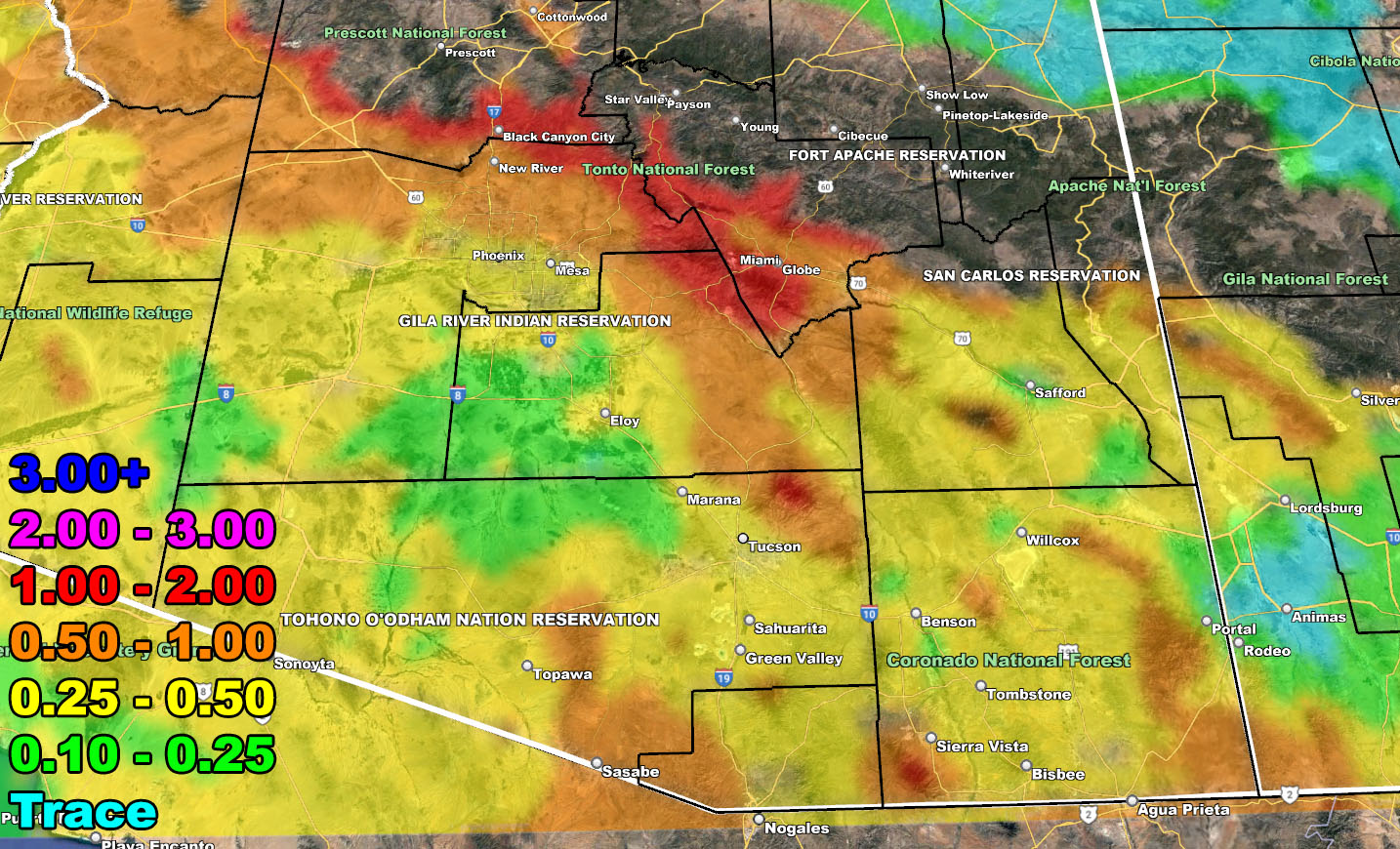
Rain Model – VALID TUESDAY NIGHT AND THROUGH THE WEEKEND – 2-21-2023 TILL 2-27-2023
SUPPORTING MEMBERS: Click Here To See The GPS Version Of This Model In Your Member Section Tab.

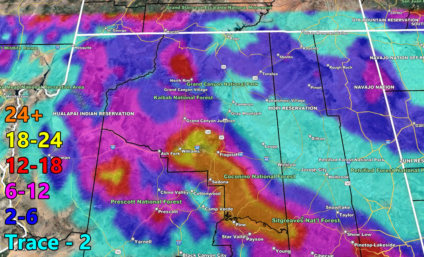
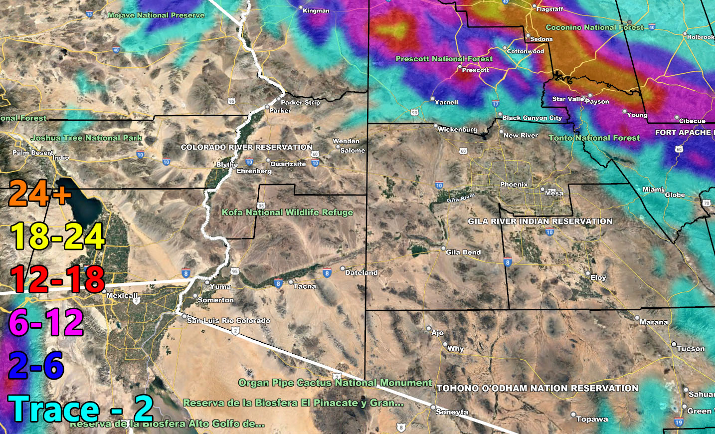
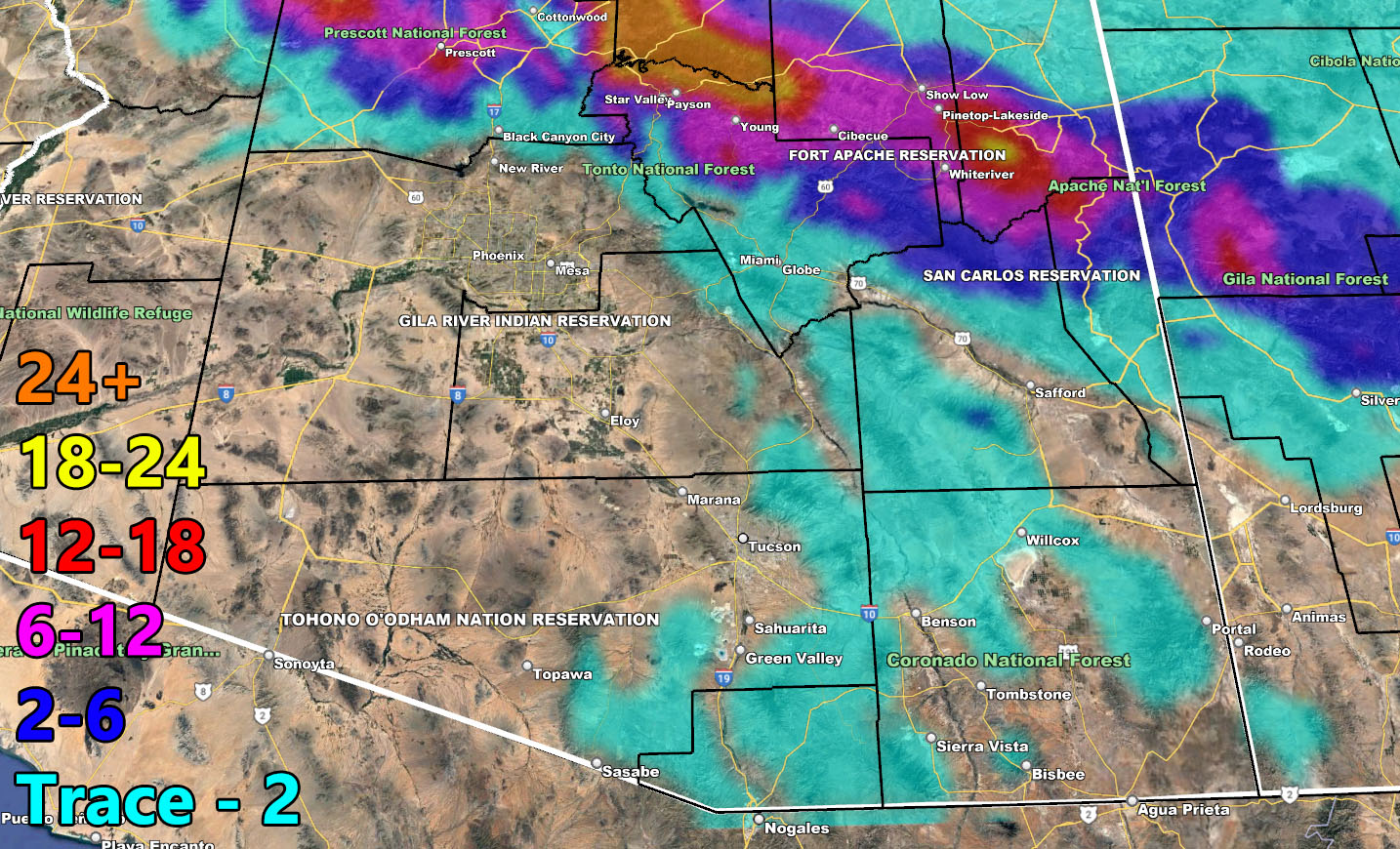
Snow Model – VALID TUESDAY NIGHT AND THROUGH THE WEEKEND – 2-21-2023 TILL 2-27-2023
SUPPORTING MEMBERS: Click Here To See The GPS Version Of This Model In Your Member Section Tab.

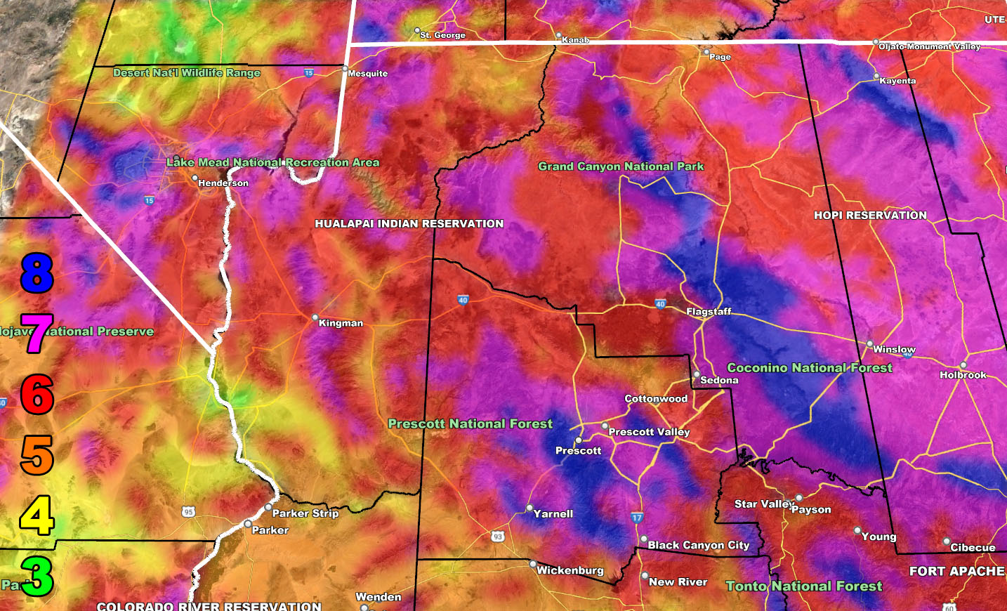
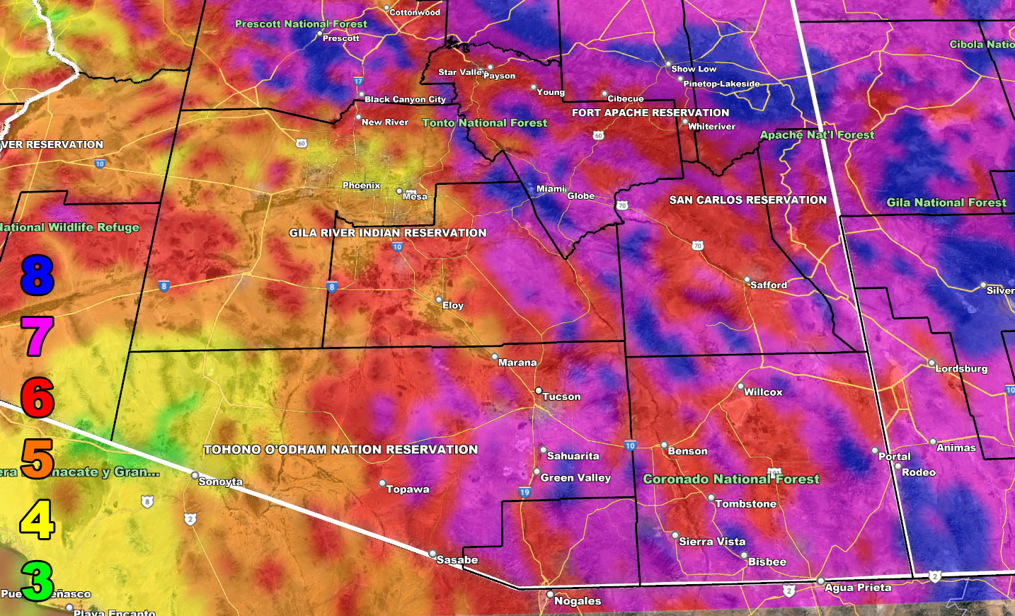
Wind Model – VALID TUESDAY NIGHT THROUGH WEDNESDAY 2-22-2023
SUPPORTING MEMBERS: Click Here To See The GPS Version Of This Model In Your Member Section Tab.
Raiden Storm Wind Gust Intensity Scale –
8. Extensive widespread damage.
7. Trees are broken or uprooted, building damage is considerable. – High Profile Vehicle Roll-Over CERTAIN.
6. SOME Trees are broken or uprooted, building damage is possible. – High Profile Vehicle Roll-Over Likely, Do NOT recommend Traveling in this zone. This zone also is the starting zone where trees and powerlines will fall and damage cars and even kill people near or in them!
5. Slight damage occurs to buildings, shingles are blown off of roofs. HIGH WIND WARNING CRITERIA – High Profile Vehicle Roll-Over Possible if weight is not corrected.
4. Twigs and small branches are broken from trees, walking is difficult.
3. Large trees sway, becoming difficult to walk. POWER SHUTDOWN THRESHOLD DURING FIRE WEATHER / WIND ADVISORY CRITERIA


WANT THESE DELIVERED VIA THE APP? JOIN THE PATREON COMMUNITY TODAY FOR ALL THOSE PERKS INCLUDING BEING ON THE MICRO-CLIMATE ALERT SYSTEM BECAUSE NOT EVERY ALERT IS POSTED ON SOCIAL MEDIA FROM THIS WEATHER OFFICE – https://www.patreon.com/weatherforce
TWITTER: Join the AZWF Twitter For Articles By Clicking Here
Join The Main Arizona Weather Force Facebook Group (50 percent delivery time of micro-climate alerts not posted on the main AZWF page) – You can join the main AZWF page as well through that group.
Click Here To Join The Page Today