
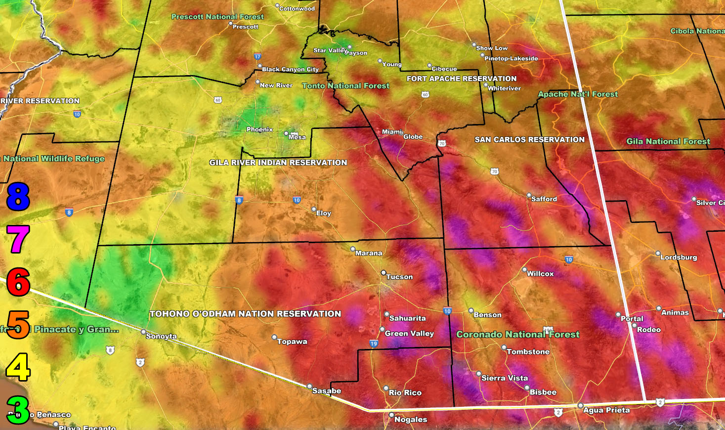
Arizona Weather Force is tracking a very cold system that will move into Arizona for your Wednesday and last into Wednesday night. This system is so cold that a focus spot for some flakes flying will be Cave Creek to Carefree as snow-levels plummet to the 2,000 FT mark. Heavy snow with blizzard criteria conditions will be likely for the mountain areas, including Prescott to Payson, with a now official Blizzard Warning in effect from this office along with thundersnow. Low elevation areas will see some rain moving through, but you in the Tucson areas have snowfall pegged on the AZWF snow model so for details read on …
Join the Facebook Page for Further Updates If You Have Not Yet!
ARIZONA WEATHER FORCE MAIN:
SPRING 2023 TIER NOW OPEN FOR MEMBERSHIP: WANT THESE DELIVERED VIA THE APP? JOIN THE PATREON COMMUNITY TODAY FOR ALL THOSE PERKS INCLUDING BEING ON THE MICRO-CLIMATE ALERT SYSTEM BECAUSE NOT EVERY ALERT IS POSTED ON SOCIAL MEDIA FROM THIS WEATHER OFFICE – https://www.patreon.com/weatherforce
Not much to say other than this is the coldest system of the season thus far. Snow-levels going a bit below 2,000 FT proves this point. This is a potent system, even for the Mogollon Rim locations. Here are the key points.
- AZWF Blizzard Warning officially in effect for Wednesday/Wednesday night.
- Thundersnow will be happening at times, upping the snowfall rates.
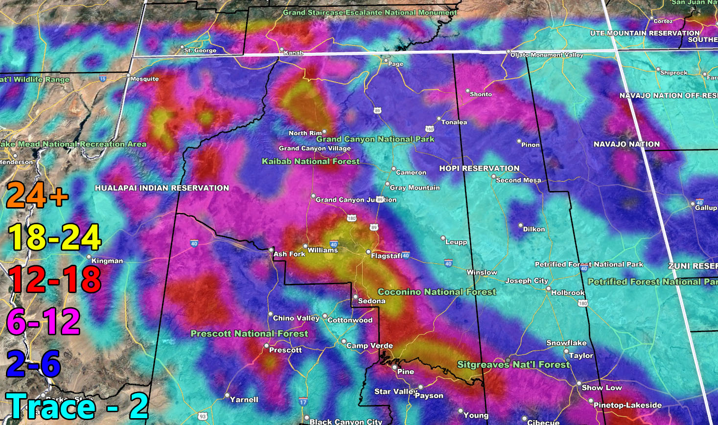
- Cave Creek to Carefree have Trace – 2″ on the AZWF snow model.
- Tucson and all of Cochise, Graham, and Greenlee County will see some snow.
- All of Arizona will have strong winds with this system on Wednesday
- The next storm pattern will be through March 5th to the 12th as a window, but the strongest one looks around March 9th to 11th, with 10th being the central focus
For the rest of the region, please use the information source below for your rain, snow, and wind maps from the AZWF model suites.
DO NOT FORGET TO LOOK AT THE VALID TIMING IT IS FOR
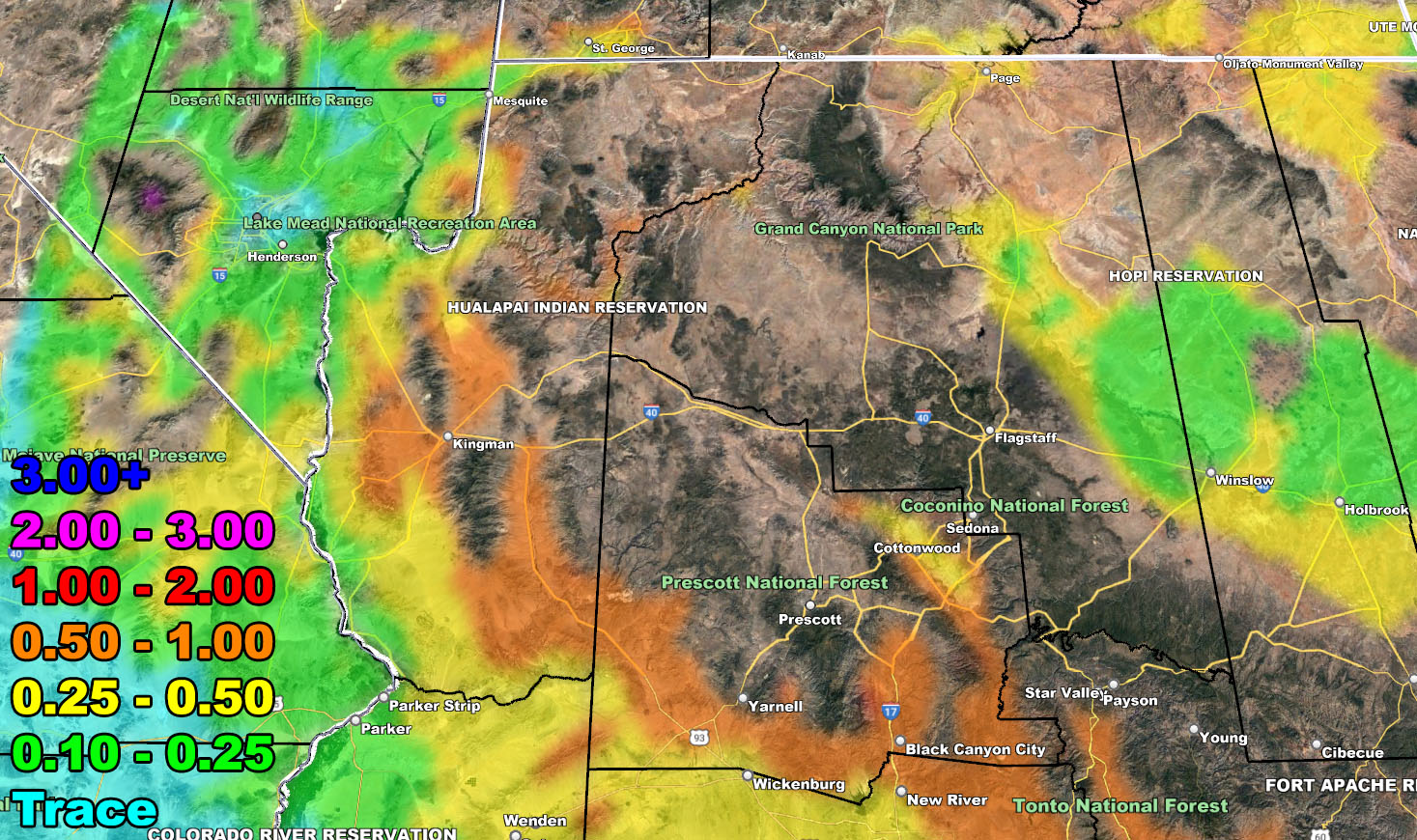
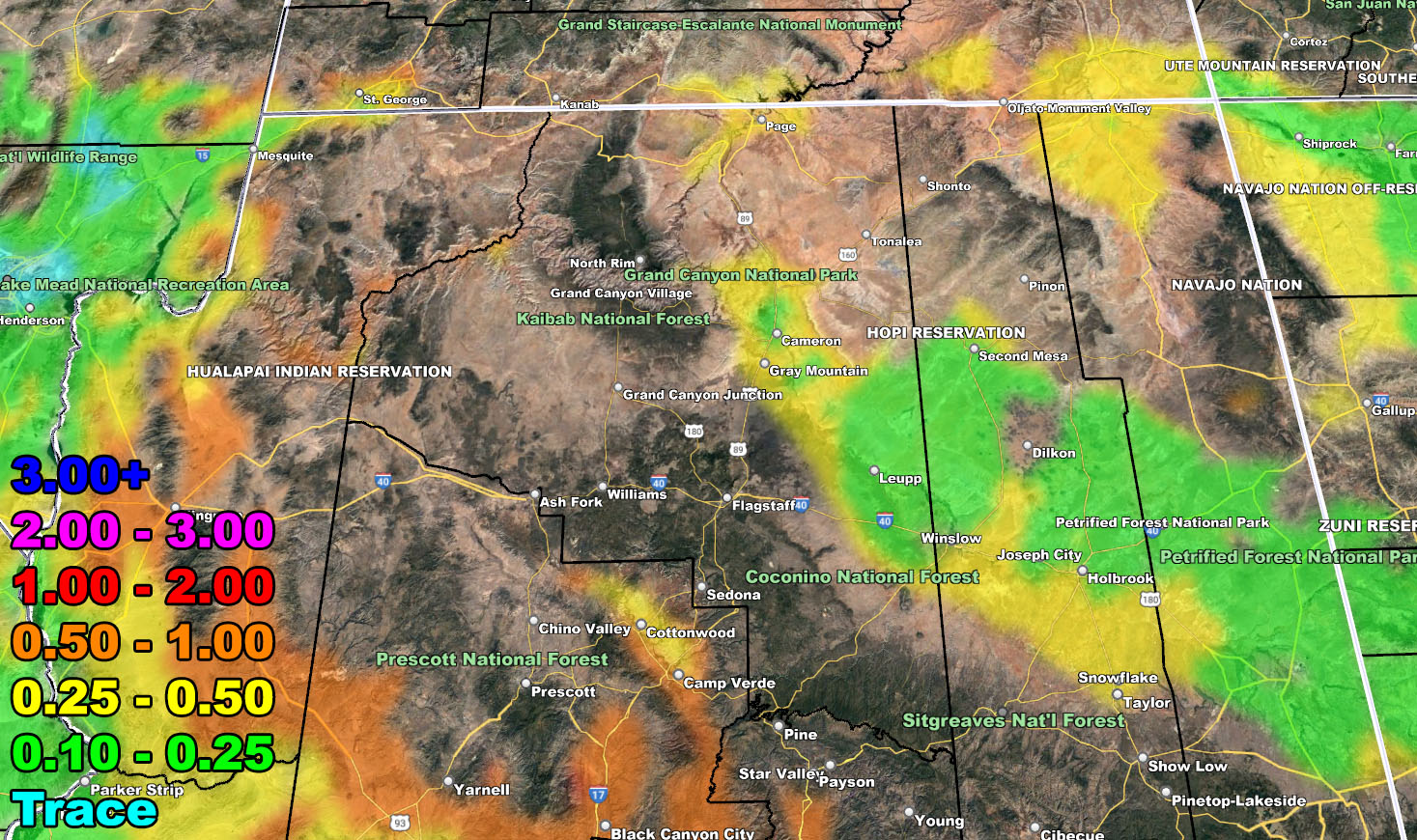
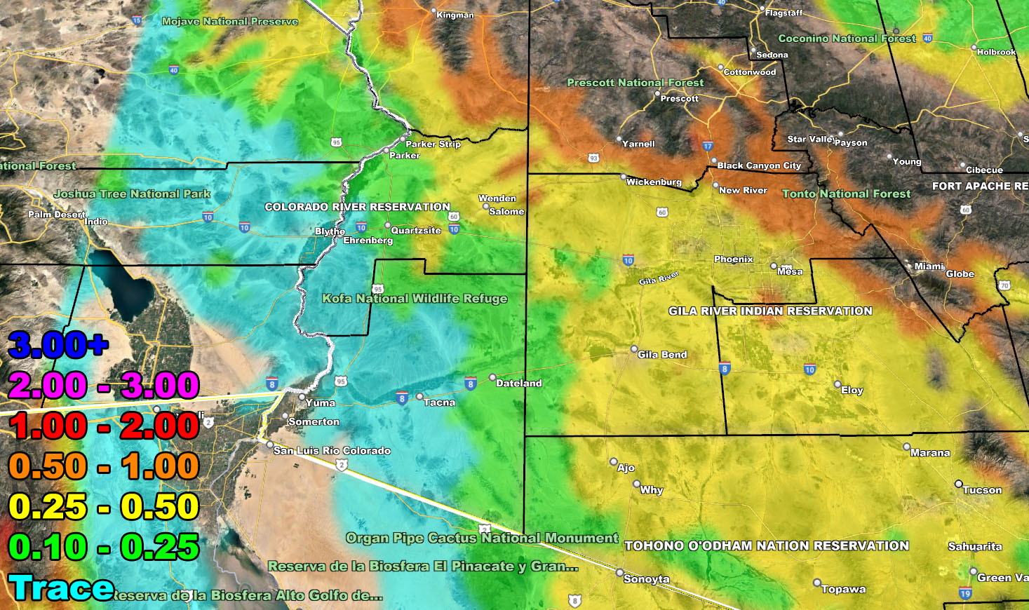
Rain Model – VALID WEDNESDAY INTO SOME OF THURSDAY MORNING 3-2-2023
SUPPORTING MEMBERS: Click Here To See The GPS Version Of This Model In Your Member Section Tab.

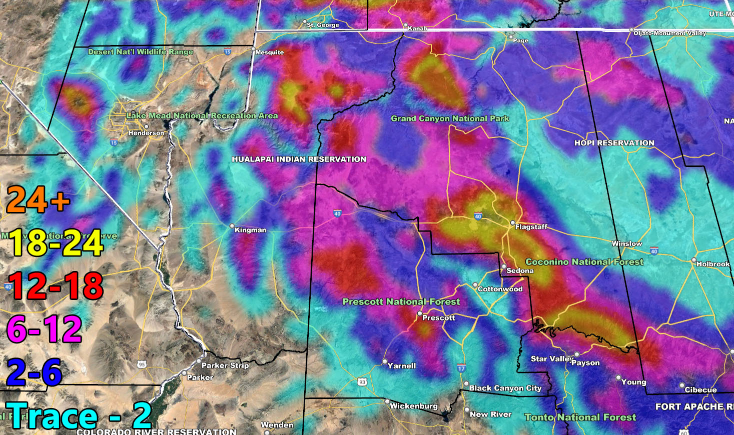
Snow Model – VALID WEDNESDAY INTO SOME OF THURSDAY MORNING 3-2-2023
SUPPORTING MEMBERS: Click Here To See The GPS Version Of This Model In Your Member Section Tab.


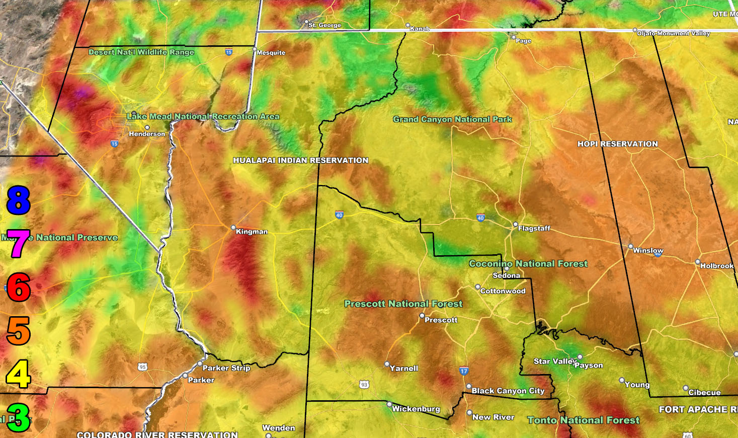
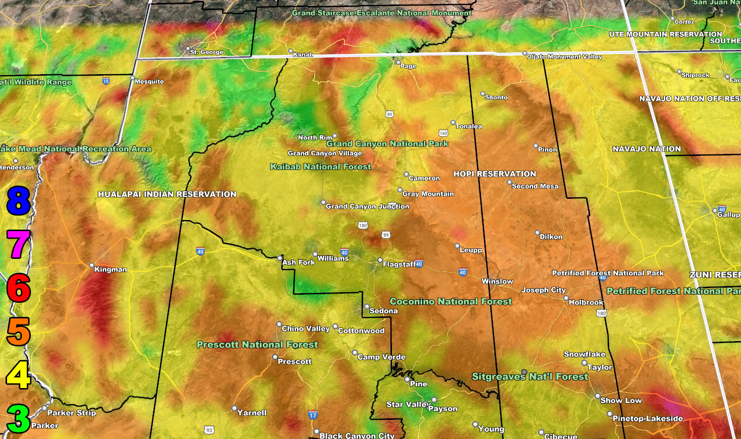
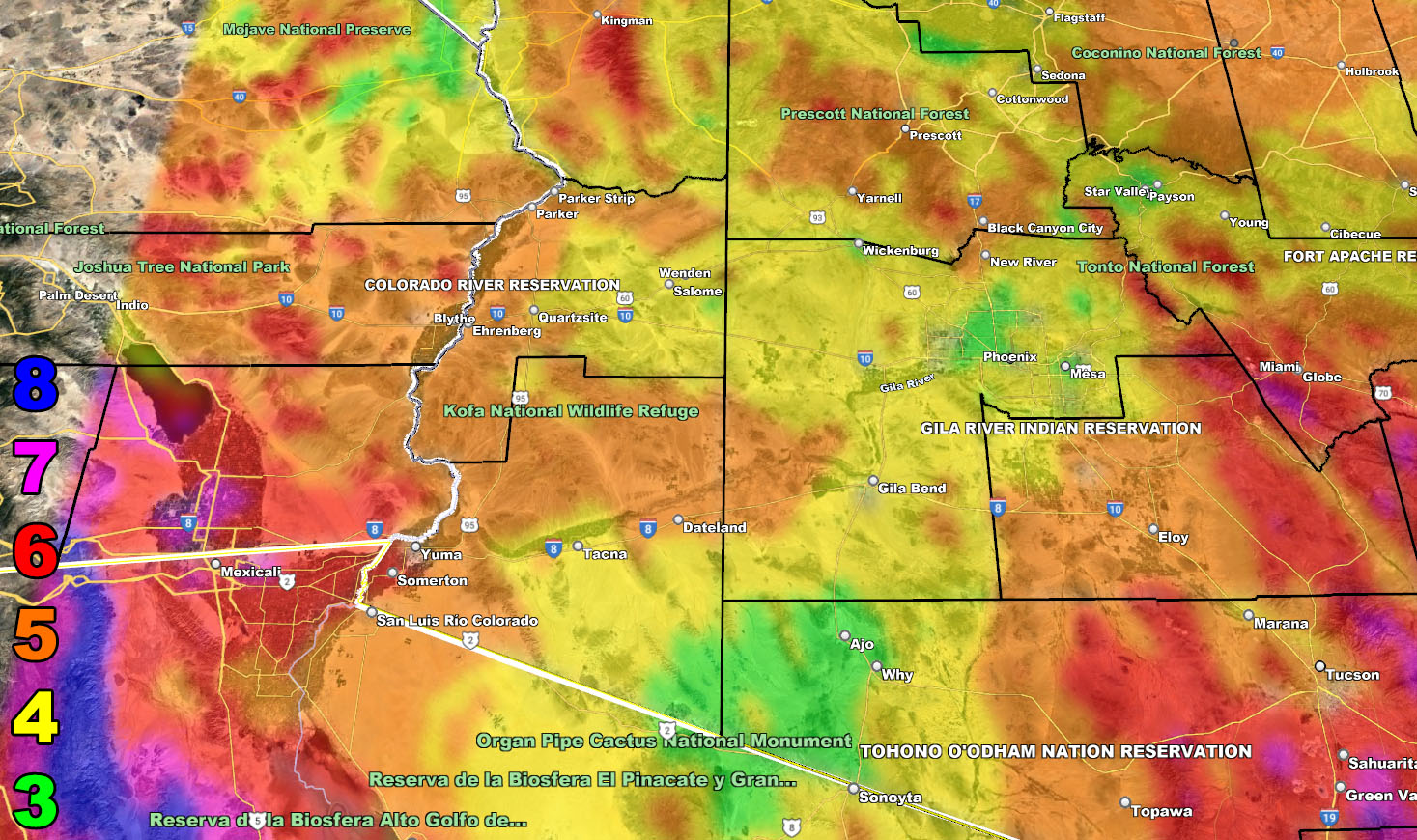
Wind Model – VALID WEDNESDAY INTO SOME OF THURSDAY MORNING 3-2-2023
SUPPORTING MEMBERS: Click Here To See The GPS Version Of This Model In Your Member Section Tab.
Raiden Storm Wind Gust Intensity Scale –
8. Extensive widespread damage.
7. Trees are broken or uprooted, building damage is considerable. – High Profile Vehicle Roll-Over CERTAIN.
6. SOME Trees are broken or uprooted, building damage is possible. – High Profile Vehicle Roll-Over Likely, Do NOT recommend Traveling in this zone. This zone also is the starting zone where trees and powerlines will fall and damage cars and even kill people near or in them!
5. Slight damage occurs to buildings, shingles are blown off of roofs. HIGH WIND WARNING CRITERIA – High Profile Vehicle Roll-Over Possible if weight is not corrected.
4. Twigs and small branches are broken from trees, walking is difficult.
3. Large trees sway, becoming difficult to walk. POWER SHUTDOWN THRESHOLD DURING FIRE WEATHER / WIND ADVISORY CRITERIA
WANT THESE DELIVERED VIA THE APP? JOIN THE PATREON COMMUNITY TODAY FOR ALL THOSE PERKS INCLUDING BEING ON THE MICRO-CLIMATE ALERT SYSTEM BECAUSE NOT EVERY ALERT IS POSTED ON SOCIAL MEDIA FROM THIS WEATHER OFFICE – https://www.patreon.com/weatherforce
TWITTER: Join the AZWF Twitter For Articles By Clicking Here
Join The Main Arizona Weather Force Facebook Group (50 percent delivery time of micro-climate alerts not posted on the main AZWF page) – You can join the main AZWF page as well through that group.
Click Here To Join The Page Today