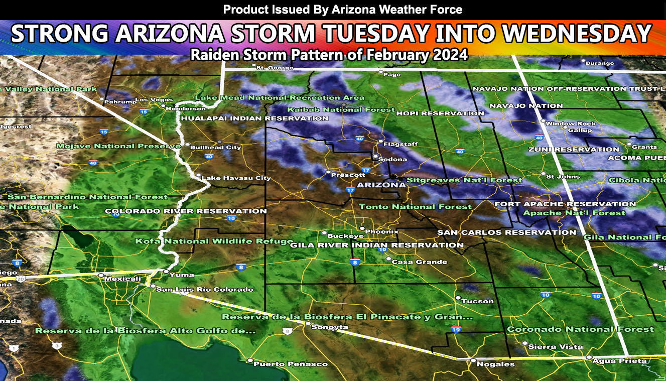
A storm system is set to hit on Tuesday into Tuesday overnight through Wednesday morning. As previously stated, these will deliver the high rainfall totals.
Additional alerts will be issued if needed. This also contains windy conditions along with thunderstorm chances.
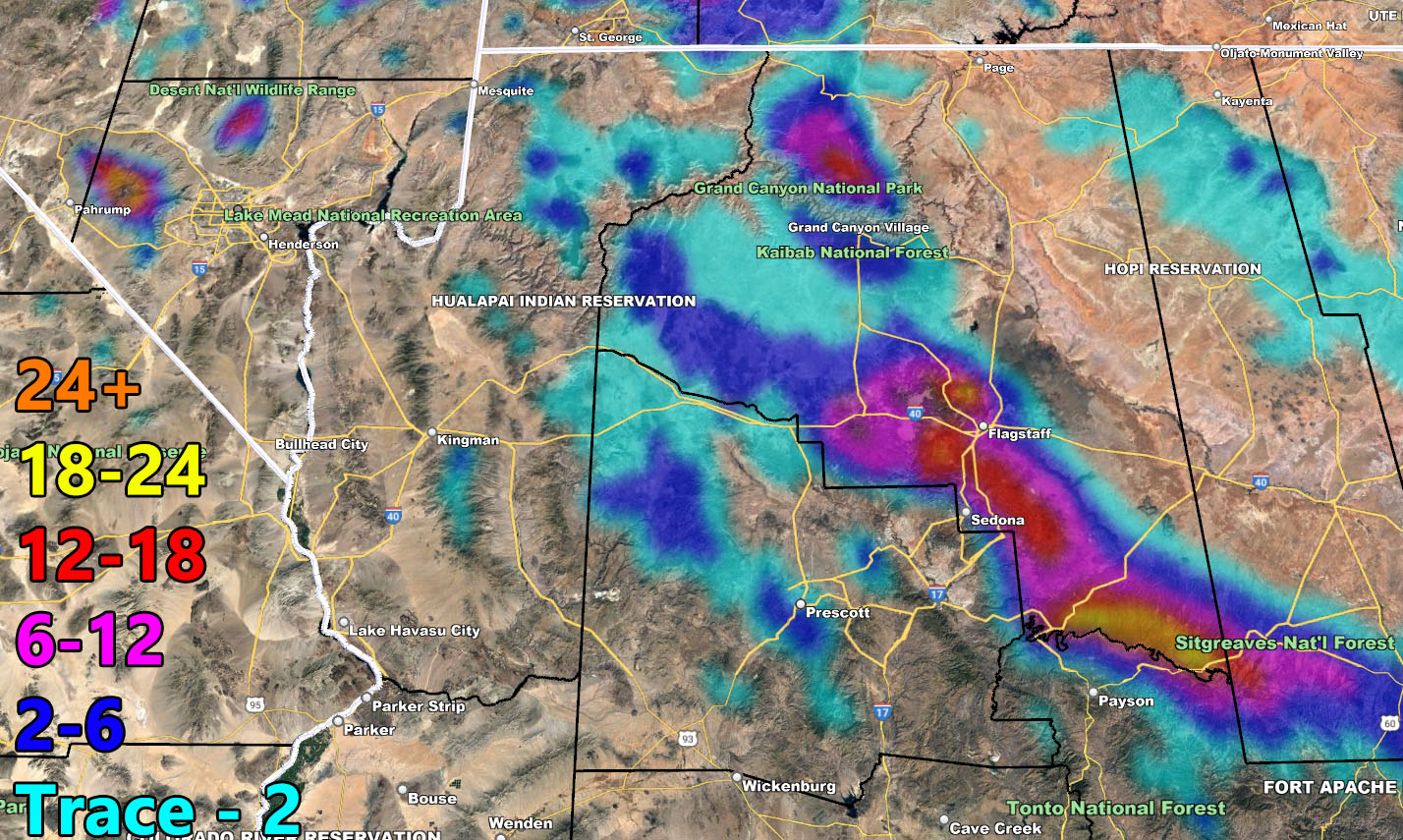
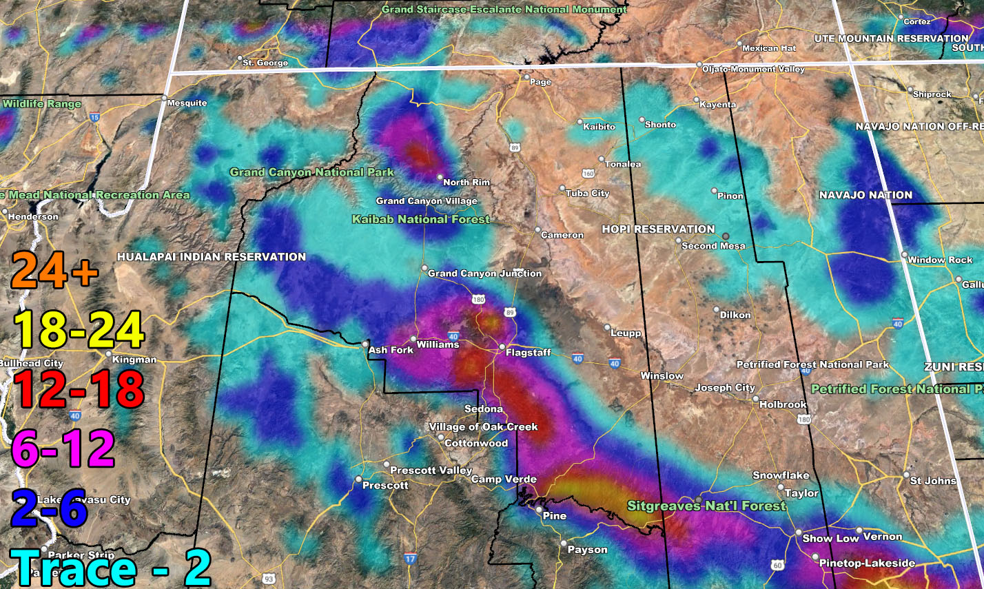
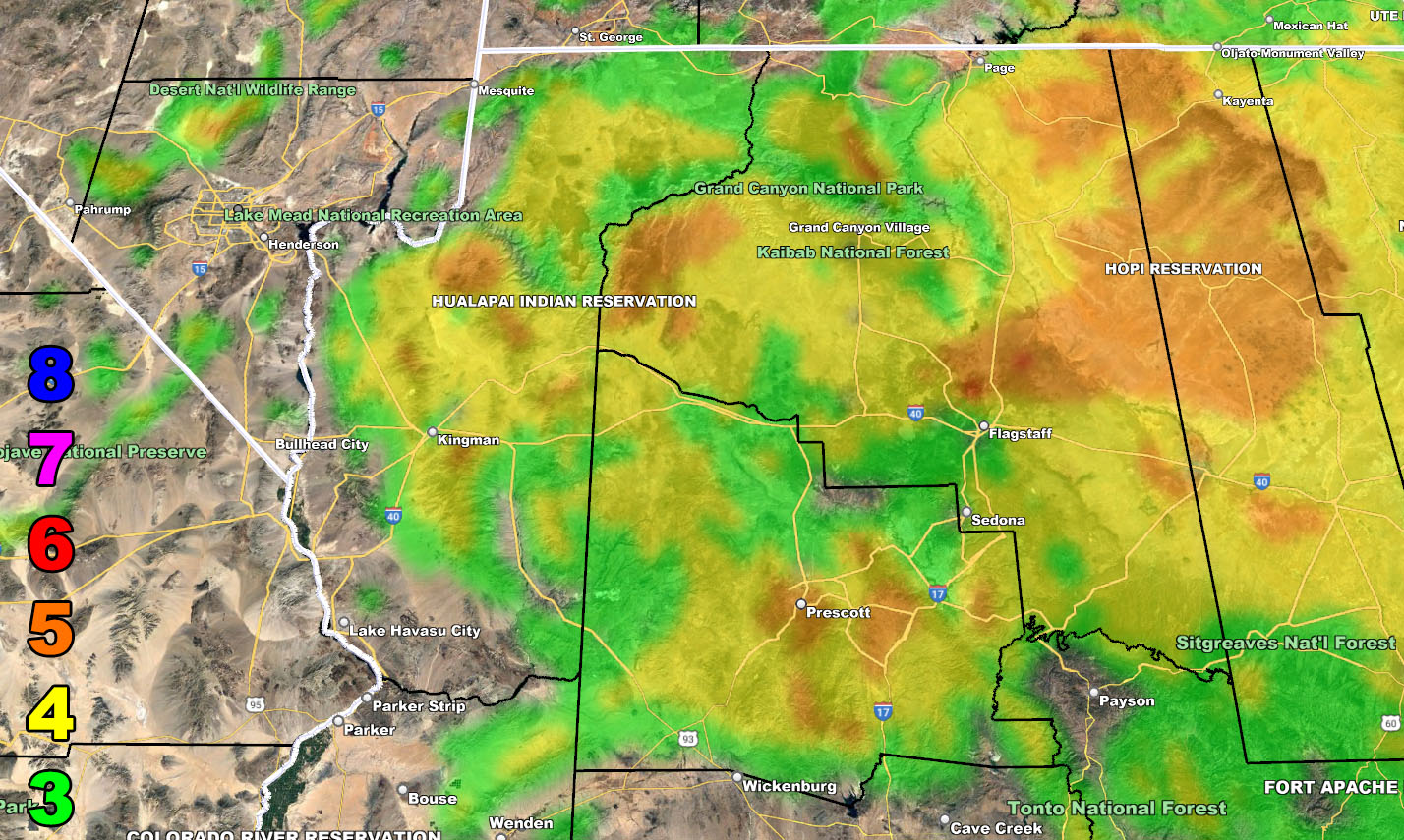
The Mogollon Rim will have snowfall, especially Flagstaff, where I expect nearly a foot of snow to fall.
Long Range: A third system is set to hit behind this one Thursday into Saturday as we resume the Raiden Storm Pattern. There is another chance of another pattern of storms returning after the 20th.
A Raiden Storm Pattern means a pattern that was foreseen ahead of any source, which; like a comet, bears the name of the one who discovered it.
Stay tuned to Arizona Weather Force for further updates …
Use the maps below for rain, snow, and wind for this final forecast.
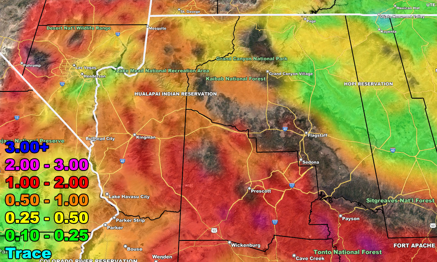
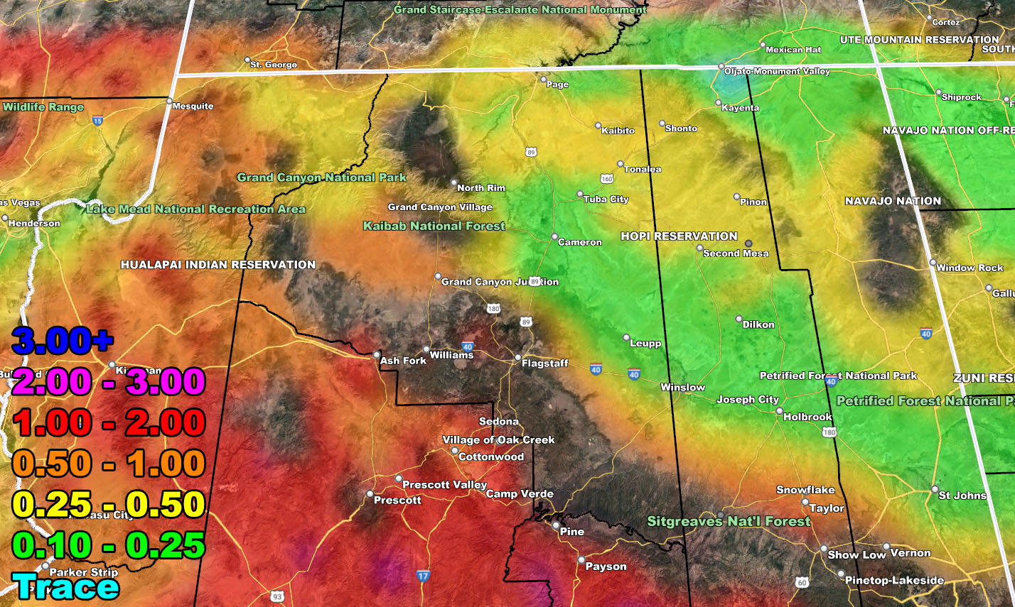
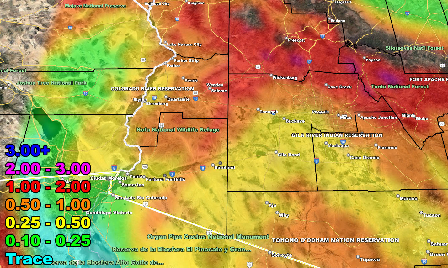
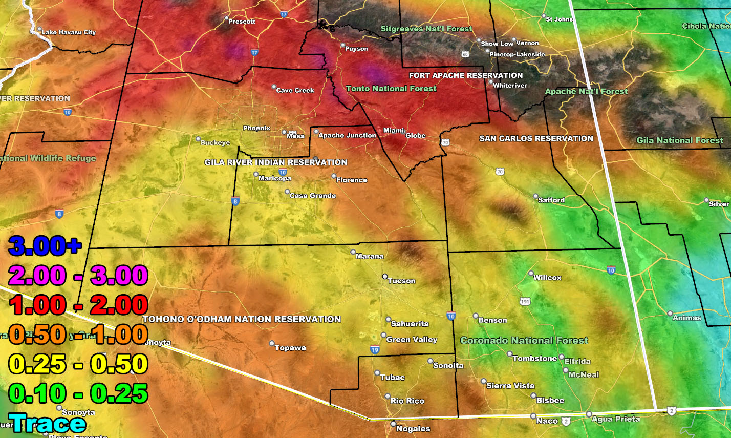
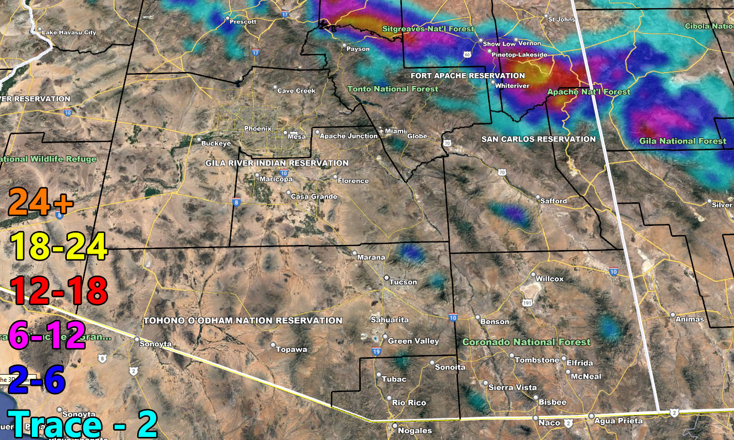
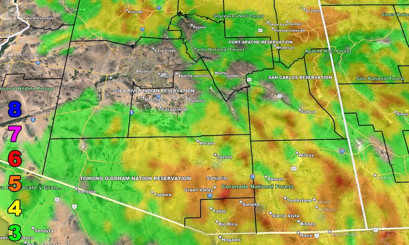
RAIN
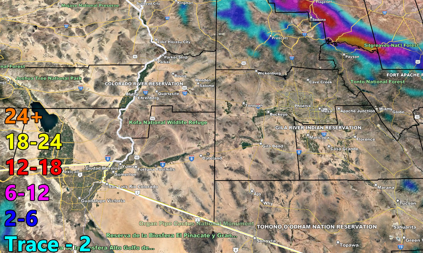
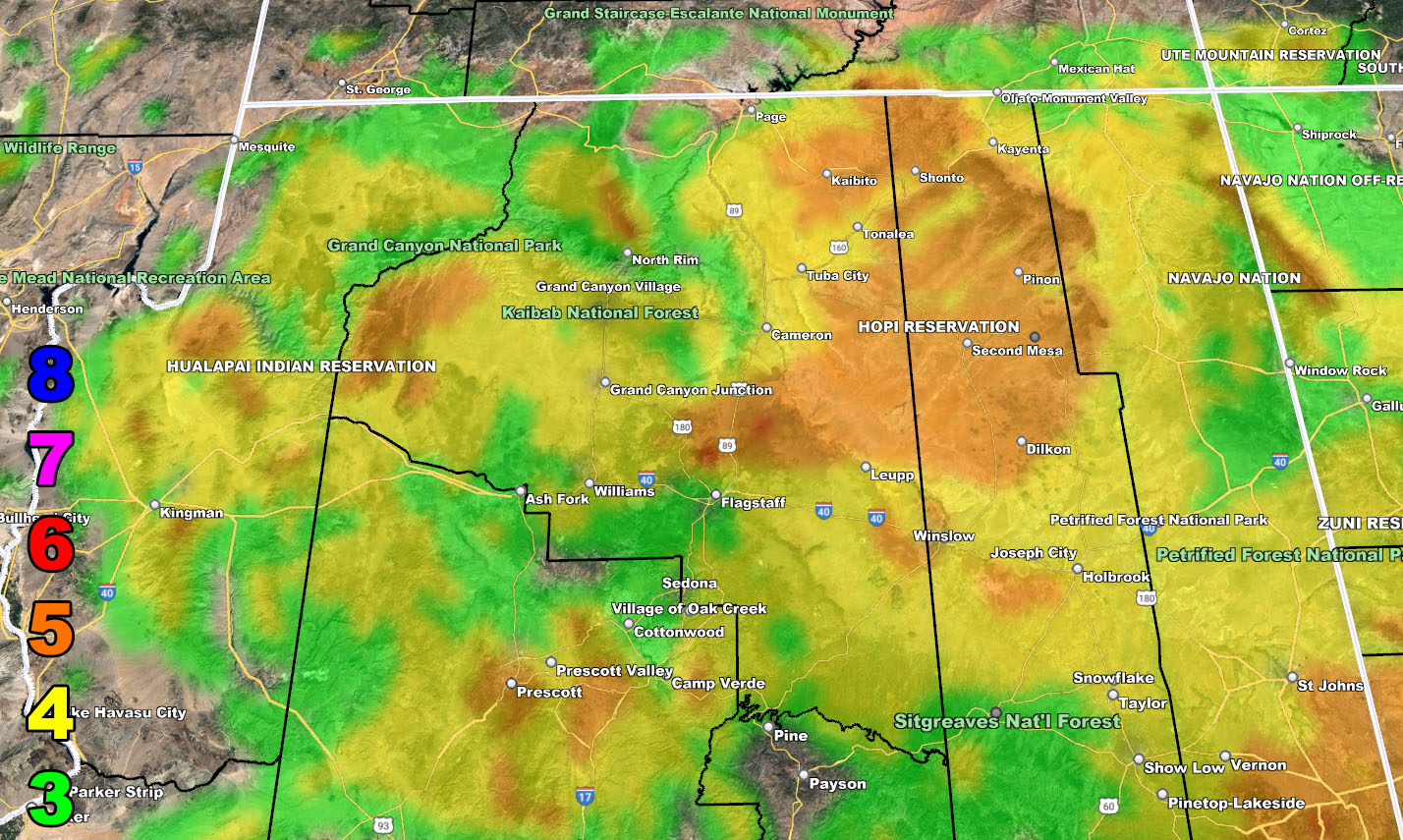
SNOW
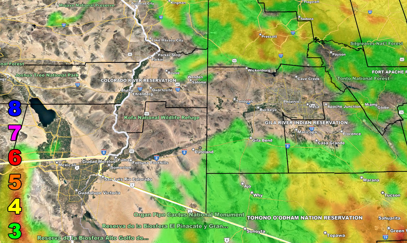
WIND
Raiden Storm Wind Gust Intensity Scale –
8. Extensive widespread damage.
7. Trees are broken or uprooted, building damage is considerable. – High Profile Vehicle Roll-Over CERTAIN.
6. SOME Trees are broken or uprooted, building damage is possible. – High Profile Vehicle Roll-Over Likely, Do NOT recommend Traveling in this zone. This zone also is the starting zone where trees and powerlines will fall and damage cars and even kill people near or in them!
5. Slight damage occurs to buildings; shingles are blown off of roofs. HIGH WIND WARNING CRITERIA – High Profile Vehicle Roll-Over Possible if weight is not corrected.
4. Twigs and small branches are broken from trees, walking is difficult.
3. Large trees sway, becoming difficult to walk. POWER SHUTDOWN THRESHOLD DURING FIRE WEATHER / WIND ADVISORY CRITERIA
– Raiden Storm –
https://www.arizonaweatherforce.com
Master General Meteorologist – is the Owner and CEO of AZWF, a consulting meteorologist with over 26 years’ experience for over 50 companies, including energy, agriculture, aviation, marine, leisure, and many more areas. He has certs from Mississippi State for broadcast met and Penn State forecasting certs MET 101, 241, 341 and 361 as a meteorologist, but before then was completely self-taught, barely learning a thing from the schools that he did not already know.
NOTE: Alerts are posted on here, be it a tornado watch, etc, and these alerts are issued from this office and nowhere else. At times, which is often, you will see an alert forecast posted on here that you do not see elsewhere.