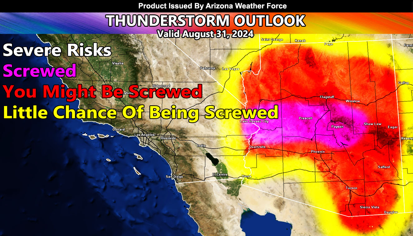
Arizona Weather Force has issued a Thunderstorm Outlook for August 31st, 2024
Zones Issued For: Maricopa County – Pinal County – Gila County – Graham and Greenlee County – Cochise County – Santa Cruz County – Pima County – Flagstaff – Yavapai County – Apache County and Navajo County – Parker, Lake Havasu, Kingman, Bullhead City.
Discussion: Okay let us get back to the real fun graphics. Today will be an interesting day. Storms will start forming by noon across the rim. Strawberry and Payson are my target zones for the most severe updrafts today, meaning highest chance of larger hail and flooding. The rim storms, including Prescott, will move off the rim into the low terrain, like Phoenix, Pinal, Parker, Havasu, and Bullhead City. One thing I will note is that the outflow from such a flow can and will likely make a dangerous situation for boats on Havasu between 5-7pm.
Tucson, you will get a southeast flow through the area with a chance of thunderstorms too, separate from the rim flow.
Yuma: Your best chance is later this evening or night with the outflow out of the north from Parker.
Best Target Zones for Severe Thunderstorms: Strawberry, Payson, Prescott, Havasu.
As always, we take it one day at a time with these events.
– Raiden Storm –
https://www.arizonaweatherforce.com
Master General Meteorologist – is the Owner and CEO of AZWF, a consulting meteorologist with over 26 years’ experience for over 50 companies, including energy, agriculture, aviation, marine, leisure, and many more areas. He has certs from Mississippi State for broadcast met and Penn State forecasting certs MET 101, 241, 341 and 361 as a meteorologist, but before then was completely self-taught, barely learning a thing from the schools that he did not already know.
NOTE: Alerts are posted on here, be it a tornado watch, etc, and these alerts are issued from this office and nowhere else. At times, which is often, you will see an alert forecast posted on here that you do not see elsewhere.

