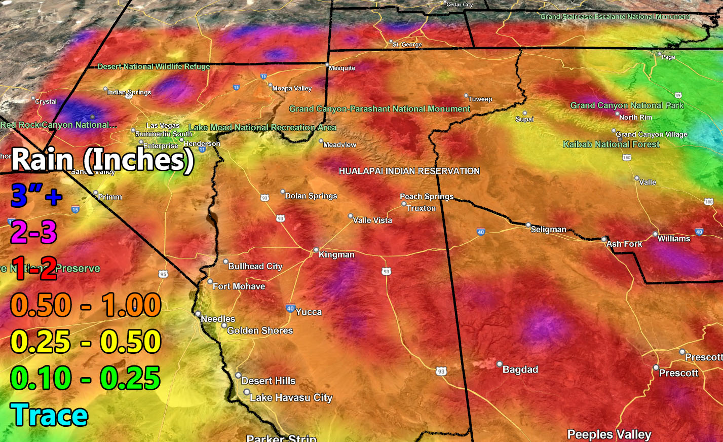
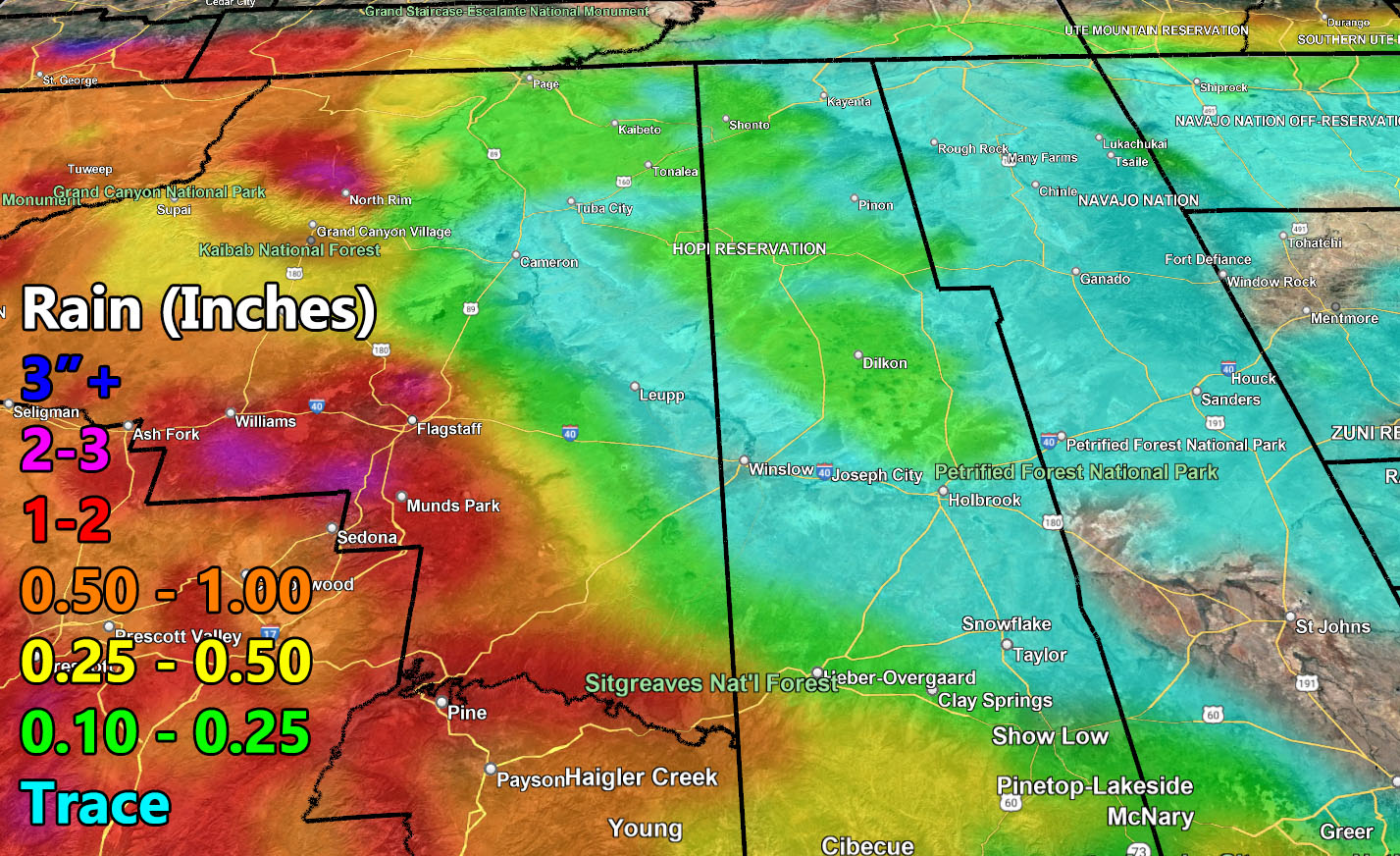
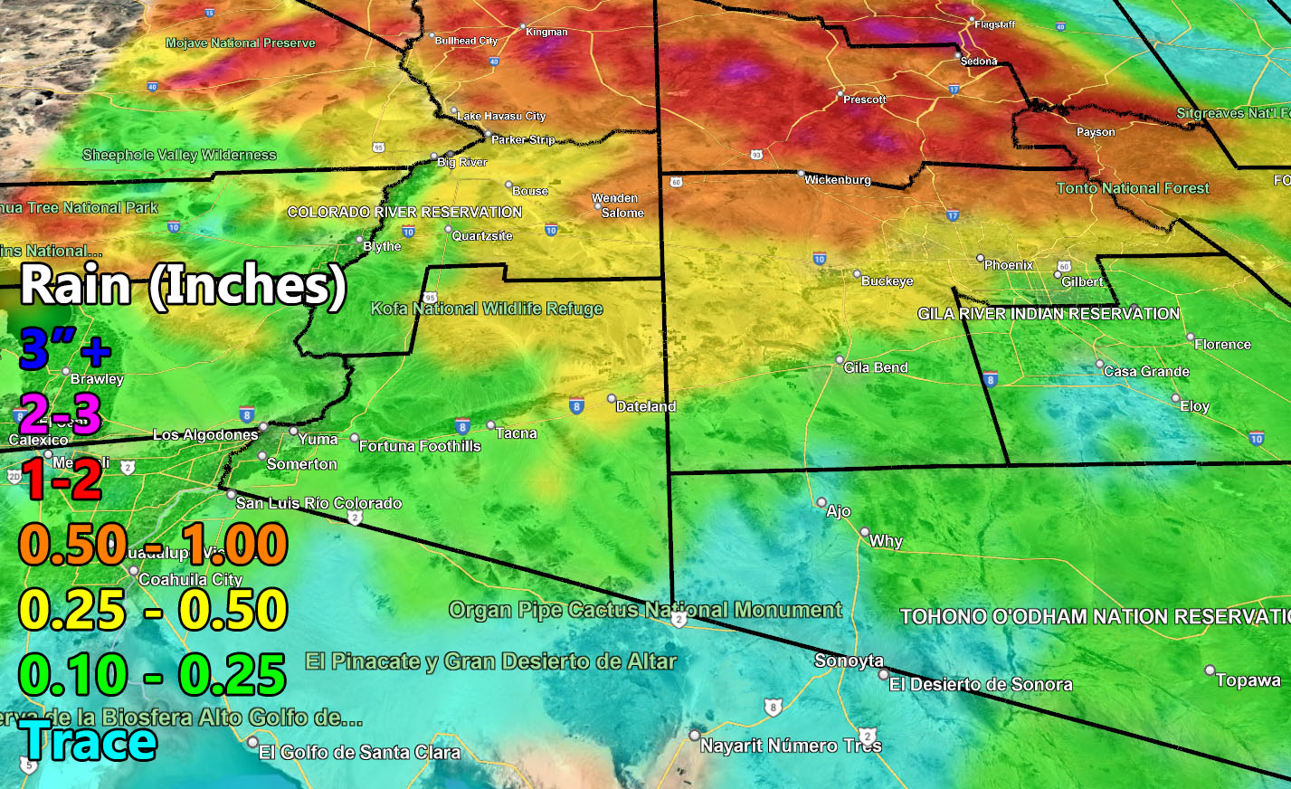
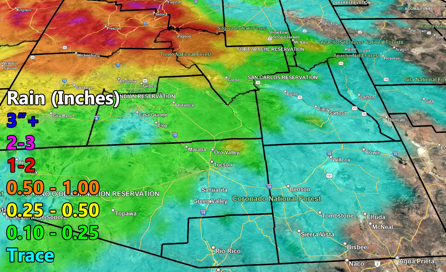
Arizona Weather Force has issued the final forecast for the rainfall across Arizona this evening through Christmas so read on for details …
This will impact the Central and Northern half of the state more than the southern portions due to the orientation of the front coming out of Southern California. The Riverside and San Diego Mountains usually wash a lot of the moisture out before reach the state, but as stated many days ago in the cat meme, the week of the 21st would have storms, hence this is a Raiden Storm Pattern, meaning it is named after the one whom predicted it.
Although you will not see the danger Southern California faces, it is stormy never the less during the Christmas season. Gusty winds will accompany the front, with the strongest rainfall and wind gusts in Prescott to Kingman.
Use the rainfall maps from my model below for the forecast now through Christmas.
Long Range: The pattern does suggest more storms near the end of the month or just after the New Year. Another Raiden Storm Pattern.
Raiden Storm
Master General Meteorologist
Rain maps