A ridge of high pressure this week will finally move eastward this weekend, allowing for the storm window to open so read on for some details …
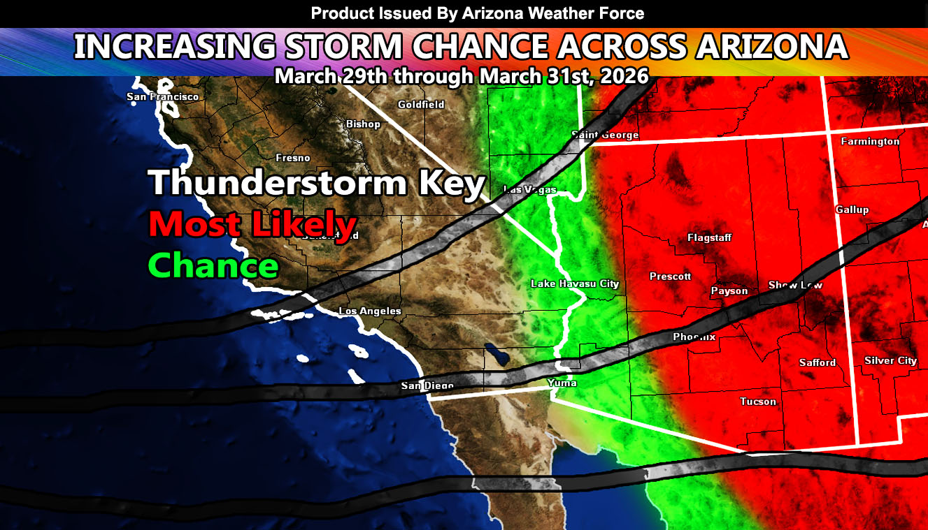
Arizona Weather Force is monitoring a system that may affect a large area of Arizona, starting March 29th and into the 31st. Without going into a major novel, I will go ahead and say how this looks to happen and why.
Heatwave conditions will remain this entire week as a secondary ridge of high pressure rotates in from the Pacific, rotating around the first one from last week. As the second ridge rotates over Arizona, it will exist down into Northern Mexico, below New Mexico, by the weekend. This will bring moisture up from the south within the western periphery. This will act similar to a monsoon pattern, where the ridge is east of the state, with moisture flow south to north.
As this happens, a storm pattern coming in for the first week of April will be establishing in the mid/upper levels off California. This west to east jet stream ahead of multiple storms systems expected there in April will be what drives the instability up for Arizona during the watch period.
Given the higher sun angle, with some cold air aloft, instability will bring the chance not only rain showers, but a chance of thunderstorm activity during the date period.
The period of forecast will be between March 29th and the 31st. Additional updates will be released from here as the system dates get closer so stay tuned to Arizona Weather Force.
Raiden Storm
Master General Meteorologist