Arizona Weather Force has issued the final forecast for a cold-front moving through the state later tonight, but a Thunderstorm Watch ahead of the front is now in effect here at this weather office as well for Yavapai County so read on for details and see the zoom-in maps.
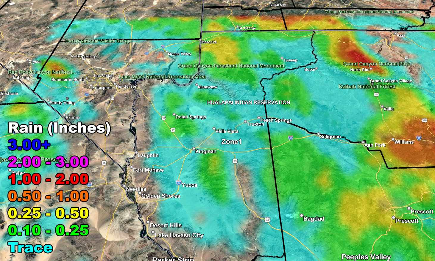
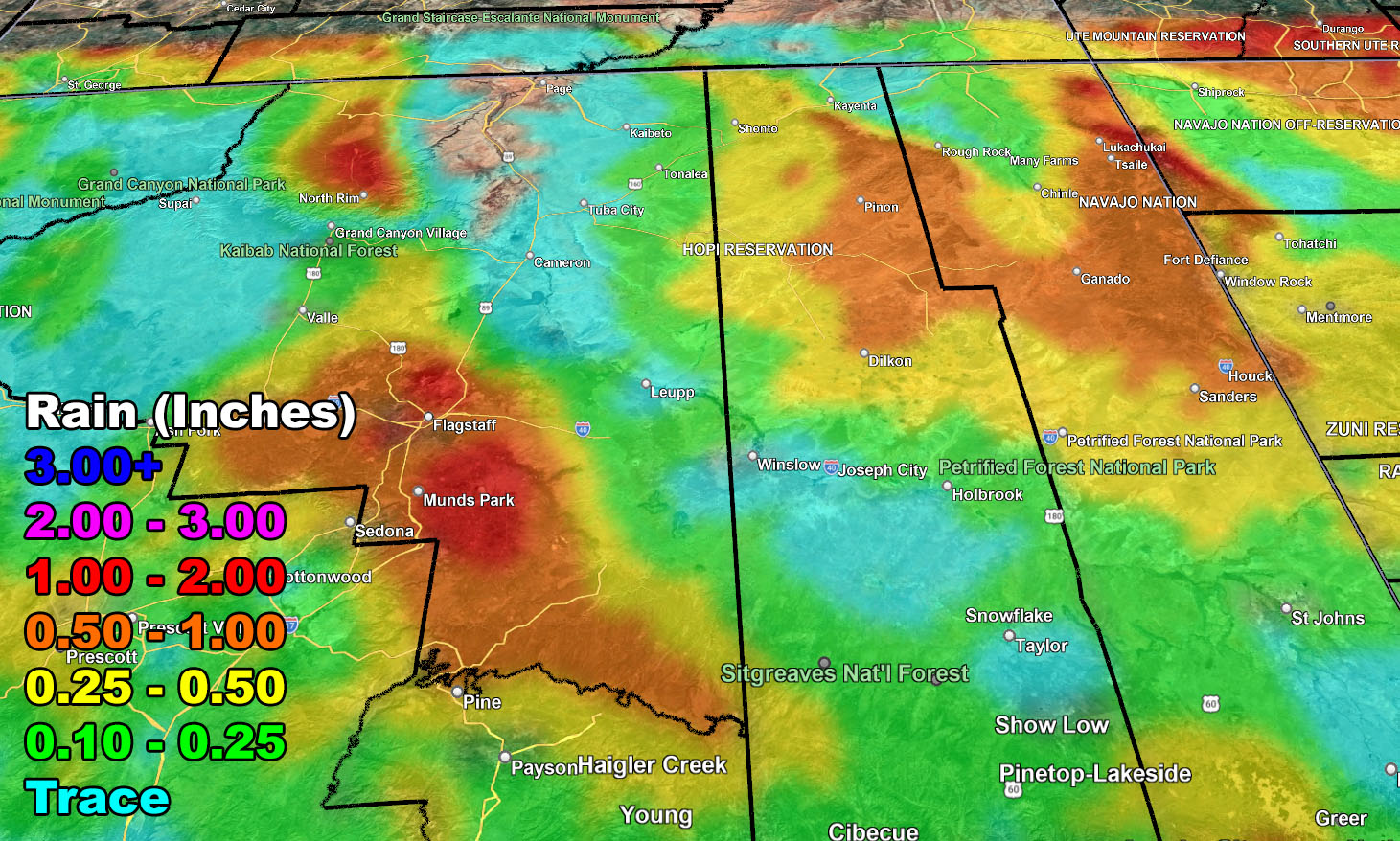
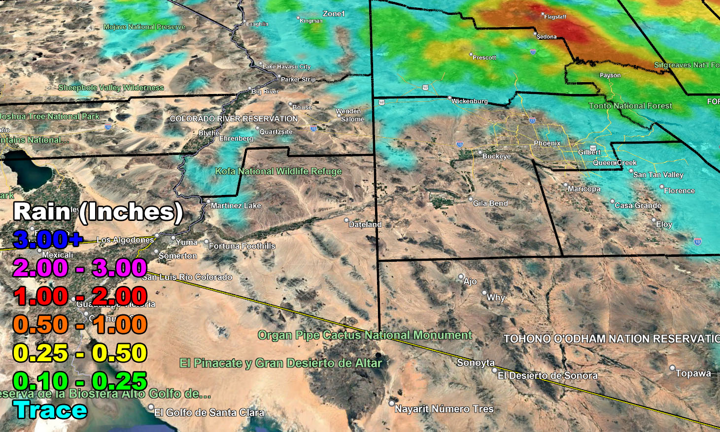
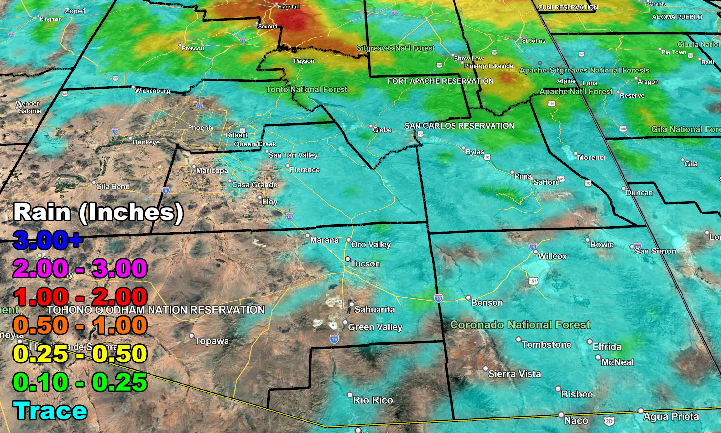
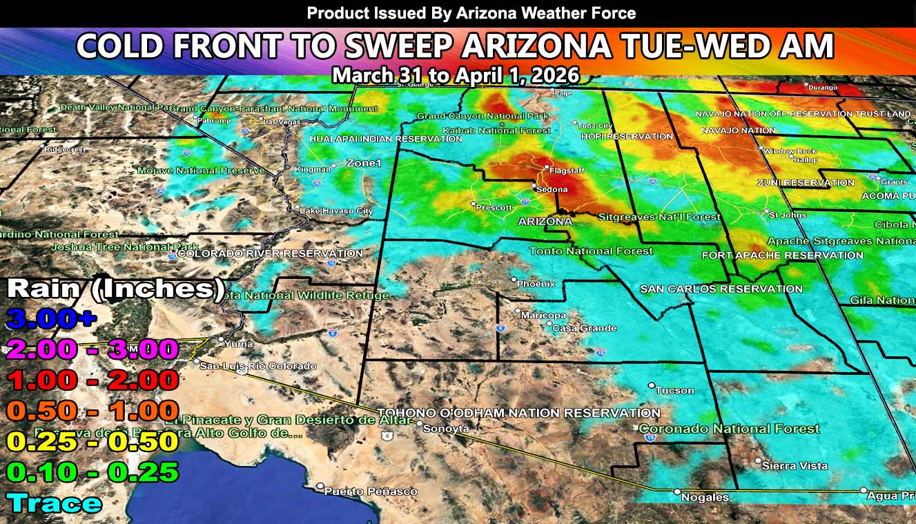
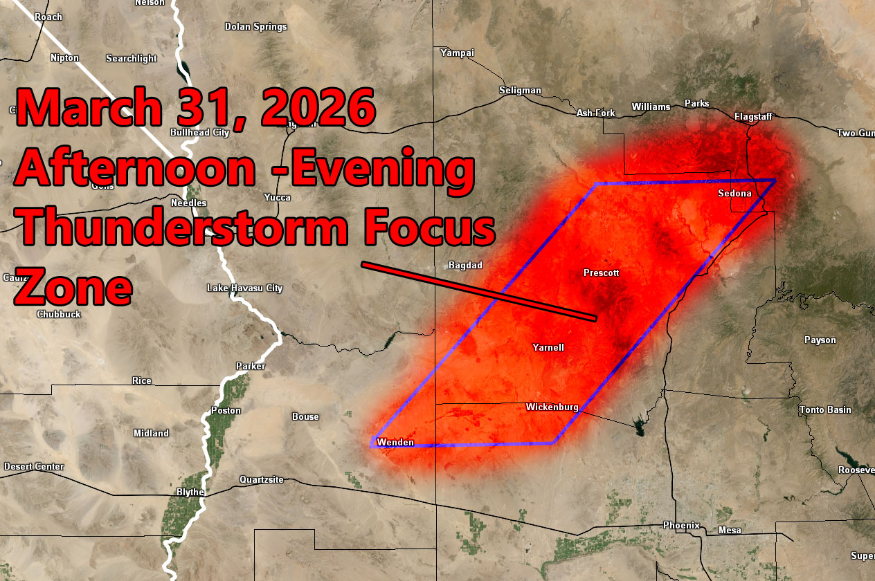
The final zoom-in rainfall maps paints a picture that the Northern half of Arizona will see the most action from this system today into Wednesday morning. This will be a two part system. The first part will be the southwest to northeast flow over Yavapai County, stretching from Wenden and Wickenburg, north and northeast directly over the Prescott forecast zones, and ending near the Sedona forecast area. A large part of Yavapai County will seen thunderstorms today, which means that Arizona Weather Force has issued the official Thunderstorm Watch as the focus spot until around later evening.
The main cold-front will hit overnight and into early Wednesday morning for the state. Given this is rather moisture starved, only very light amounts will be expected in the metros of Phoenix and Tucson, as clearly seen on the maps. This is a highly terrain based system, where the higher terrain and Rim Country will see more. Good for the fire situation in the short term, but we do need more storms before the peak season hits, which will be later May into June this year.
Use the zoom-in rainfall maps below, valid today into Wednesday morning, when the storm pulls east of the state over the day.
Raiden Storm
Master General Meteorologist ( D15 )