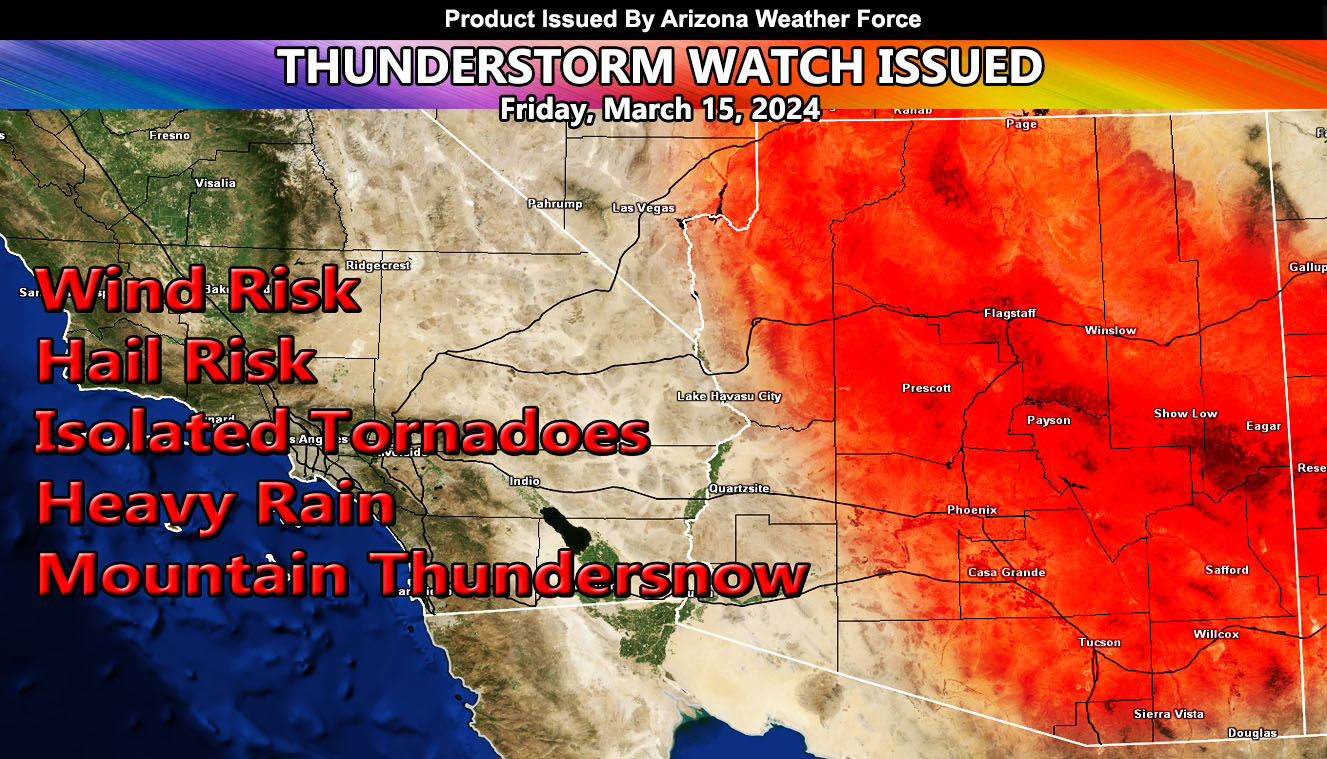
Arizona Weather Force has issued a Thunderstorm Watch effective for most of Arizona for today, Friday, March 15, 2024, effective now through all of today.
A cutoff low that caused the damaging Santa Ana Winds in Southern California yesterday has placed itself over Southwest Arizona. This is why Southwest Arizona will not see the thunderstorm activity today, a healthy dryslot is forming around it.
However, for the metros areas of the Phoenix, Pinal, Tucson areas, you are in the line for the south to north flow and attended lift zone on the eastern periphery of this system. Therefore, widespread thunderstorms are expected to form in or around the watch area depicted in the article graphic.
In higher rim locations, you can expect thundersnow, which means thunderstorms happening while snow is falling. Thundersnow possible, hardest hit zones will be Flagstaff and south and east along the rim.
SATURDAY: Will likely need to re-issue the thunderstorm watch centering the North Central Arizona locations. Areas like Prescott, Flagstaff, and Winslow are targeted by me on this.
A Thunderstorm Watch means that thunderstorms are expected in or around the watch zone, which can have a hail, wind, funnel cloud/tornado, and heavy rain risk.
– Raiden Storm –
https://www.arizonaweatherforce.com
Master General Meteorologist – is the Owner and CEO of AZWF, a consulting meteorologist with over 26 years’ experience for over 50 companies, including energy, agriculture, aviation, marine, leisure, and many more areas. He has certs from Mississippi State for broadcast met and Penn State forecasting certs MET 101, 241, 341 and 361 as a meteorologist, but before then was completely self-taught, barely learning a thing from the schools that he did not already know.
NOTE: Alerts are posted on here, be it a tornado watch, etc, and these alerts are issued from this office and nowhere else. At times, which is often, you will see an alert forecast posted on here that you do not see elsewhere.

