Arizona Weather Force has issued a Long-Range Weather Advisory out ahead of the remnants of Hurricane Beryl as it moves through the Caribbean, with impacts to Arizona expected.
Discussion: Hurricane Beryl is moving through the Caribbean as we speak. This system will continue to weaken as it hits through the Mexican mainland around Sunday or Monday, curving north into Texas. However, that is the surface low. When a surface low detaches from the upper-level low, the upper-level system can move away from it. This will happen after July 10th, with increasing moisture thereafter through Mid-July for Western Mexico.
When Western Mexico ignites storms from tropical moisture like this, in the past these storms have been extremely powerful, owning up to sending outflow boundaries northwestward into Arizona. This looks to happen this month and Hurricane Beryl is to thank for it.
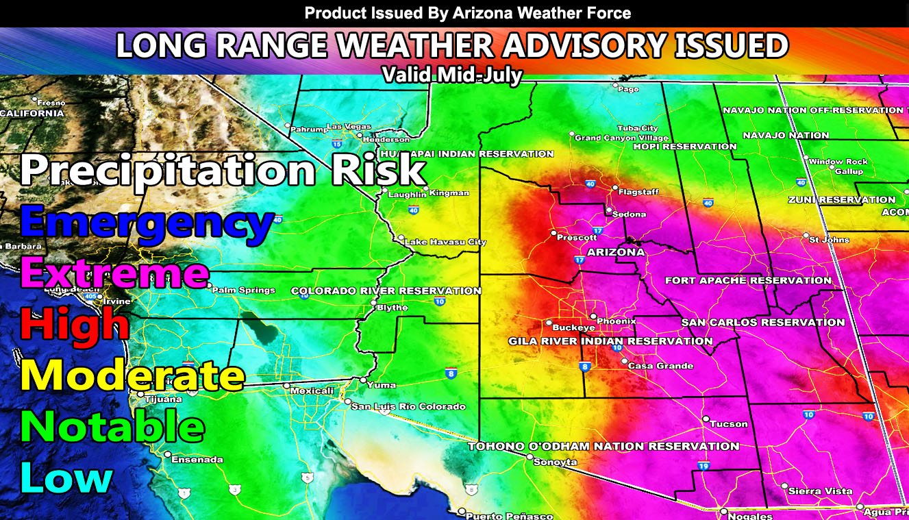
Arizona Weather Force models are showing an extreme and high risk for the main metro zones and Mogollon Rim locations. These zones, as shown on the Arizona Weather Force long range precipitation risk model are for Southeastern Arizona, including Tucson, Safford, Cliffton, Pinal, Phoenix, Gila, Mogollon Rim, and Prescott zones. Given the model shows notable as far as the California border, we can assume this is a major push of moisture, the strongest of this monsoon season thus far.
– Raiden Storm –
https://www.arizonaweatherforce.com
Master General Meteorologist – is the Owner and CEO of AZWF, a consulting meteorologist with over 26 years’ experience for over 50 companies, including energy, agriculture, aviation, marine, leisure, and many more areas. He has certs from Mississippi State for broadcast met and Penn State forecasting certs MET 101, 241, 341 and 361 as a meteorologist, but before then was completely self-taught, barely learning a thing from the schools that he did not already know.
NOTE: Alerts are posted on here, be it a tornado watch, etc, and these alerts are issued from this office and nowhere else. At times, which is often, you will see an alert forecast posted on here that you do not see elsewhere.