Latest long range numbers suggests that the beginning of the Monsoon 2025 will be on time, in terms of the reverse flow in the mid and upper levels. Usually, we will see a major spike in temperatures across the Southwestern United States just before the atmosphere transforms from the onshore flow pattern to the offshore flow pattern out of Mexico.
This signal means that once it happens, we will have another 7-14 days before the four corners ridge fully develops. We see this during the period, with a number of tropical systems down south, west of Mexico. This area will be a hotspot for hurricane development this season. Being it is still thought that a lot of hurricanes will form down there, each time one does, a ‘kink’ in the ridge will form and the thunderstorm outflow from Western Mexico will carry the monsoon moisture northwestward into the Southwestern United States, sparking the dynamics needed for thunderstorm development.
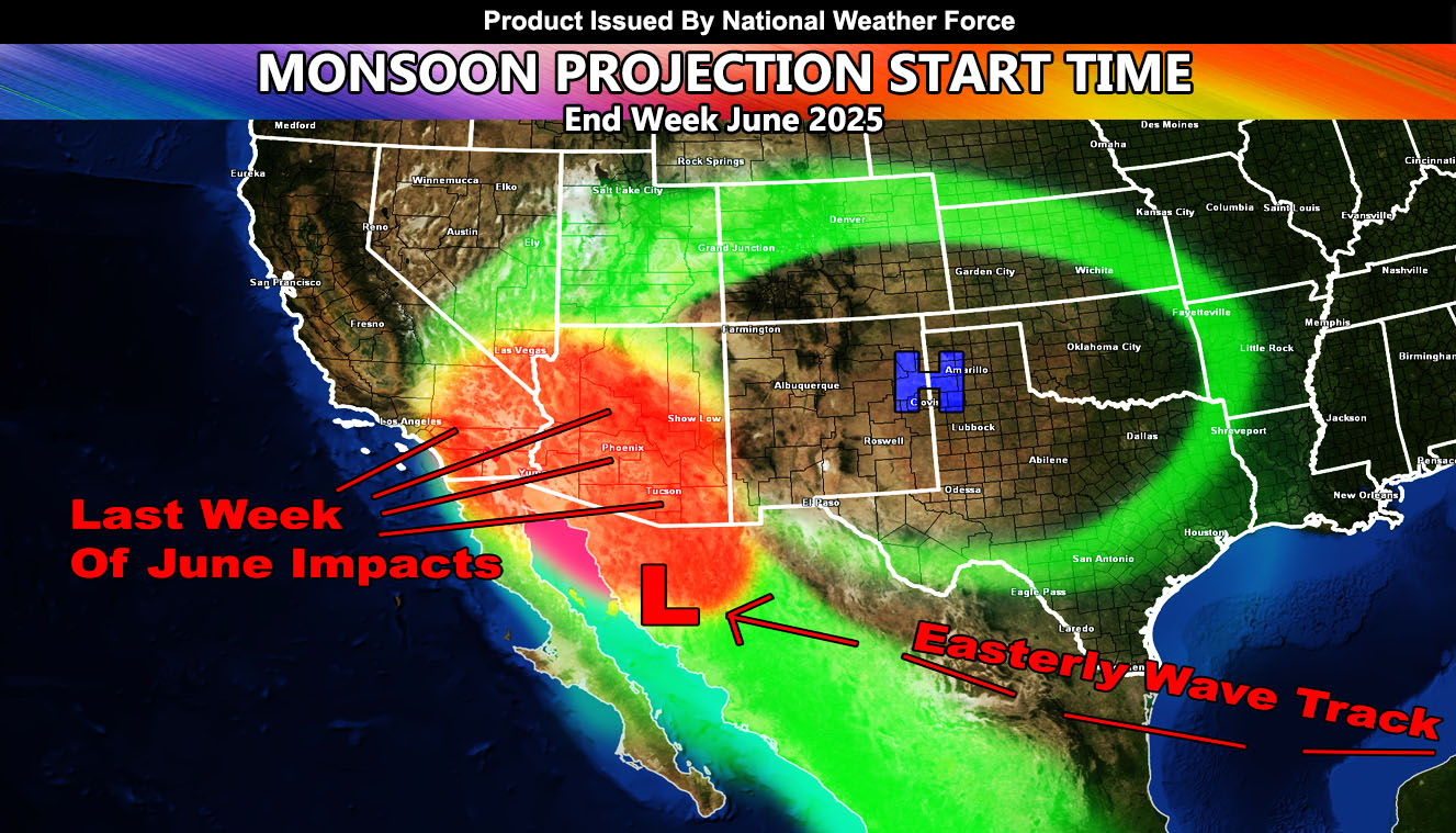
At the same time, an elongated ridge for this season will bring tropical waves out of the Gulf of America, across Northern Mexico, and into the Southwestern United States, in what is known as the Easterly Wave Patterns. Such patterns have the upper dynamics for widespread severe thunderstorm dynamics, and what you look for when you get what I call Interstate 10 corridor runners. These go from Tucson to Phoenix, along I-10, bringing damaging with them.
CONCLUSION: So, look for extremely hot temperatures for the middle of this month (June 2025), followed by the monsoon flow starting the last week of the month, which looks to be a very healthy flow
Monsoon Season Flow will start on June 15th and end on September 30th.
Raiden Storm
Master General Meteorologist