Monsoon moisture is pooling into Southeast Arizona as we speak. A Weather Advisory was issued here at Arizona Weather Force yesterday for today in that area, be it Reference A link below. Thunderstorms, some severe due to wind, will be likely in the Southeast Arizona areas today, mostly across Southern Graham into Cochise County. Activity looks to border Tucson, however it is not a focus spot for today.
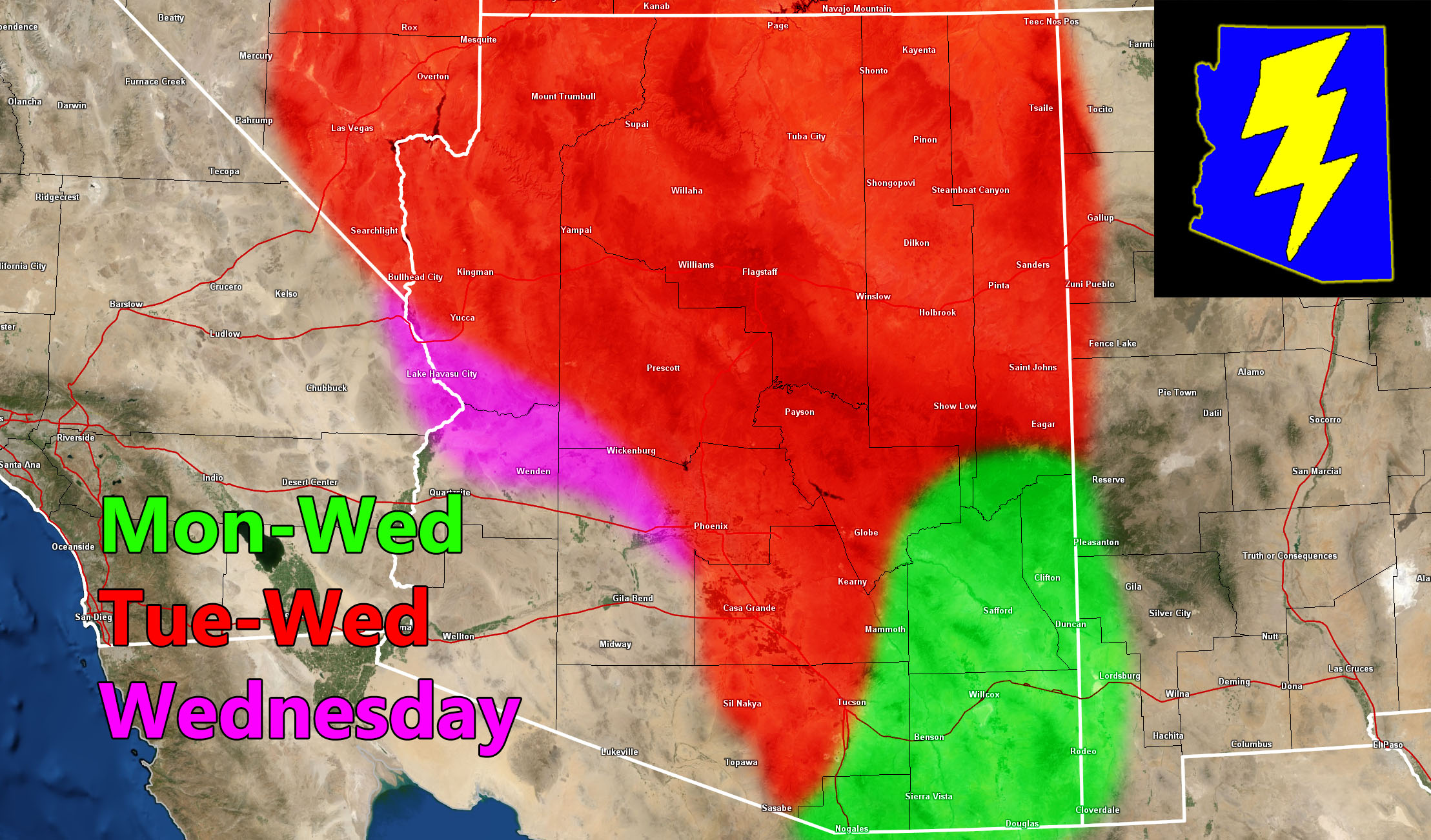
What is a focus spot will be the increase on Tuesday and Wednesday. This is the main Raiden Storm Pattern, where storms will be developing across the Mogollon Rim to Flagstaff and Prescott. An upper-level low off the West Coast of California will work with a ridge to the east. The upper-level low’s lifting dynamics on the east end will provide the storm development, and the storms from the high terrain will move southward into Maricopa, Pinal, and Pima County’s populated zones, with a north to south flow later in the period.
Northwest Arizona – What is interesting is that because of this upper-level low off the West Coast of California, a south to north flow with it will be present across this zone, including Kingman, Needles, Bullhead City on Wednesday, which will increase thunderstorm risks there.
Storm updates will be given the morning of the events, released by at least 10-11am when the first storms in the high terrain are expected to develop.
Reference A Link – Weather Advisory for Southeast Arizona – June 30th, 2025
Link – https://arizonaweatherforce.com/2025/06/29/weather-advisory-16/
Raiden Storm
Master General Meteorologist