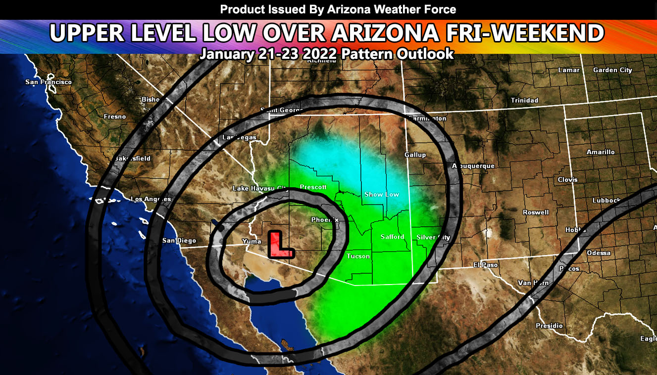
A potent upper-level low dropping directly over the state will provide areas of higher elevation snowfall for some, gusty winds for others, both for some as well. As always, it will depend where you are. Read on for the AZWF wind/snow model for this event. Some of you will see nothing as is with these cutoff systems. The AZWF Member Section GPS model for wind has also been updated and this time non-members will be able to view it to see what their area will be, only for this event so continue on for those details …
FACEBOOK PAGES TO JOIN!
ARIZONA WEATHER FORCE MAIN: Arizona Weather Force Office Main Page For updates
There isn’t much to say about this system. Use the maps below for snow and wind.
Cold nights will follow the system’s departure after the weekend …
These maps in this article are also on the Member Section GPS where you can see where you on within them, even while driving during the day/night of the valid event – If you like the GPS feature, consider getting a membership this season. click below to enter as for this event it is free for everyone to view…
Click Here for the GPS Member Section
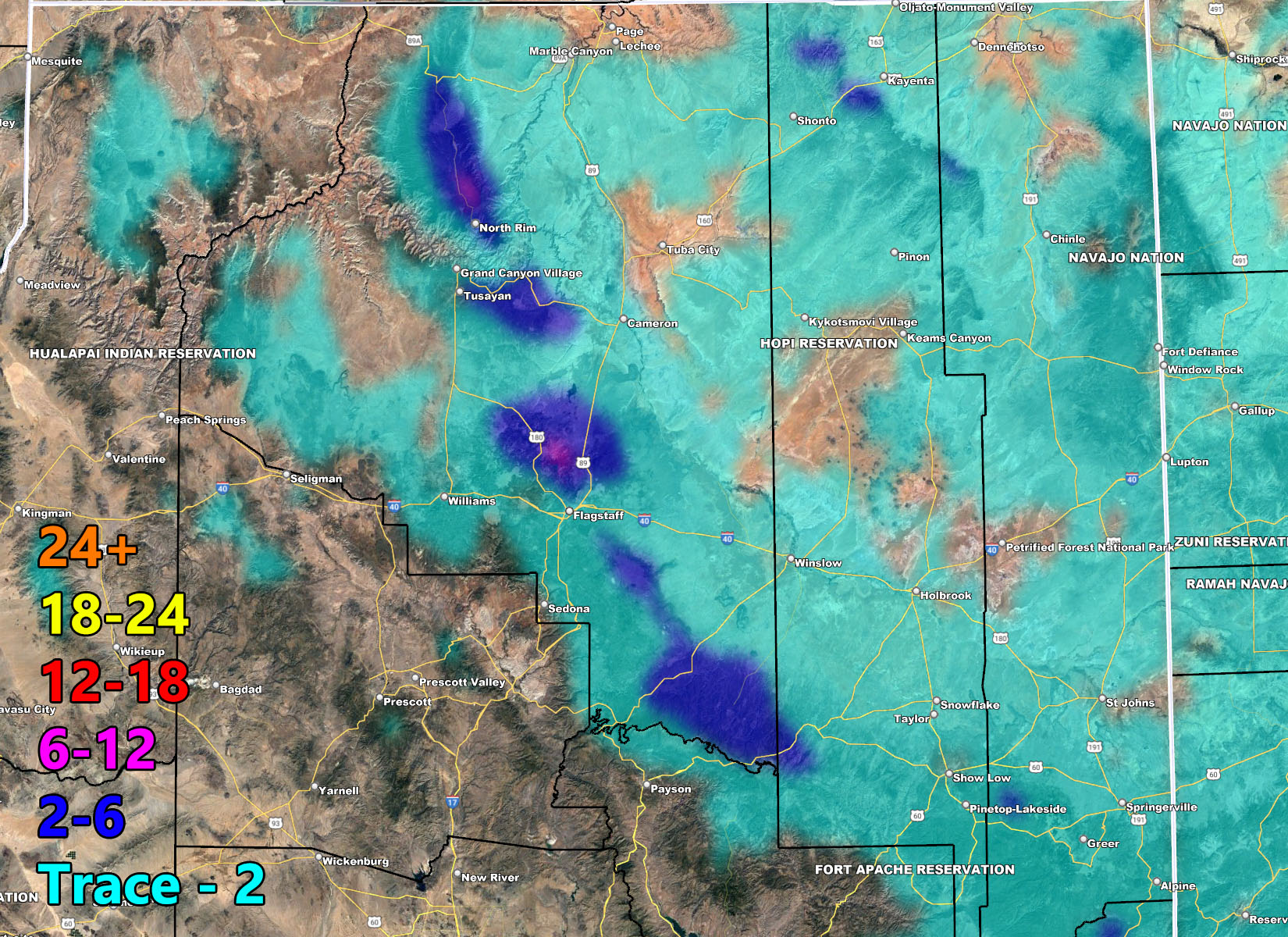
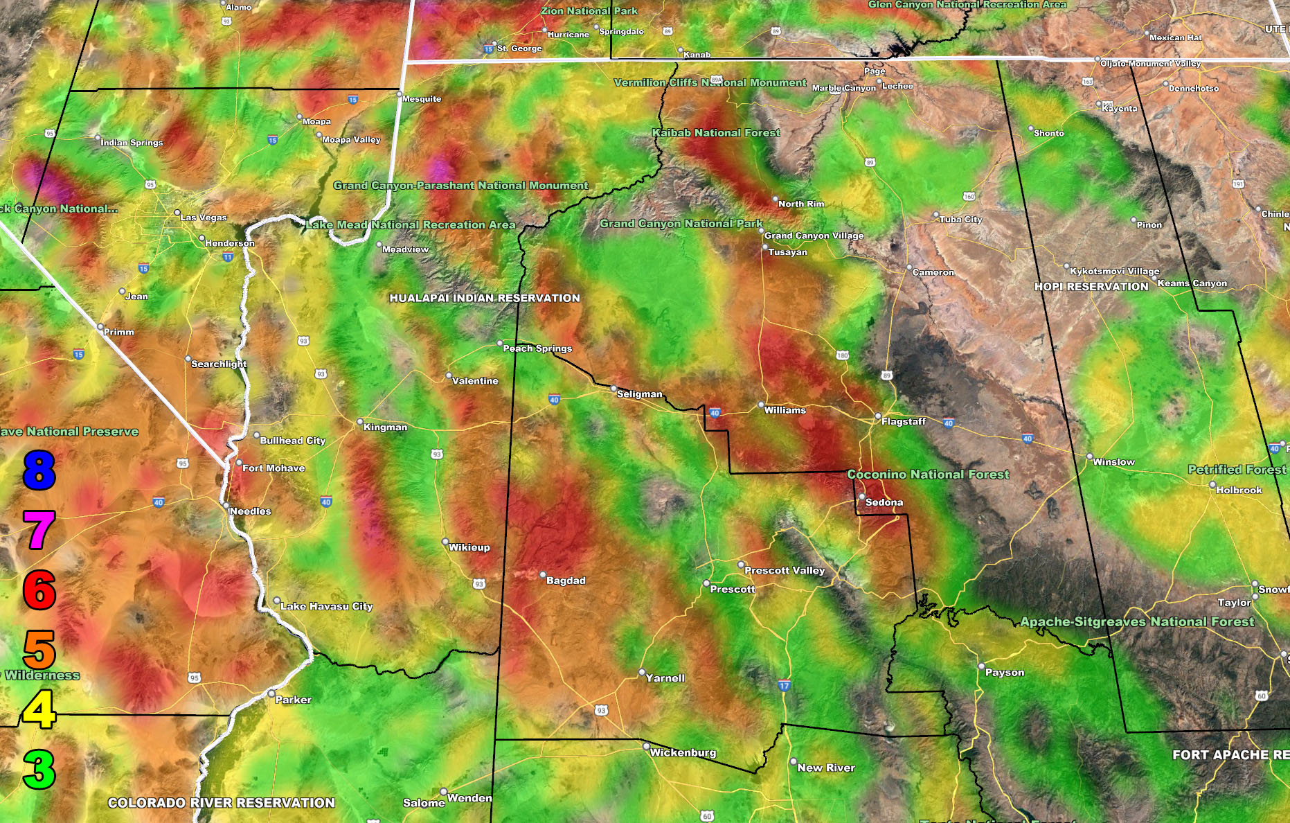
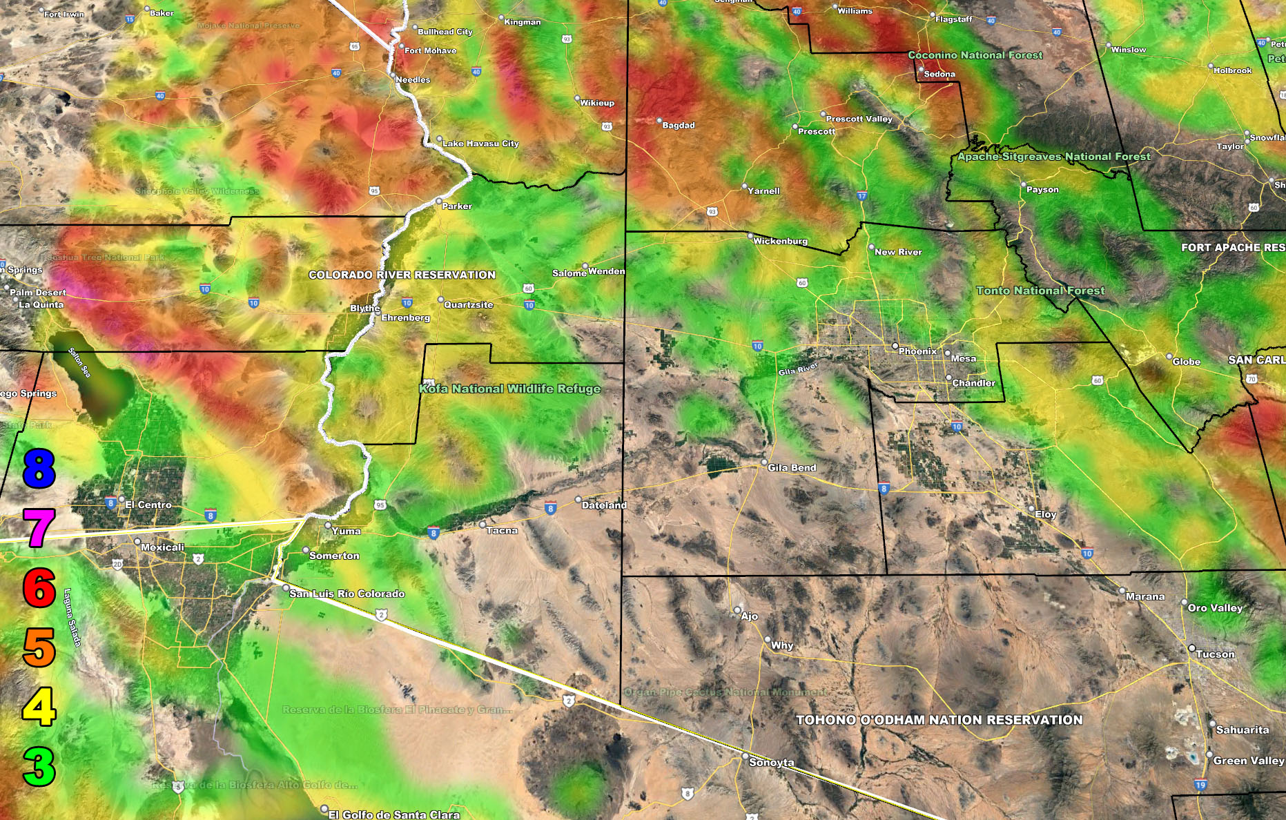
Below are the AZWF models in the form of rain, snow, and wind, snow-levels, or whatever is available for this forecast. They are clickable. Image 1 is NW AZ, 2 is NE AZ, 3 is SW AZ, and 4 is SE AZ –
GET TO KNOW YOUR MAP BECAUSE THESE NEVER CHANGE LOCATIONS
Wind Forecast – Valid Friday night into the Weekend
MEMBERS (Click Here To Open The GPS Version Of These Maps In The Member Section)
Martin Wind Gust Intensity Scale –
8. Extensive widespread damage.
7. Trees are broken or uprooted, building damage is considerable. – High Profile Vehicle Roll-Over CERTAIN.
6. SOME Trees are broken or uprooted, building damage is possible. – High Profile Vehicle Roll-Over Likely, Do NOT recommend Traveling in this zone. If you are in this zone and above, do not park your car near trees as downed trees can easily harm you.
5. Slight damage occurs to buildings, shingles are blown off of roofs. HIGH WIND WARNING CRITERIA – High Profile Vehicle Roll-Over Possible if weight is not corrected.
4. Twigs and small branches are broken from trees, walking is difficult.
3. Large trees sway, becoming difficult to walk. POWER SHUTDOWN THRESHOLD DURING FIRE WEATHER / WIND ADVISORY CRITERIA


Snow Forecast – Valid Friday night into the Weekend