February ended up drier and warmer than average across many parts despite some cold spells, on target to the February 2022 forecast. March 2022 will be about the same with yet again more see-saw (back and forth) patterns for temperatures so read on for details …
The previous article (click here) stated that another arctic air mass will come down into the area for the first/second week of this month. This was released on February 24th, which would definitely make it a long range forecast. This looks to come true as the current warm spell will break down with an inside slider storm system moving through the region by the end of this week. Those details will be worked out in another article, but this will bring in a cold air-mass for the forecast areas beginning end this week and going on through the second week of the month.
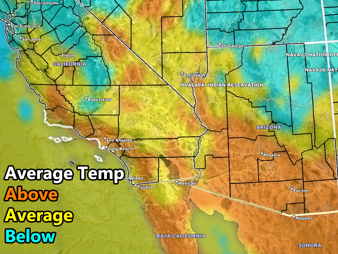
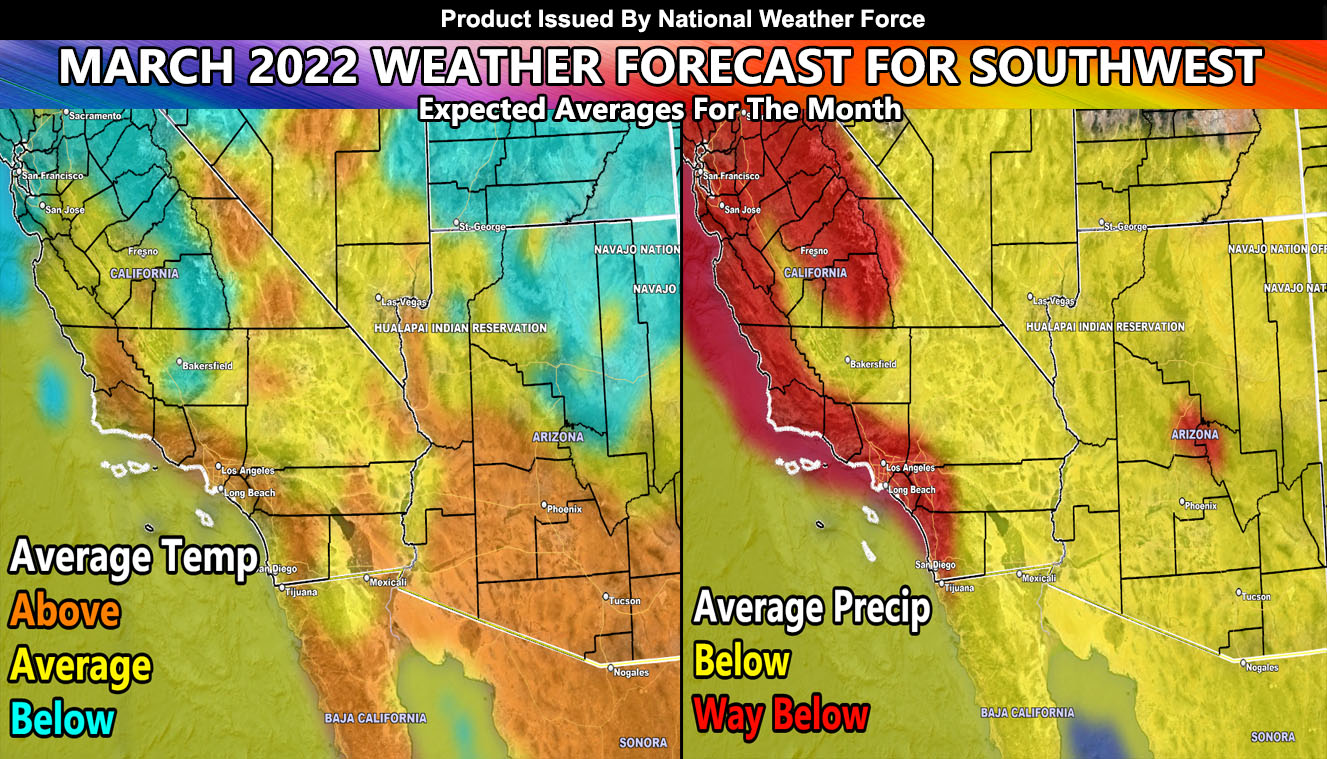
After the second week however we are in-line for another ridge, which means from cold to warm yet again. There are indications this ridge will be strong and temperatures as a result toward the end of the second week and especially after March 19th will be near or at heatwave level for the month. This will calm a bit toward the end of the month, but still remaining above average. Despite the cold spell for the first two weeks of the month, the warm-up happening will keep most of the area average to above average in temperatures. The exception being Northern Arizona where you will be closer to the inside sliders and snow events for below normal temperatures there, especially in areas where snow remains on the ground.
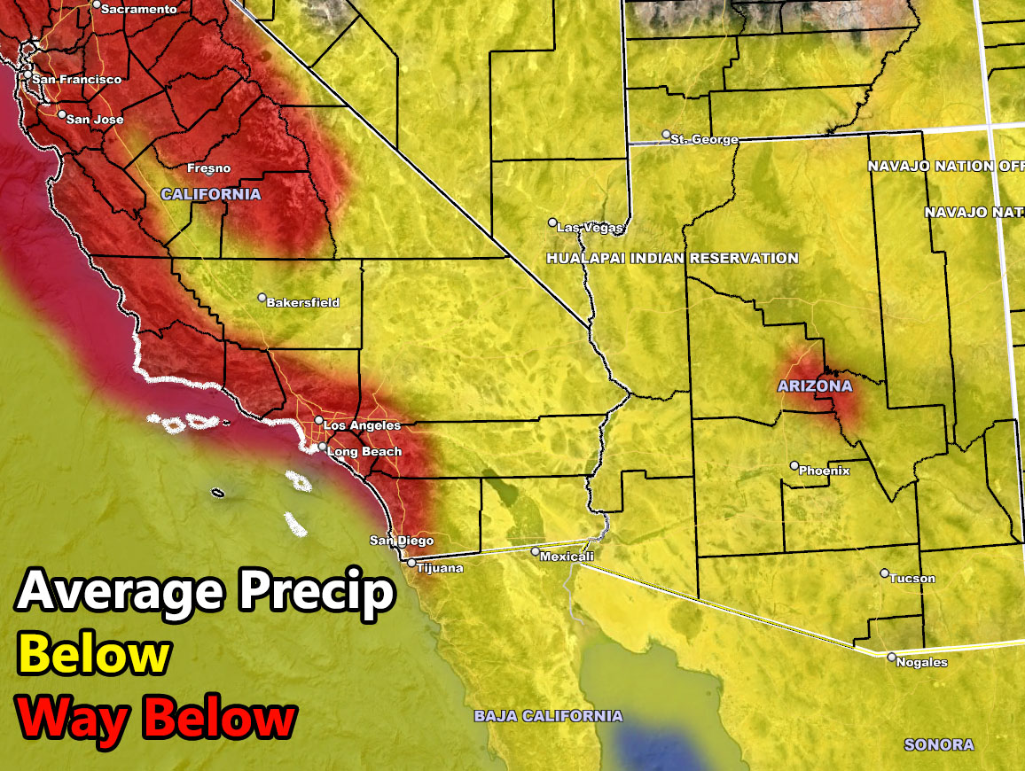
So the inside slider chances happen the beginning half of the month followed by drier conditions through the last half. In other words, not a real exciting month except for the next system in Southern California that can produce the dynamics for Thunderstorms Thursday night or Friday … I’d call this month a tease month where it seems the first system will bring more storms with it, but it will be a wham bam thank you … you know the rest … type of month …
Still, Los Angeles is hovering just above the 10.60″ rainfall mark for the water year. My forecast was for 10-14″ and we seem to be sticking right around there. Despite having this ‘lull’ for the start of spring, scientifically we remain with the accuracy level being high and unlike last month, we will tack on some more of those numbers to bring that 10.60″ closer to the 11+” mark.
This was given to both Southern California and Arizona Weather Force.
FACEBOOK: Click here to join Southern California Weather Force
FACEBOOK: Click here to join Arizona Weather Force