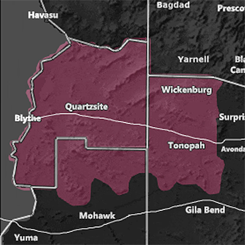
Issued Zones: Western Maricopa County … La Paz County …
Site: Arizona Weather Force has issued a Weather Advisory for isolated thunderstorm activity that would affect I-10 … effective this afternoon until 9pm tonight …
Date: 6/11/22 at 10:30am local
Forecast: A trough of low pressure approaching Northern California will work with a slight increase in moisture and instability in a small section of Western Arizona this afternoon/evening. This would work with the local convergence zone along I-10 at the La Paz and Maricopa Border to bring high-based thunderstorms to the region.
The storms in this area could bring some hail as well as damaging 40-50 mph winds and reduced visibility due to blowing dust …
Any photographers/storm chasers in the area would want to be in this advisory area. There are indications that they can surround the Parker, AZ forecast area as I do think they will also form west of the CO River Valley into Southern California’s Desert Territory as well …
Want these delivered to your e-mail and also the many other alerts for your area that area custom forecast for that you won’t see elsewhere? Sign-up for your free community paid for memberships for this season by going to this link – follow the terms of service directions as well – – https://arizonaweatherforce.com/?/register/BKNmp3
Join the Facebook Page for Further Updates If You Have Not Yet!
ARIZONA WEATHER FORCE MAIN:
Join The Main Arizona Weather Force Facebook Group (50 percent delivery time) – You can join the main AZWF page as well through that group.
Click Here To Join The Page Today
10 mile rule: These alerts issued on this site
means that within your zone and 10 miles from you will see the event
forecast for. You may or may not see the event but it means you are in
the zone or 10 miles from where someone will.
Forecaster: Raiden Storm
MODE