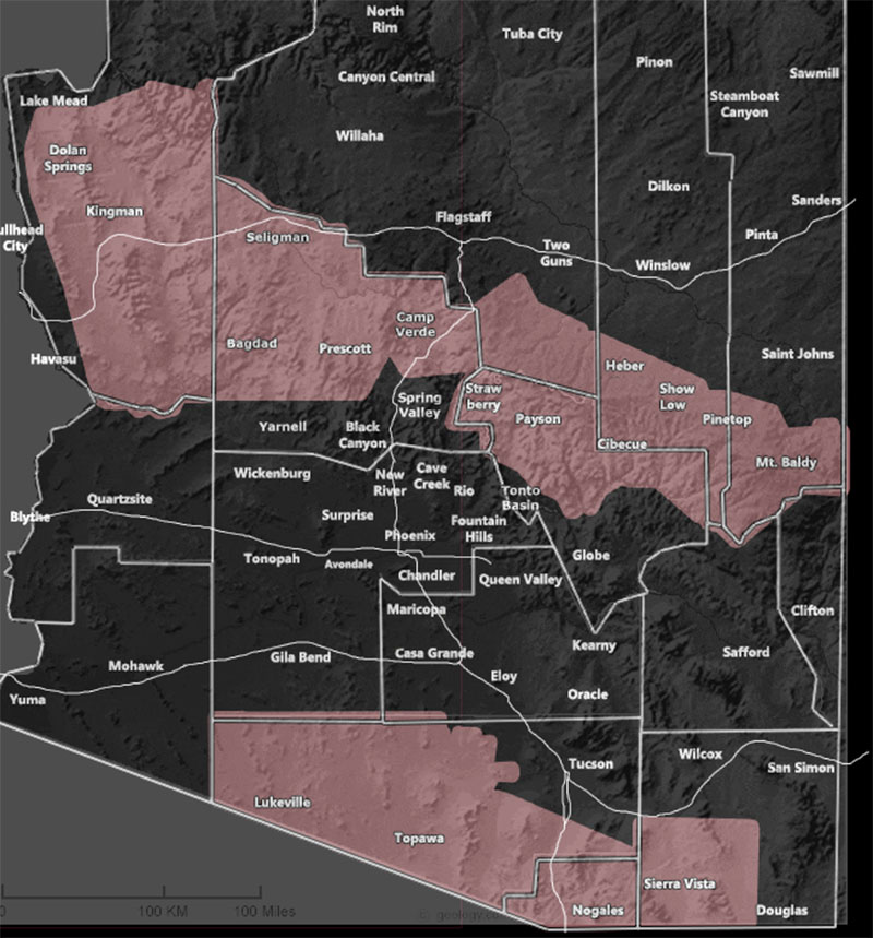
Issued Zones: Pima County … Southwest Cochise County … Mogollon Rim … Kingman Forecast Area …
Site: Arizona Weather Force has issued a Thunderstorm Watch effective later this morning through this evening …
Date: 6/28/22 at 10:00am PT
Forecast: A ridge of high pressure centered at the Nevada / Utah border will continue to shift eastward, slowly. This will continue bringing monsoon moisture into the state. The two thunderstorm watches are the focus spots for today for hail and strong winds with the storms, along with flooding potential.
Storms should remain south of Flagstaff, which is odd and rare, but due to the lift along the rim in the first thunderstorm watch, the flow is east to west, which means storms forming near Kingman will hit in town and possibly at or near the Dolan Springs areas as well.
Storms in the second watch in south state will be strongest in the Topawa forecast zones, in Southeast/South Pima County …
Storm coverage will be stronger in Tucson and Phoenix tomorrow, Wednesday, as deeper moisture comes available …
Want these delivered to your e-mail and also the many other alerts for your area that area custom forecast for that you won’t see elsewhere? Sign-up for your free community paid for memberships for this season by going to this link – follow the terms of service directions as well – – https://arizonaweatherforce.com/?/register/BKNmp3
Join the Facebook Page for Further Updates If You Have Not Yet!
ARIZONA WEATHER FORCE MAIN:
Join The Main Arizona Weather Force Facebook Group (50 percent delivery time) – You can join the main AZWF page as well through that group.
Click Here To Join The Page Today
10 mile rule: These alerts issued on this site
means that within your zone and 10 miles from you will see the event
forecast for. You may or may not see the event but it means you are in
the zone or 10 miles from where someone will.
Master Meteorologist: Raiden Storm