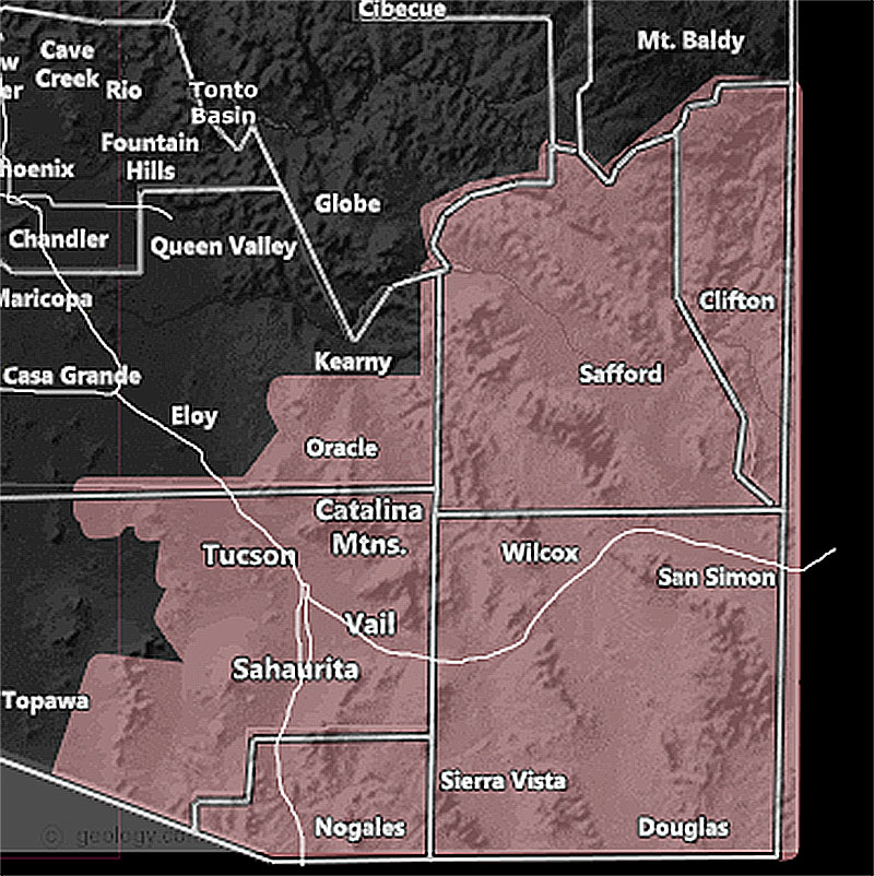
Issued Zones: Cochise, Graham, and Greenlee County … Santa Cruz County … Eastern Pima County … Southeast Pinal County ..
Site: Arizona Weather Force has issued a Thunderstorm Watch effective this afternoon until 5am Thursday morning …
Date: 7/20/22 at 10:10am PT
Forecast: Storms will develop over the higher terrain first this afternoon and then head to the lower terrain areas by evening. Storms will be the strongest in the Santa Cruz, Cochise, Graham, and Greenlee County zones with damaging winds and large hail in the strongest cells … Movement is expected to be northeast to southwest.
Overnight however, an impulse moving out of that same area will move across Tucson’s forecast area, which is why you are kept in this watch overnight. Isolated to scattered thunderstorms will be possible in that zone, but you are not in the strongest storm sector … Still, a solid flow from the Catalina Mountains would mean Tucson is in the downrange spot for storms to move in … and weaken as they move southwest/west of the city more so …
Want these delivered to your e-mail and also the many other alerts for your area that area custom forecast for that you won’t see elsewhere? Sign-up for your free community paid for memberships for this season by going to this link – follow the terms of service directions as well – – https://arizonaweatherforce.com/?/register/BKNmp3
Join the Facebook Page for Further Updates If You Have Not Yet!
ARIZONA WEATHER FORCE MAIN:
Join The Main Arizona Weather Force Facebook Group (50 percent delivery time) – You can join the main AZWF page as well through that group.
Click Here To Join The Page Today
10 mile rule: These alerts issued on this site
means that within your zone and 10 miles from you will see the event
forecast for. You may or may not see the event but it means you are in
the zone or 10 miles from where someone will.
Master Meteorologist: Raiden Storm