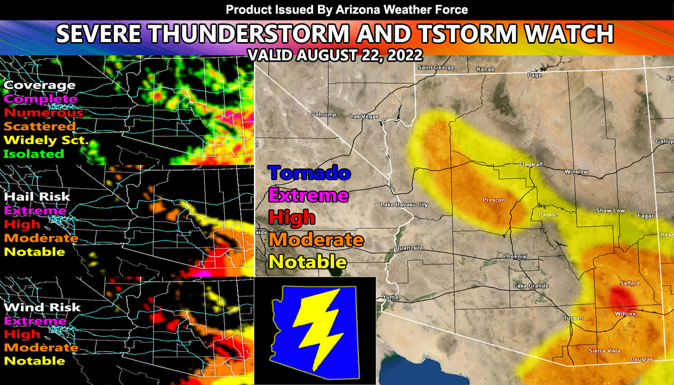
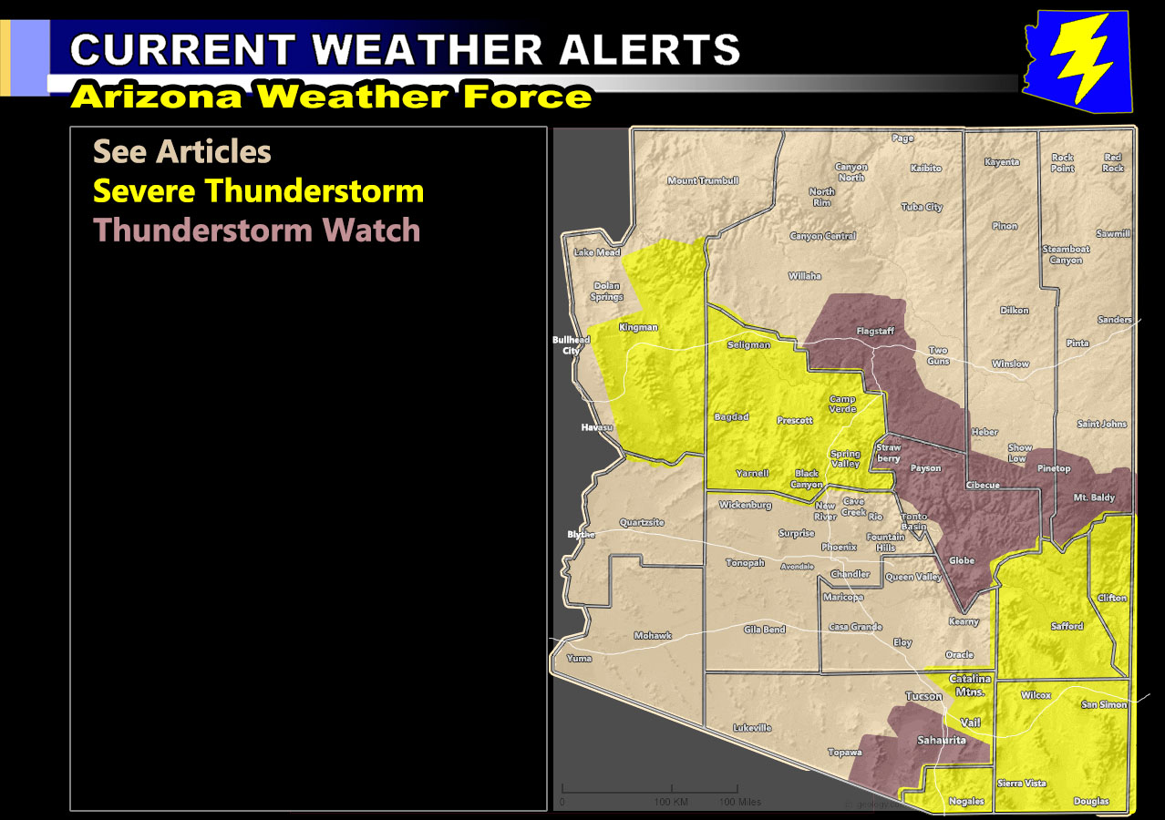
Arizona Weather Force has issued two alerts, one a larger Severe Thunderstorm Watch effective for Greenlee, Graham, and Cochise County for the most part and another in Yavapai County, with a Thunderstorm Watch for most of the southern sections of the rim. The flooding in Greenlee County will get worse as this is a target spot today for severe thunderstorms so for details of this forecast along with the AZWF Monsoon Forecast Models for coverage, hail, wind, alert type read on for details …
Join the Facebook Page for Further Updates If You Have Not Yet!
ARIZONA WEATHER FORCE MAIN:
Discussion: This is going to be a touchy day given the state has less mid-level moisture in many locations and the impulses are spotty at best. For example, the Southeastern Arizona Severe Thunderstorm Watch I issued will be covered as per the coverage model below, but there will be areas of a miss. Example the AZWF coverage model shows isolated in Safford, between the two mountain ranges to you west and east. Will be interesting to follow to see how that works out. Storms will form in Northern Greenlee County and move south-southwest through Graham County and then Cochise County later in the day. Damaging winds, large hail, and flash flooding are all concerns with the watch area. There are some indications that the Eastern Tucson areas near the Cochise County Border will see storms as well, thus you are also included in this watch as a zone.
As for the Yavapai County zones. You can note that the coverage map is spotty at best. It looks like Dewey more than Prescott, but again Dewey is in the Prescott zone so Prescott you have to be included in the watch. The most concentration will be the Bagdad area where the coverage is high, and the severity is strong.
Storms will form from Flagstaff south to Sedona and southeast to Strawberry, Payson, and along the rim south of Show Low and into the Mount. Baldy and Alpine zones.
TUESDAY AND WEDNESDAY: Given today will not be strong in the lower elevation, increased moisture and dynamics will cook the lower levels these days and produce severe thunderstorms through the lower valleys again. This update will come soon, but you have your ‘warning’ now to be ready should one of them hit you then.
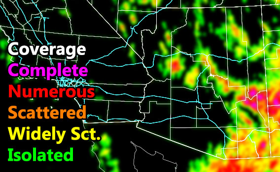
NOTE: This is the AZWF High Resolution Model with an error allowance of 0 to 10 miles, meaning if you are close to the shade, you are in the risk on the map above and in the watches on the map below. Another thing to note is Pinal County on this has a lot of areas that have blank and/or isolated so you are not a major target like Maricopa County is, as noted by the coverage model below.
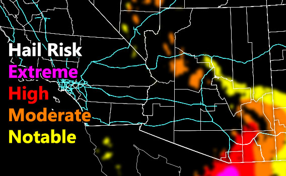
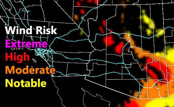
Remember find the coverage model first and see your event coverage. The higher the better chances you’ll be hit. Then compare the hail/wind and see what risk you are in.
Coverage Of Activity – Image is clickable
Hail Risk – Image is clickable
Wind Damage Risk – Image is clickable
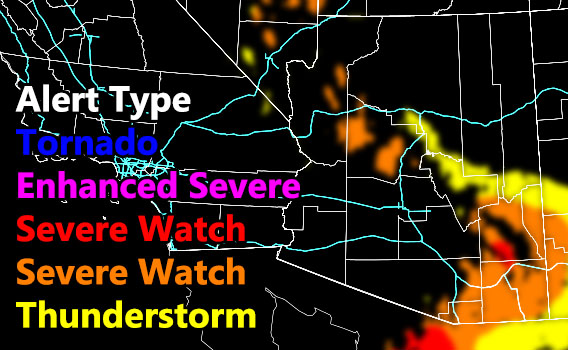
Alert Type Proposed – Image is clickable
Want these delivered to your e-mail and also the many other alerts for your area that area custom forecast for that you won’t see elsewhere? Sign-up for your free community paid for memberships for this season by going to this link – follow the terms of service directions as well – – https://arizonaweatherforce.com/?/register/BKNmp3
TWITTER: Join the AZWF Twitter For Articles By Clicking Here