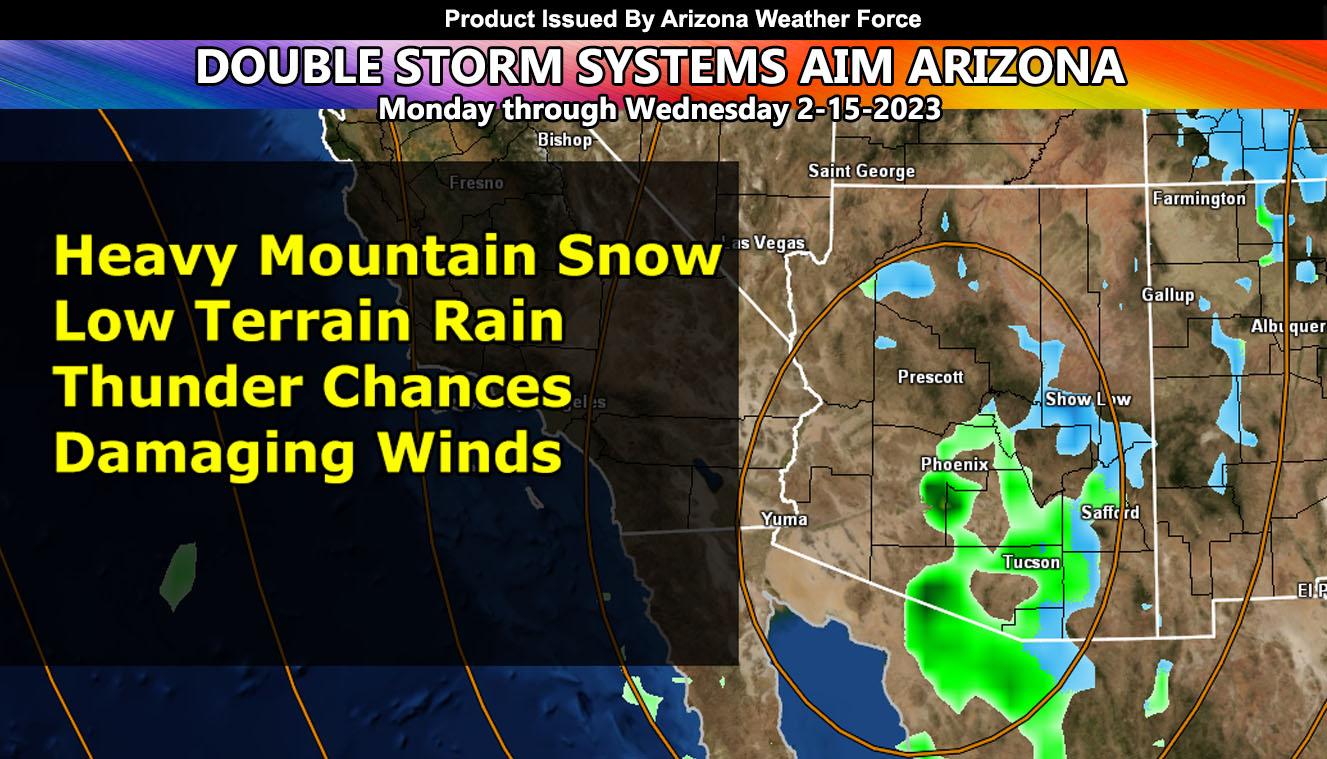
A cutoff low coming out of Northern Baja tomorrow will start a short term storm pattern that will last from Monday through noon on Wednesday, bringing two separate systems through the state, with damaging winds, thunderstorms, heavy mountain snow, and low terrain rain in a rare event for this time of year, so for the AZWF rain, snow, and wind models read on for details …
WANT THESE DELIVERED WITH ALL THOSE PERKS INCLUDING BEING ON THE MICRO-CLIMATE ALERT SYSTEM AND MODELS DURING EVENTS BECAUSE NOT EVERY ALERT IS POSTED ON SOCIAL MEDIA FROM THIS WEATHER OFFICE – JOIN TODAY BY CLICKING HERE – Arizona Weather Force Fundraiser and Subscriber System – Arizona Weather Force
Join the Facebook Page for Further Updates If You Have Not Yet!
ARIZONA WEATHER FORCE MAIN:
A cutoff low that missed most of Southern California as expected will move south of there and through Northern Baja tonight, ending up moving across Arizona over the morning through evening on your Monday. This will bring mountain snow and rainfall for the lower terrain. It also has enough dynamics to warrant the chance of thunderstorms across the metro zones, with thundersnow possible in the mountain zones. Thunderstorms on Monday will bring the chance of hail as well as funnel clouds which could briefly touchdown as a small tornado. This usually is the case with such a cold upper-level low.
There will be a break on Monday night, but on Tuesday a storm system approaching the Pacific Northwest today will dip into Arizona. This will bring heavier snowfall for the mountain areas, and renewed rainfall for the lower terrain. This system is also an extremely powerful one in terms of downward force wind. This means that the entire state will see gusts over 40+ mph, with some areas easily over 50 mph. The wind model in the information and/or links below shows the scale at which is being thought for Tuesday’s wind-fest across the state.
As the system exists, a small bit of snow is going to be possible for the Tucson metro zones on Tuesday night as well as most of Cochise, Graham, and Greenlee County.
Another system is possible over this weekend … but for now, use the rain, snow, and wind models below for the 48 hour period starting tomorrow (Monday morning).
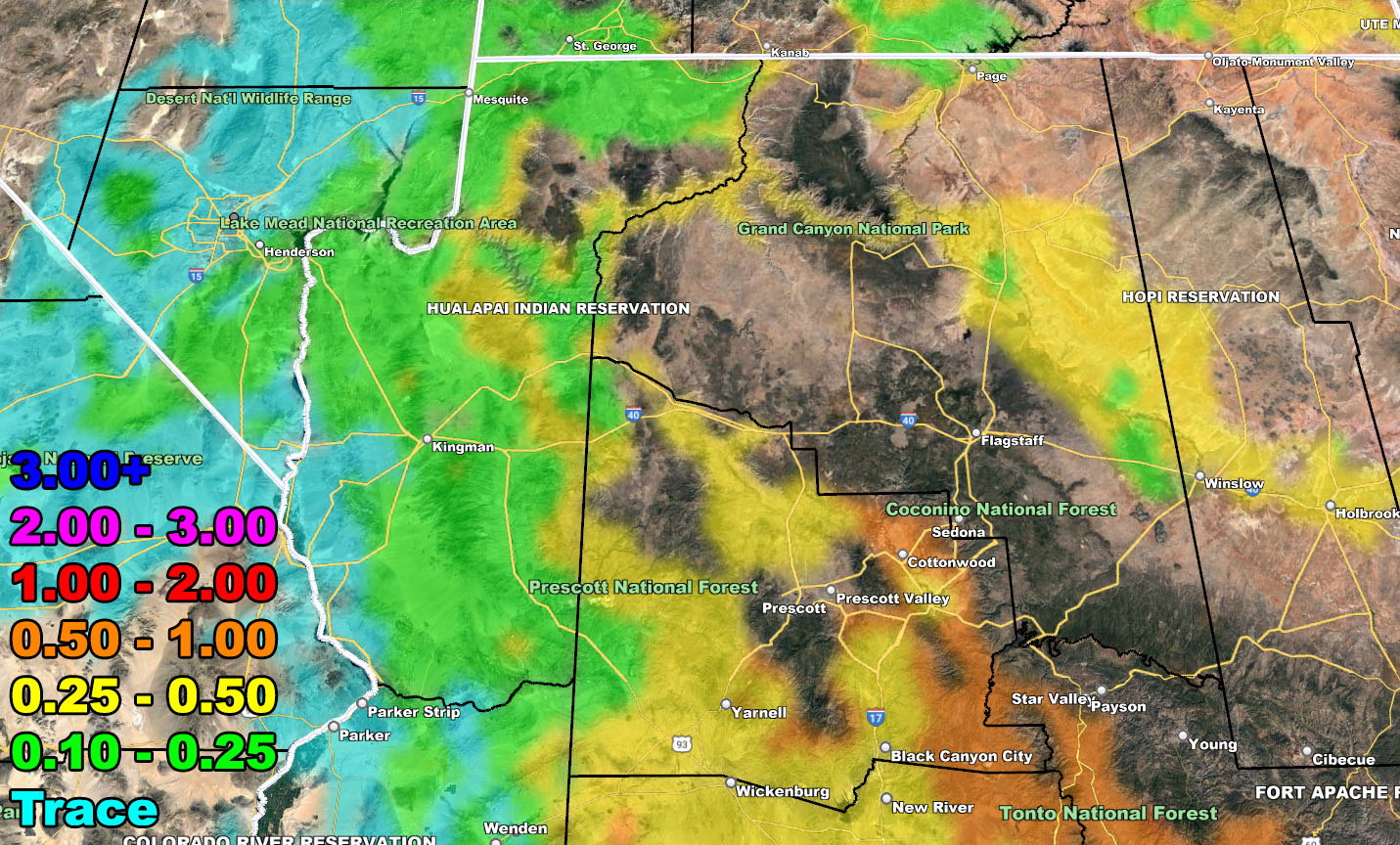
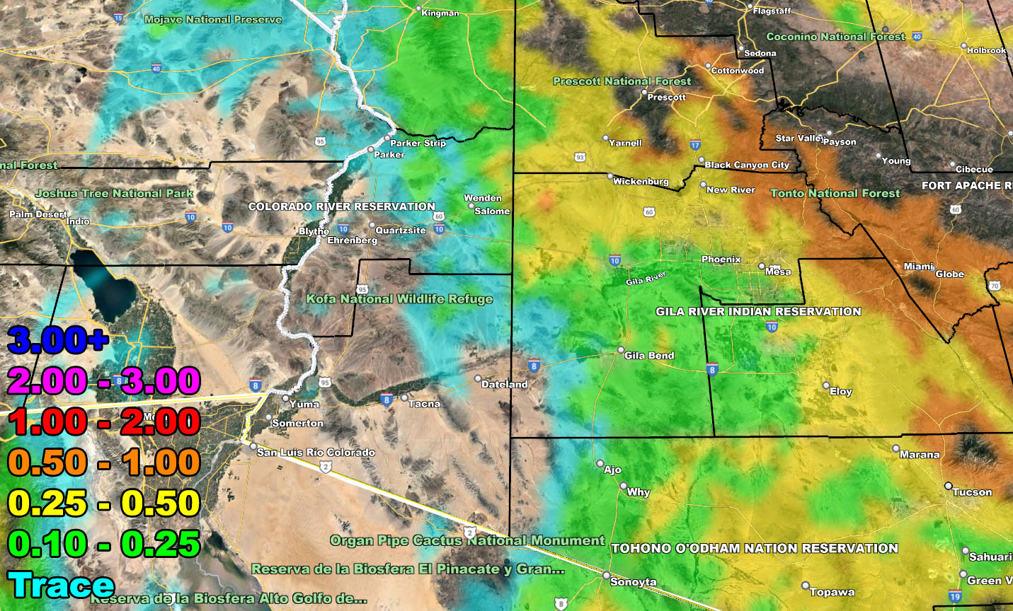
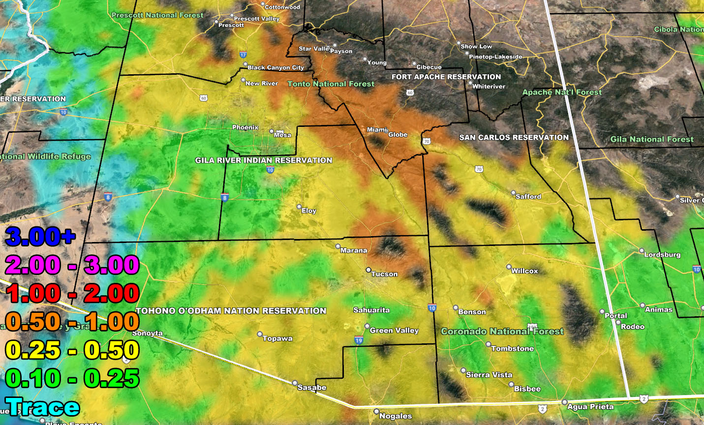
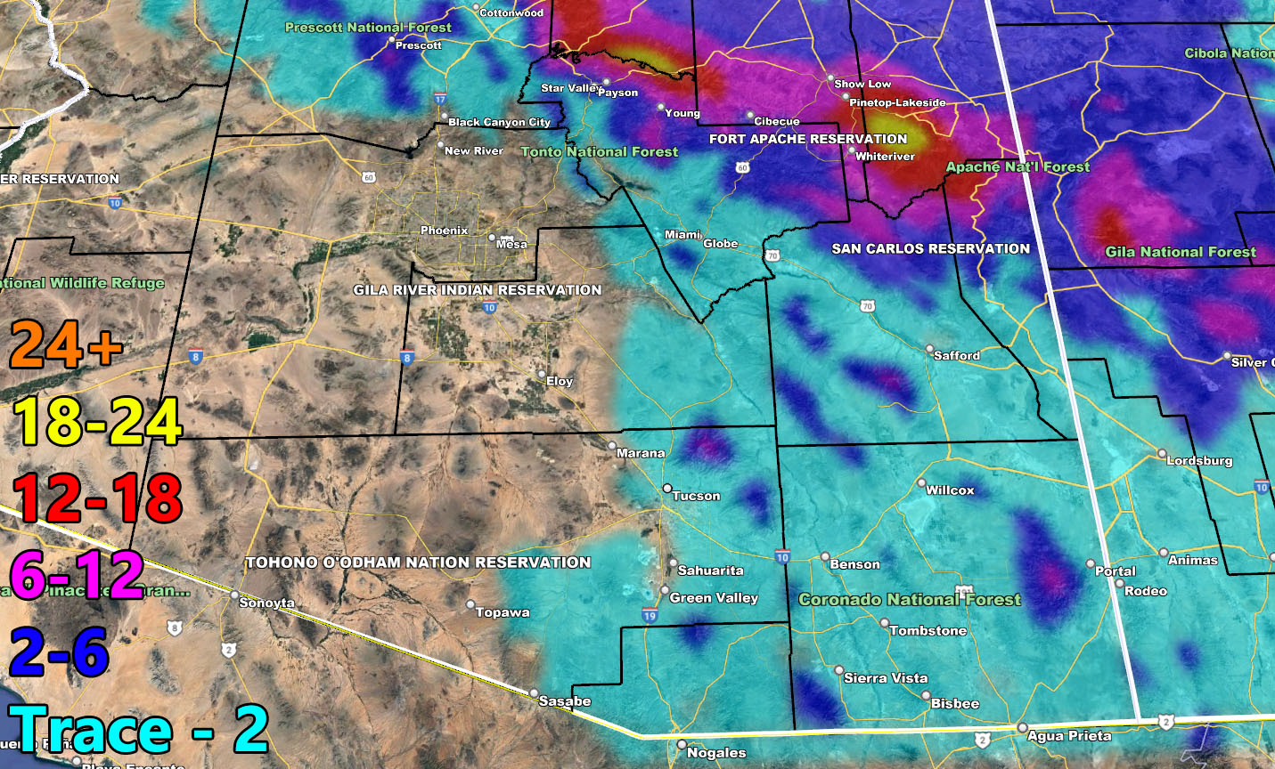
Rain Model – VALID MONDAY THROUGH NOON WEDNESDAY – 2-15-2023
SUPPORTING MEMBERS: Click Here To See The GPS Version Of This Model In Your Member Section Tab.
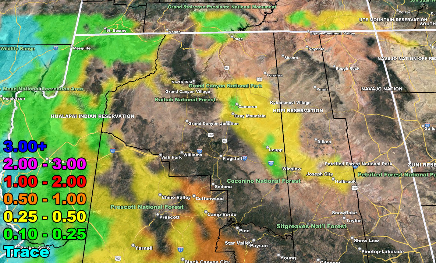
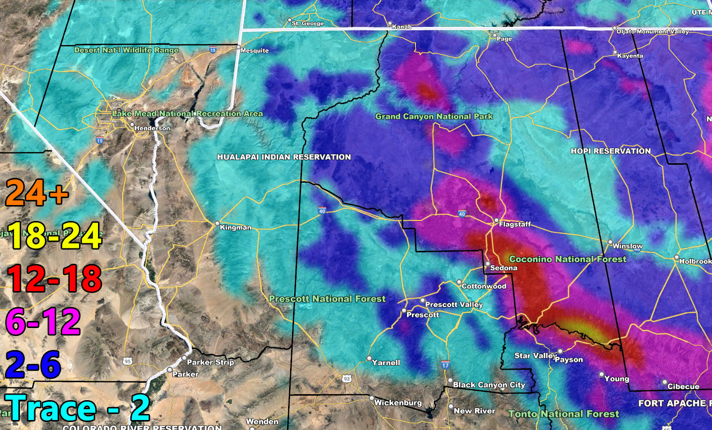
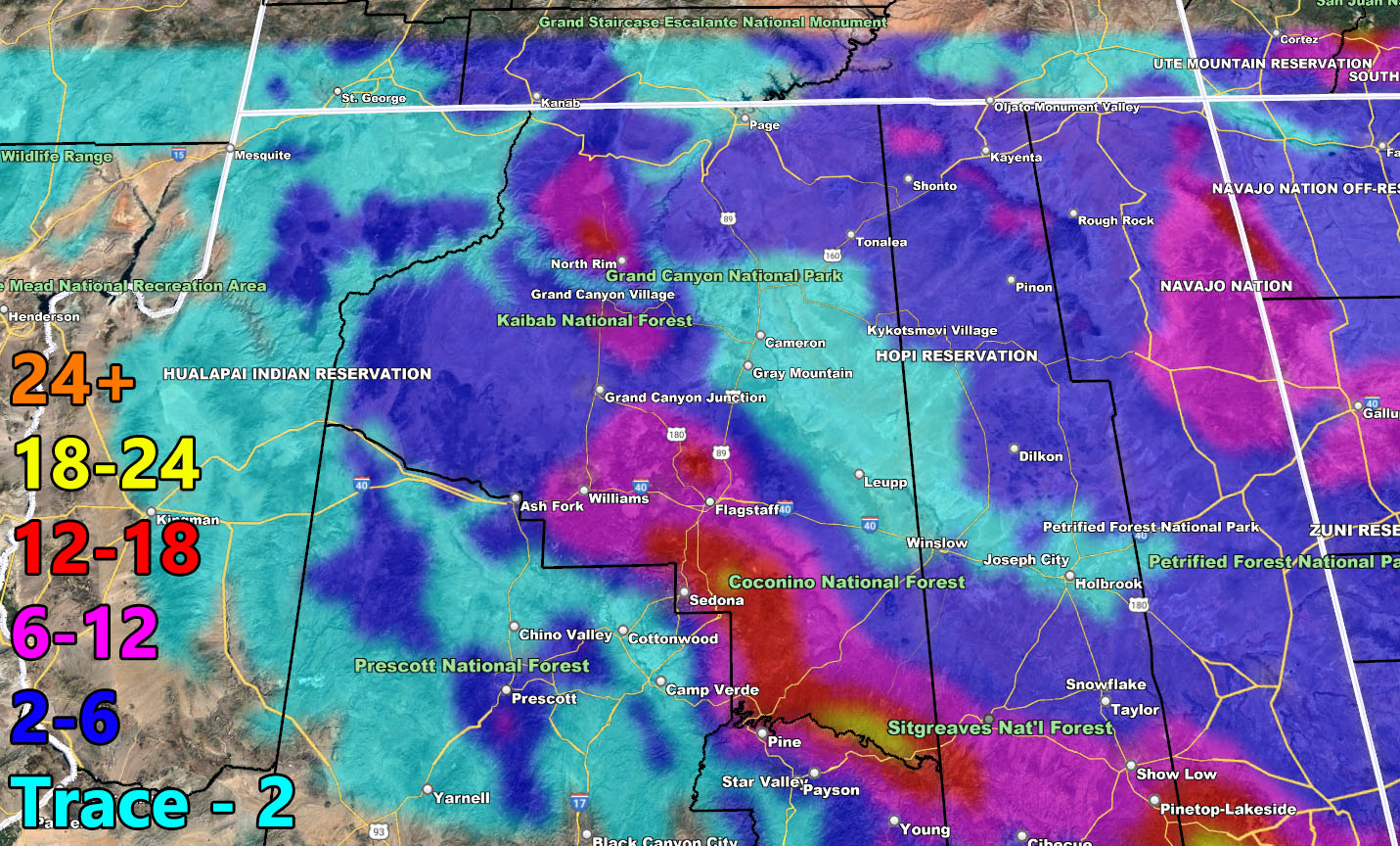
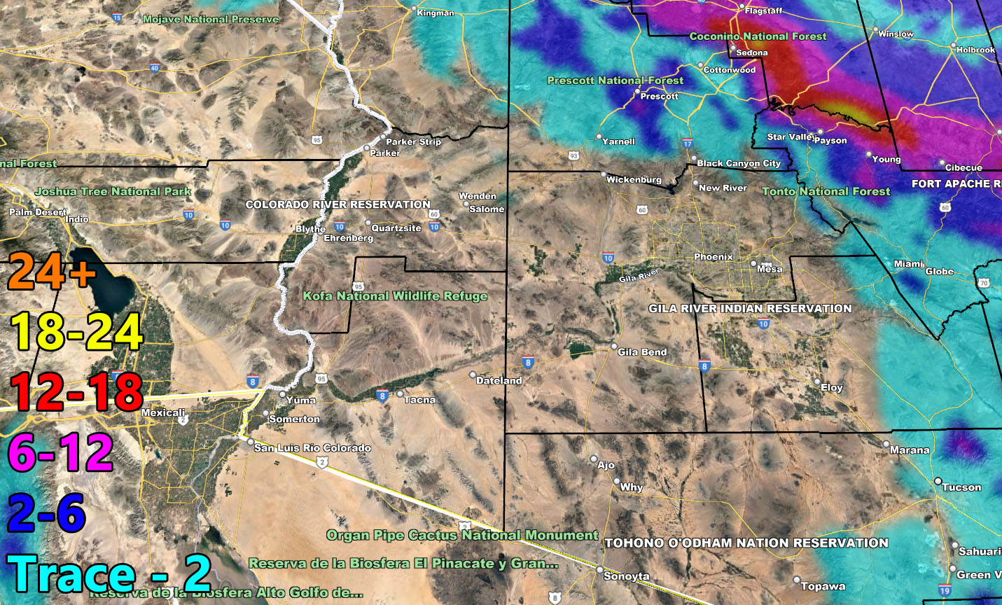
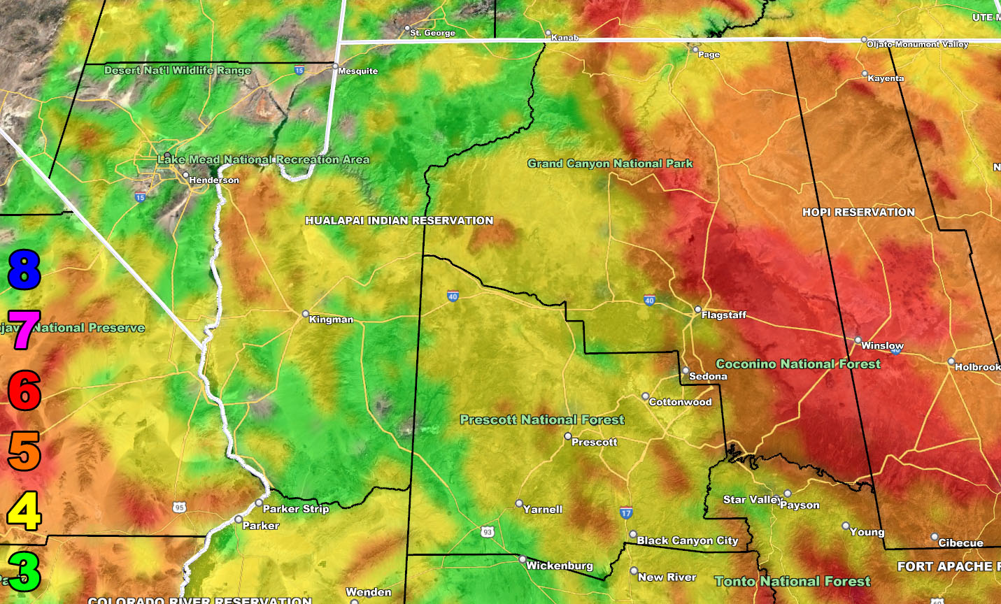
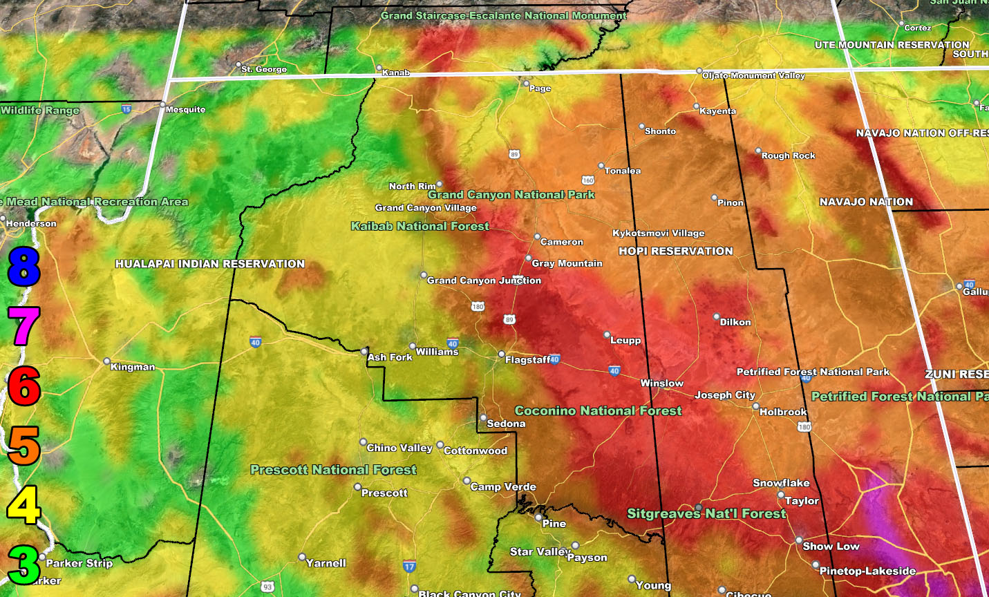
Snow Model – VALID MONDAY THROUGH NOON WEDNESDAY – 2-15-2023
SUPPORTING MEMBERS: Click Here To See The GPS Version Of This Model In Your Member Section Tab.
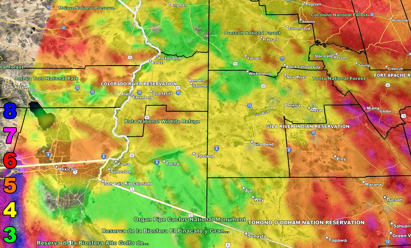
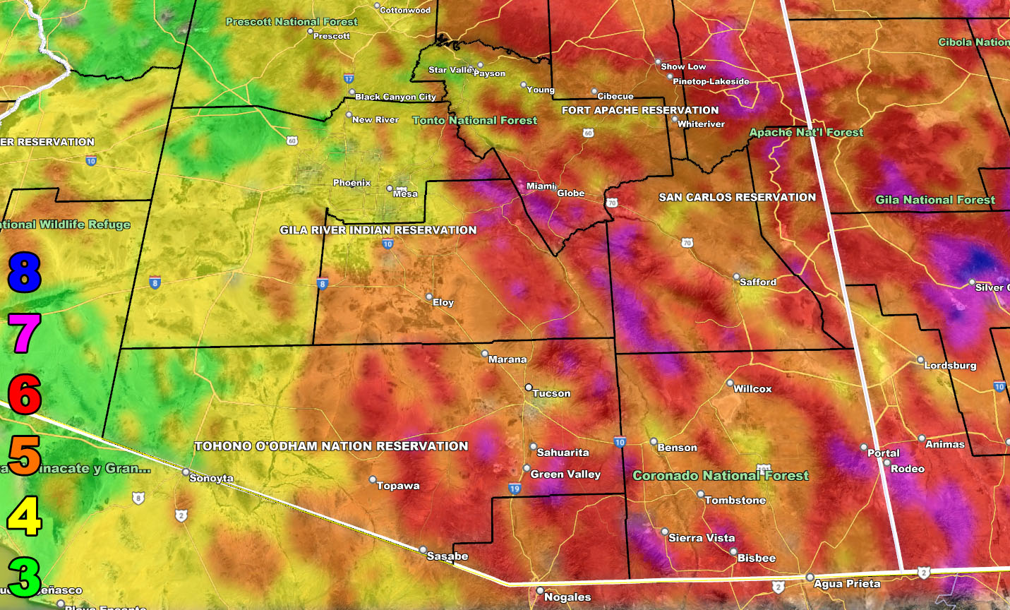
Wind Model – VALID TUESDAY – 2-14-2023
SUPPORTING MEMBERS: Click Here To See The GPS Version Of This Model In Your Member Section Tab.
8. Extensive widespread damage.
7. Trees are broken or uprooted, building damage is considerable. – High Profile Vehicle Roll-Over CERTAIN.
6. SOME Trees are broken or uprooted, building damage is possible. – High Profile Vehicle Roll-Over Likely, Do NOT recommend Traveling in this zone. This zone also is the starting zone where trees and powerlines will fall and damage cars and even kill people near or in them!
5. Slight damage occurs to buildings, shingles are blown off of roofs. HIGH WIND WARNING CRITERIA – High Profile Vehicle Roll-Over Possible if weight is not corrected.
4. Twigs and small branches are broken from trees, walking is difficult.
3. Large trees sway, becoming difficult to walk. POWER SHUTDOWN THRESHOLD DURING FIRE WEATHER / WIND ADVISORY CRITERIA
WANT THESE DELIVERED WITH ALL THOSE PERKS INCLUDING BEING ON THE MICRO-CLIMATE ALERT SYSTEM AND MODELS DURING EVENTS BECAUSE NOT EVERY ALERT IS POSTED ON SOCIAL MEDIA FROM THIS WEATHER OFFICE – JOIN TODAY BY CLICKING HERE – Arizona Weather Force Fundraiser and Subscriber System – Arizona Weather Force
TWITTER: Join the AZWF Twitter For Articles By Clicking Here
Join The Main Arizona Weather Force Facebook Group (50 percent delivery time of micro-climate alerts not posted on the main AZWF page) – You can join the main AZWF page as well through that group.
Click Here To Join The Page Today