Arizona Weather Force has issued a Long-Range Weather Advisory as a ridge of high pressure after July 20th will move into place for a major upswing in the monsoon activity between then and the end of the month.
Parts of the Mogollon Rim and Southeastern Arizona have been seeing storms this week as the monsoon starts up in those areas. A ridge of high pressure that will push temperatures in Phoenix to 118 this weekend will develop. This will cause afternoon delays at Phoenix Sky Harbor Airport as temperatures over 117F and higher is the threshold to stop planes from taking off due to dynamics I will not discuss here.
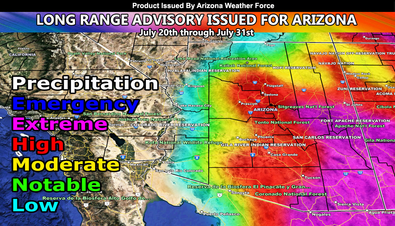
This same ridge will migrate into Nevada around July 20th. It will stick around in that area through the rest of this month. A northeast to southwest flow on the southeast periphery of this high-pressure area will finally ignite the Mogollon Rim and shove severe storm activity into the Tucson/Pinal/Phoenix metro areas.
Arizona Weather Force long range risk assessment models show that the high-risk shade extends into the metro areas, with extreme risk in the South and Eastern Arizona zones. Long Range models here at Arizona Weather Force into August continue to show severe storms affecting the state, which will keep the original forecast for average to above average precipitation, along with storms being more severe off the rim down into the low terrain.
Get these alerts over the new Android and Iphone app and/or e-mail service by becoming a full member subscriber today and never miss an update from this office. Remember, you cannot just make an account on the app and get notifications. You must select your zones and then go through the payment process.
Click here to learn more.