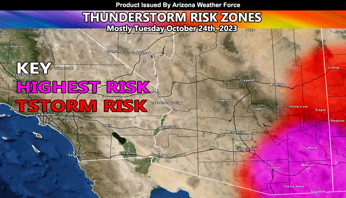
Arizona Weather Force has issued a Special Weather Statement effective for Eastern Arizona starting October 23rd, and for the Southeastern Arizona zones for Tuesday, October 24th.
Hurricane Norma has weakened to a tropical storm but will be a depression across Northern Mexico this week. Moisture streaming northward into the statement area will start with isolated activity for extreme Eastern Arizona by tomorrow (Monday). The increase in upper-level dynamics will maximize on Tuesday, as far west as the Tucson Metro zones, but impacting all of Cochise County as well.
This event will not go to the Phoenix forecast zones and will remain south and east of that metro.
Get these alerts over the new Android and Iphone app and/or e-mail service by becoming a full member subscriber today and never miss an update from this office. Remember, you cannot just make an account on the app and get notifications. You must select your zones and then go through the payment process.
Click here to learn more.
Join the Facebook Page for Further Updates If You Have Not Yet!
ARIZONA WEATHER FORCE MAIN:
Join The Main Arizona Weather Force Facebook Group (50 percent delivery time) – You can join the main AZWF page as well through that group.
Click Here To Join The Page Today
10 mile rule: These alerts issued on this site
means that within your zone and 10 miles from you will see the event
forecast for. You may or may not see the event but it means you are in
the zone or 10 miles from where someone will.
Master General Meteorologist: Raiden Storm