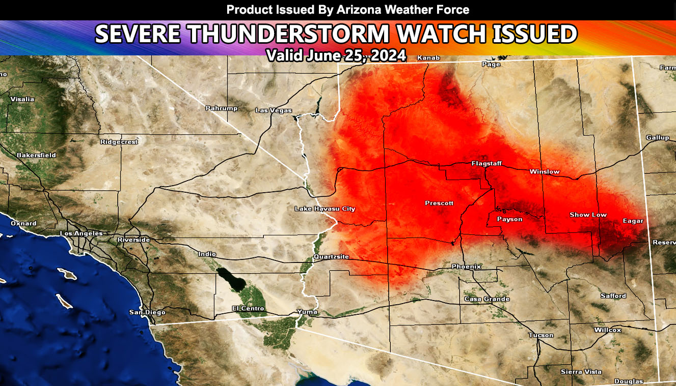
Arizona Weather Force has issued a Severe Thunderstorm Watch effective for the following zones:
Zones issued for: Mogollon Rim … Prescott … Flagstaff … Grand Canyon … and Northwest Maricopa County Wickenburg …
THIS IS A PARTICULARLY DANGEROUS SITUATION ON FLOODING …
Discussion: Thunderstorm development is expected by the early noon hours across the higher terrain zones of the Mogollon Rim, with spreading activity developing on a convergence boundary over the Flagstaff and Grand Canyon forecast zones. This activity will develop further into the Prescott forecast zones. Additional outflow boundaries will make it as far as the Wickenburg forecast zone.
Severe thunderstorms will be capable of flooding, large hail, and damaging winds, especially in the Wickenburg forecast zone for the wind as colder air north produces sinking air.
LONG RANGE: The next activity will be expected in the metros of Phoenix by around July 7th.
A Severe Thunderstorm Watch is issued as the final alert for the day, which will outline large hail, damaging winds, flooding, and/or tornado within the description itself.
– Raiden Storm –
https://www.arizonaweatherforce.com
Master General Meteorologist – is the Owner and CEO of AZWF, a consulting meteorologist with over 26 years’ experience for over 50 companies, including energy, agriculture, aviation, marine, leisure, and many more areas. He has certs from Mississippi State for broadcast met and Penn State forecasting certs MET 101, 241, 341 and 361 as a meteorologist, but before then was completely self-taught, barely learning a thing from the schools that he did not already know.
NOTE: Alerts are posted on here, be it a tornado watch, etc, and these alerts are issued from this office and nowhere else. At times, which is often, you will see an alert forecast posted on here that you do not see elsewhere.