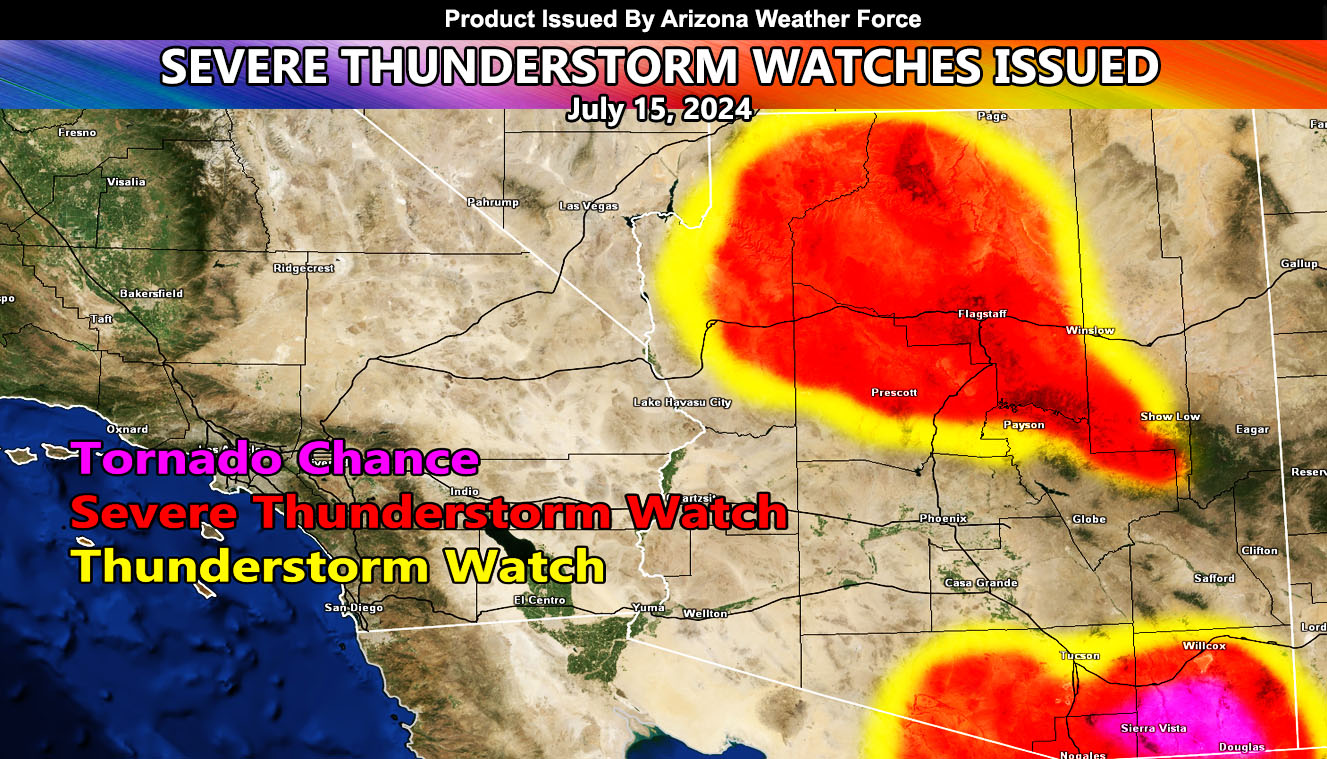
Arizona Weather Force has issued a Severe Thunderstorm Watch for Southeast, Central, and the Northwest sections of Arizona, effective through today, July 15, 2024. Metro zones of Phoenix will return to monsoon service by the weekend and into the week of July 21st.
Zones Affected: Mogollon Rim including Payson, Prescott, Flagstaff, and Show Low southward – Kingman – The Grand Canyon – Graham County – Eastern half of Pima County – Cochise County – Santa Cruz County.
Discussion: Monsoon moisture continues in the area. Storms are expected to form near the 11am to noon hour across both watch zones today. The general flow in Southeastern Arizona is going to be from due east to west. That means that storms forming in Cochise County will move westward into parts of Eastern Pima County and the entire Santa Cruz County zones. Latest Arizona Weather Force values suggests that the southwest half of Cochise County will have the best chance of severe weather, including a tornado risk, going into parts of Pima and Santa Cruz County.
Although the tornado risk is lower than yesterday, the wording was mentioned, but an official Tornado Watch will not be issued down there. Outflow from these storms will move toward the Tucson forecast zones as well, however the further north into Tucson you are, the less chances these would form. Still, a stray pop-up cell will be likely in that zone with this. The outflow ignites stronger storms east into the Three Points and Topawa forecast zones later in the period.
Storms today will also form across the upper rim locations. They also will include the Prescott and Chino Valley forecast zones, northward and ignite the Kingman and Grand Canyon zones as well.
Storms today will have less chances of sending outflow for storms into Maricopa County.
Long Range: Expecting a return of Maricopa County storms to be widespread this weekend and into next week as a deeper moisture flow works in.
– Raiden Storm –
https://www.arizonaweatherforce.com
Master General Meteorologist – is the Owner and CEO of AZWF, a consulting meteorologist with over 26 years’ experience for over 50 companies, including energy, agriculture, aviation, marine, leisure, and many more areas. He has certs from Mississippi State for broadcast met and Penn State forecasting certs MET 101, 241, 341 and 361 as a meteorologist, but before then was completely self-taught, barely learning a thing from the schools that he did not already know.
NOTE: Alerts are posted on here, be it a tornado watch, etc, and these alerts are issued from this office and nowhere else. At times, which is often, you will see an alert forecast posted on here that you do not see elsewhere.

