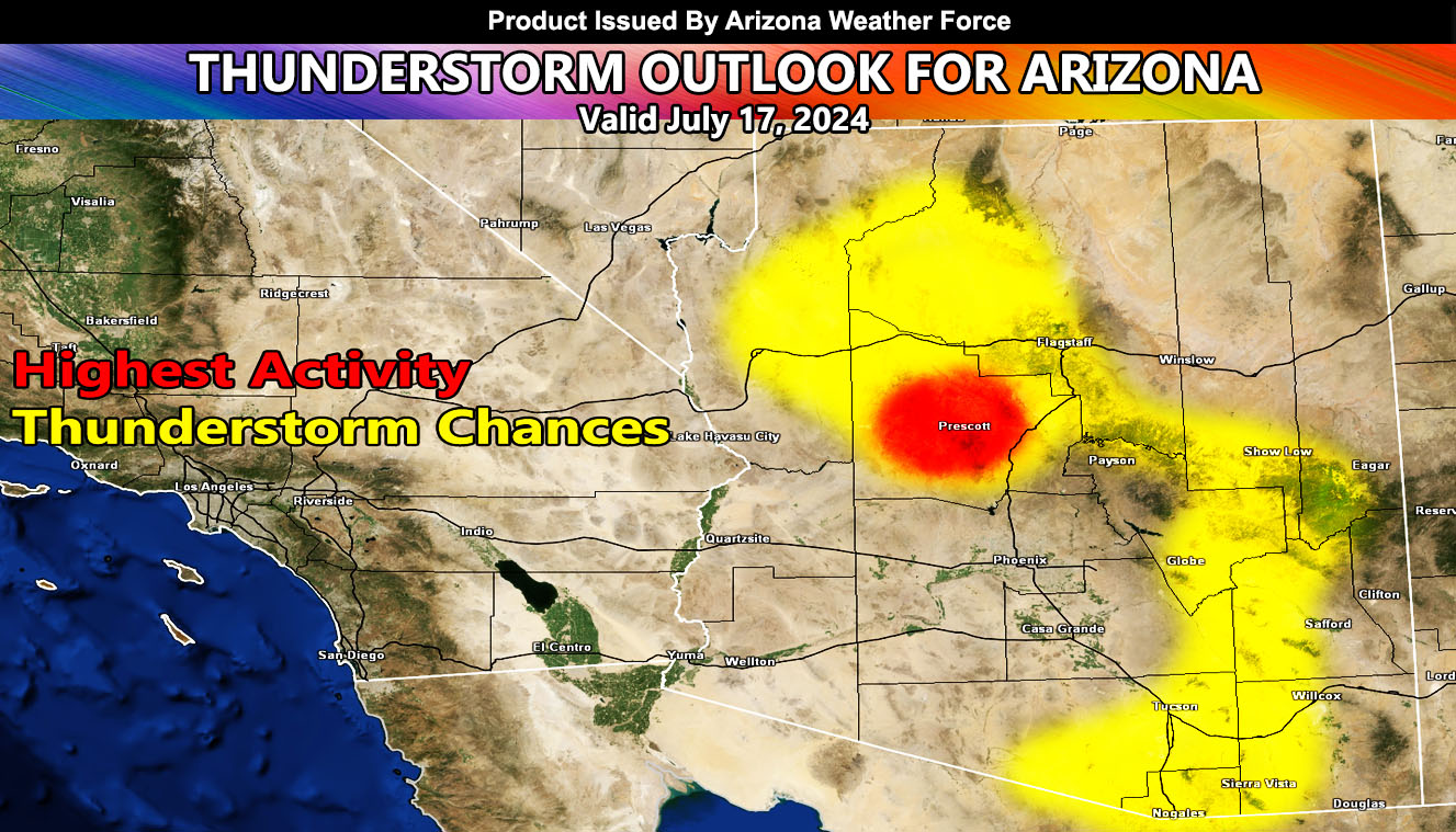
Arizona Weather Force has issued the Thunderstorm Outlook for July 17, 2024.
Zones Issued For: Yavapai County – Mohave County, Kingman – Western half of Coconino County – Southeast and Southern Arizona – Mogollon Rim – Southern Gila County near Globe –
Discussion: Thunderstorms are expected to be less numerous in the lower terrain zones. Today will mark the day that the convergence boundary along the Mogollon Rim shifts northward, which will finally put the Show Low forecast zones under thunderstorms risks. Storms are expected to line the rim this afternoon. Additional storms development will happen over the Prescott forecast areas. Outflow from the Flagstaff/Sedona forecast areas will surge southwestward and reignite thunderstorm activity over the Prescott zones. Prescott stands the best target for numerous thunderstorms today with this pattern.
Outflow from the storms forming over Mt. Baldy will go southward into Graham County. Now, Safford could get something later on, however I’m more leaning to the city of Geronimo.
Storms firing in parts of Western Cochise County will move to the east, which should affect the Tucson forecast zones. Now, this is not a major event down there and it will be hit and miss, but areas Vail eastward stand a better chance at storms due to being closer to the border of Pima and Cochise County, where they would cross. Outflow from those could easily make it so the Catalinas go up, including Mt. Lemmon and Mica Mt. These would pose a damaging wind risk for anyone up there due to strong downdraft potential.
With that being said, that is how the day should move about.