Arizona Weather Force has issued the Severe Thunderstorm Outlook for July 21, 2024.
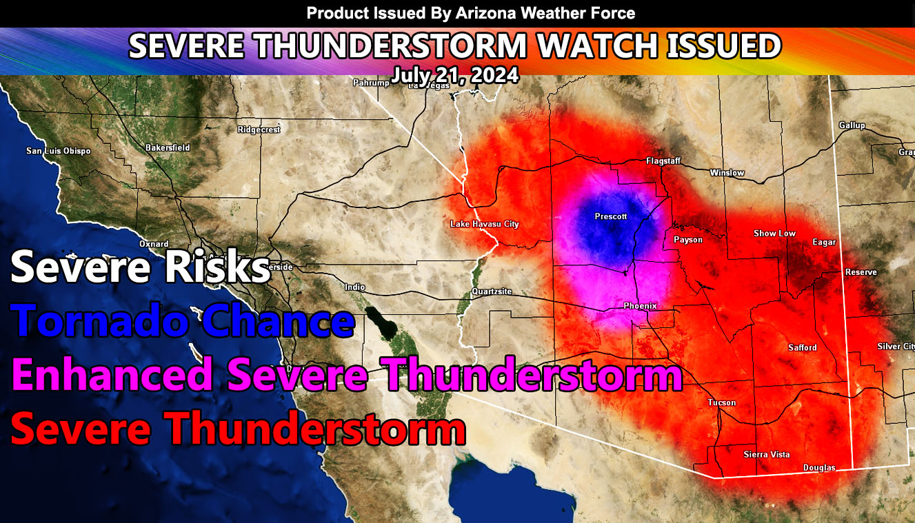
Zones Issued For: Yavapai County – Mohave County – including Lake Havasu – Mogollon Rim – Maricopa, Pinal, Gila, Graham, Greenlee, Cochise, and Pima County …
Discussion: A ridge of high pressure has moved into Nevada. This setup puts a direct north to south flow over Arizona. When this happens, thunderstorms will form over the higher terrain and then outflow will move southward into the lower terrain and metro zones. This is the type of event that will produce the most damage of the season thus for the Maricopa County zones.
Given the surface convergence, the best chance of a tornado and your pictures will be Prescott.
Storms tonight will also form in the Needles, California forecast area, which will shove outflow to the south into Lake Havasu. Enjoy the boating today but secure them tonight, should storms move in. This will be the strongest storm period of the next few days in all areas.
Storms during the watch period will be capable of large hail, damaging winds, flooding, and that Prescott zone tornado chance.
– Raiden Storm –
https://www.arizonaweatherforce.com
Master General Meteorologist – is the Owner and CEO of AZWF, a consulting meteorologist with over 26 years’ experience for over 50 companies, including energy, agriculture, aviation, marine, leisure, and many more areas. He has certs from Mississippi State for broadcast met and Penn State forecasting certs MET 101, 241, 341 and 361 as a meteorologist, but before then was completely self-taught, barely learning a thing from the schools that he did not already know.
NOTE: Alerts are posted on here, be it a tornado watch, etc, and these alerts are issued from this office and nowhere else. At times, which is often, you will see an alert forecast posted on here that you do not see elsewhere.