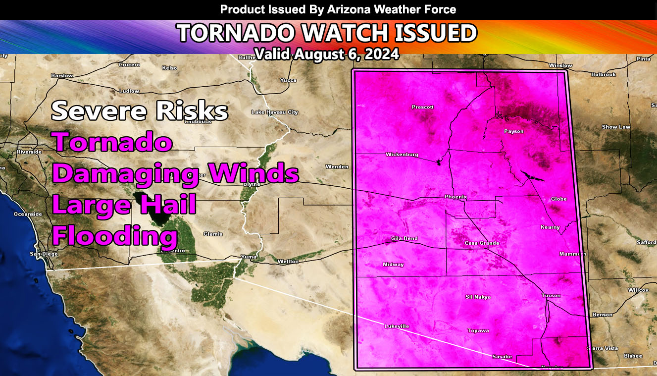
Arizona Weather Force has issued a Tornado Watch, effective for afternoon, evening, and night of August 6, 2024.
THIS IS A VERY DANGEROUS SITUATION FORECAST …
Zones affected: All of Maricopa County – All of Pinal County – All of Pima County – All of Yavapai and Western Gila Counties …
Discussion: As yesterday’s forecast outlined, we will be having an easterly wave move in. Clearing skies will build the instability. I know, many say well its clear now. Yes, but that will soon change as clear skies means the Sun is heating the lower levels like boiling water in a pot, and eventually, it will rise, which it will violently today. Severe Thunderstorms are expected to form in the watch area by afternoon for the higher elevations, but the lower elevation zones will see them this evening and tonight. Outflow boundaries colliding will make for localized low-level shear, in-which capable of producing that tornado risk.
The commanding previous update went viral, but for good reason. This event will happen, and it will contain the following: Large Hail, Damaging Winds in excess of 60-100 mph, flooding, and that risk of tornadoes. Given ‘they’ do not know how to forecast risk assessments in Arizona and keep their risk assessment for tornado alley, this is considered HIGH RISK on Arizona Weather Force scales.
Outflow from the east will go as far as the border, but you in La Paz County will see the dust storms from it later tonight, with a chance of storms, however you are not in the official Tornado Watch zone.
This event is similar to August 2021’s event across the lower and higher terrain.
Commanding Initial Article Forecast Can Be Found Here – https://arizonaweatherforce.com/2024/08/05/tornado-statement-issued-for-maricopa-pinal-pima-county-with-prescott-and-payson-for-august-6-2024-huge-monsoon-event/
A Tornado Watch is only issued 0-12 hours for the zoned area and must be taken seriously above any app or service you ascribe to.
Raiden Storm
Master General Meteorologist

