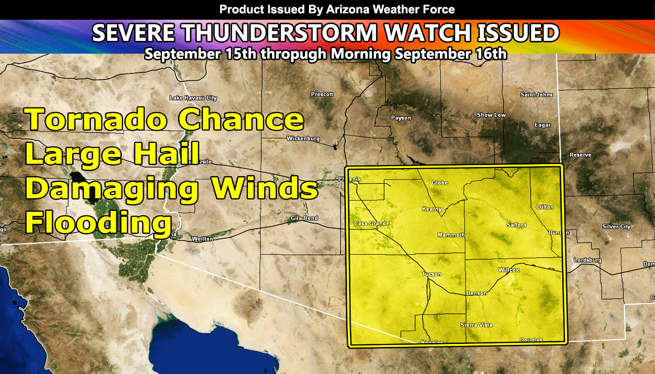
Arizona Weather Force has issued a Severe Thunderstorm Watch effective today, September 15th through September 16th, 2024.
Zones Issued For: Southeast half of Maricopa County, Pinal County, Eastern half of Pima County, Cochise, Graham, Greenlee Counties, Southern half of Gila County, and Santa Cruz County.
Alert Issuance Was At: 10:30am on September 15, 2024
Discussion: Strong instabili9ty is already popping up isolated thunderstorms over southeast Arizona. This instability will continue to build, along with moisture from an ex-tropical storm out of Mexico through today and tomorrow. Strong moisture inflow, upper jet dynamics from a west coast upper level low, and instability will hold the risk for severe thunderstorm development within the watch box and timing.
Damaging winds and large hail will be possible with these, along with flooding in the strongest cells, and of course, if you manage to get into the tornado zone, snap a photo of the clouds.
A Severe Thunderstorm Watch issued here at Arizona Weather Force means that conditions are favorable for hail, damage wind, flooding, and if mentioned a small tornado risk.
As always, we take it one day at a time with these events
Raiden Storm
Master General Meteorologist