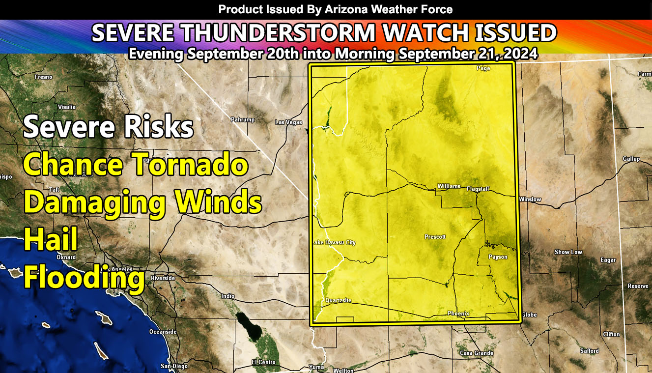
Arizona Weather Force has issued a Severe Thunderstorm Watch effective this evening through Saturday morning for the following zones;
Zones Issued For: Central and Northern Colorado River Valley … Mohave, La Paz, Yavapai, and Coconino County … Northern half of Maricopa County … Western Gila County Payson and Strawberry.
Alert Issuance Was At: 11:00am on September 20, 2024
Discussion: An early area of low pressure moving through Southern California today will continue moving eastward. This will bring the upper dynamic profiles over Western Arizona as early as this evening and spreading through the rest of the watch zone overnight. Thunderstorms within the watch area will also bring storms to the San Tan/Mesa/Fountain Hills forecast zones, as the extreme southern extent of the dynamics so do not be surprised of thunderstorms in those zones overnight. The areas with the least chances of storms would be West Central Maricopa County, within the box … still it is an area of the weakest dynamics due to a dry slot in the mid-level forming.
Storms will generally move from south to north through the period …
Damaging Winds, Large Hail, Flooding, and a tornado chance is always possible with setups like this.
A Severe Thunderstorm Watch issued here at Arizona Weather Force means that conditions are favorable for hail, damage wind, flooding, and if mentioned a small tornado risk.
As always, we take it one day at a time with these events
Raiden Storm
Master General Meteorologist