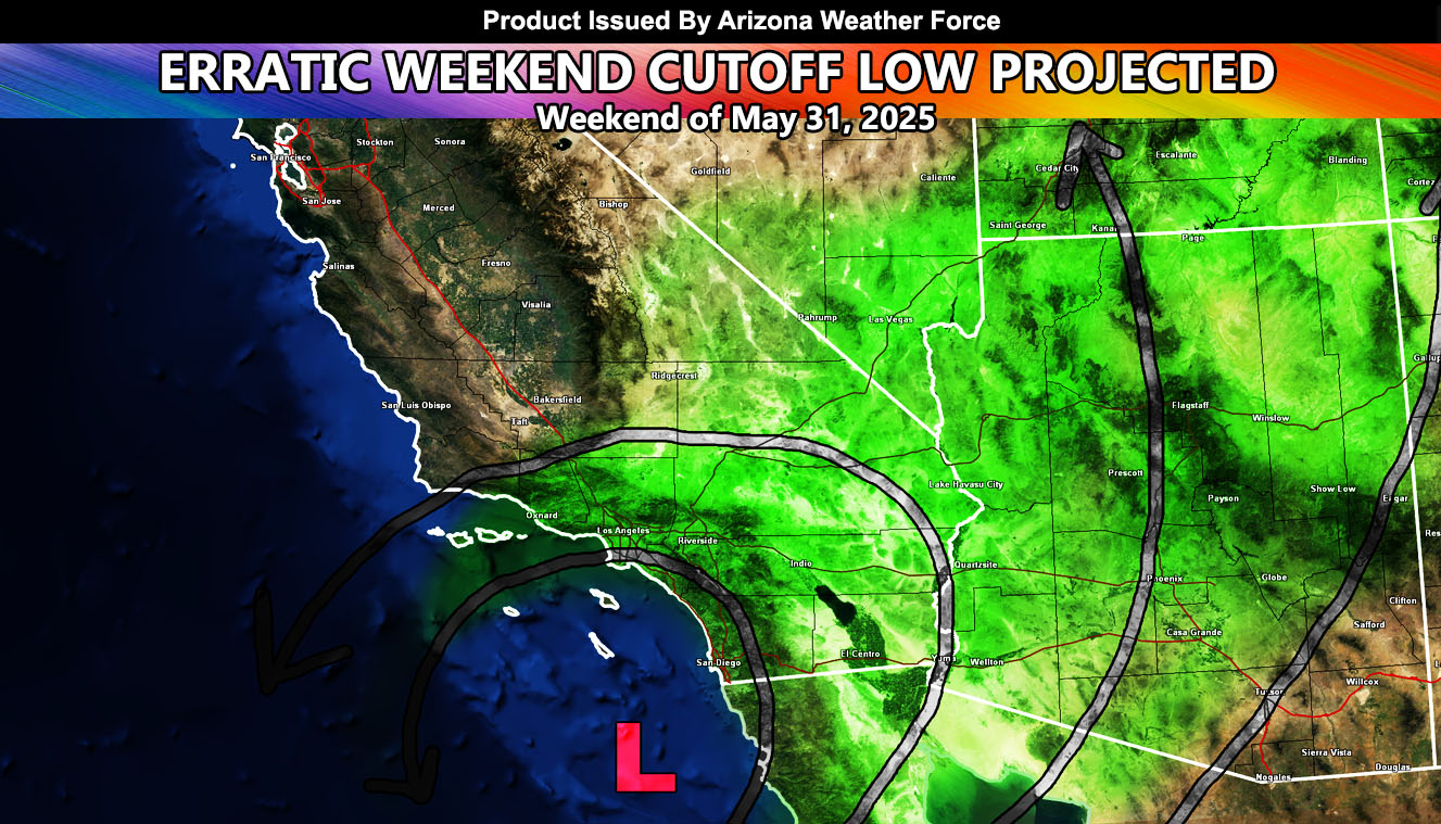
A cutoff low that brought stormy weather to the Hawaiian Islands last week is between the island state and the Southwestern United States today. This system will continue moving eastward, undercutting the stronger jet stream to the north. This means that it is a true cutoff low.
A cutoff low is when an upper level low pressure system is cutoff from the main jet stream and wobbles around out there, without much to move it in a predictable pattern. You can think of it like a river. You are stuck in the current and your distance can be predicted by how fast you are going, with a high degree of predictability. Now, if you happen to eject out of the current, then you will move in different directions, at a slow pace. The predictability of your distance to travel vs time is similar to how these low pressure systems work when the main upper level jet stream is not associated with it.
Such a system will enter the region on the weekend of May 31st, 2025, given how slow it is moving in the cutoff pattern flow. Predictability on this system is in the monitoring stages, but I do know it will cross over our region over that weekend.
Dynamics with it will be monitored. Upper-level systems like this can yank up some tropical moisture, shoving it northward into the Eastern half of Southern California, Arizona, Nevada, and Utah. Should this happen, there will be a chance of showers and thunderstorms as it moves through.
In addition to this, as stated in the previously issued Long Range Weather Watch last week, Bakersfield zones and surrounding within the Kern Valley will see 105-110 degree temperatures toward the end of this week, say maybe around Thursday, Friday, and even Saturday, as well as an upswing in temperatures region-wide across Inland Southern California and the Low Terrain of Arizona.
Stay tuned for further details …
Raiden Storm
Master General Meteorologist