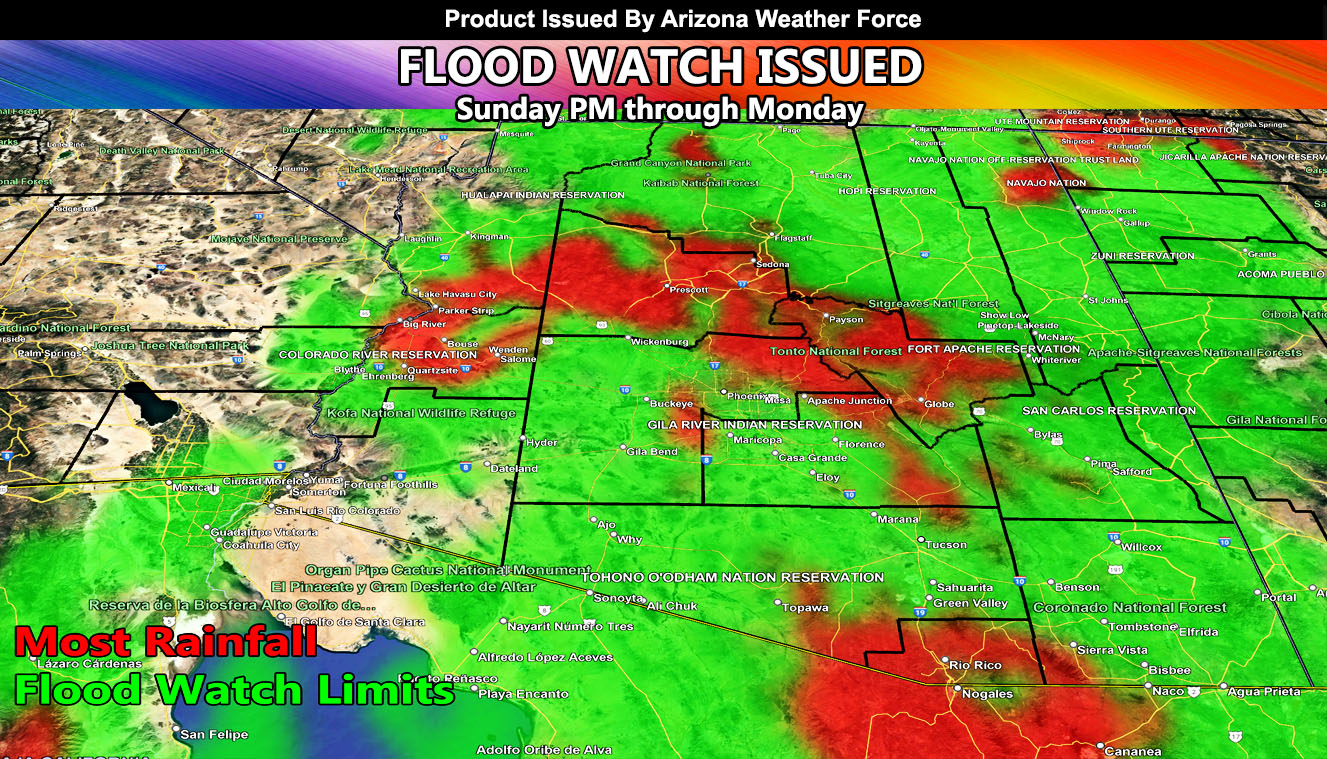
Arizona Weather Force has issued the Official Flood Watch for a large area of Arizona, within the map provided, effective Sunday into Monday, June 1st to June 2nd, 2025. It is important to note that this single system will bring Phoenix’s rainfall record for the month of June by 100x over the average.
A cutoff low that was projected here at Arizona Weather Force over a week ago is remaining stationary, just west of Baja, Mexico. The longer it stays out there, the better chances of heavier precipitation when it sucks the moisture and dynamics up from the south, where Alvin is in full supply.
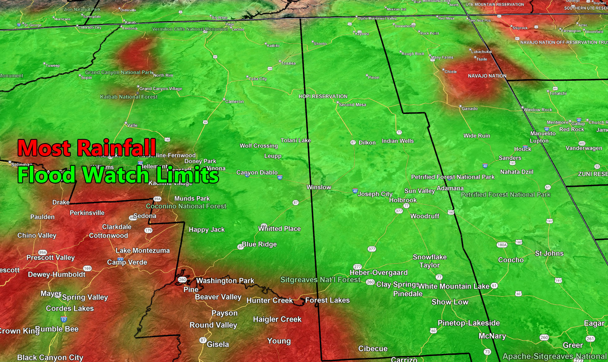
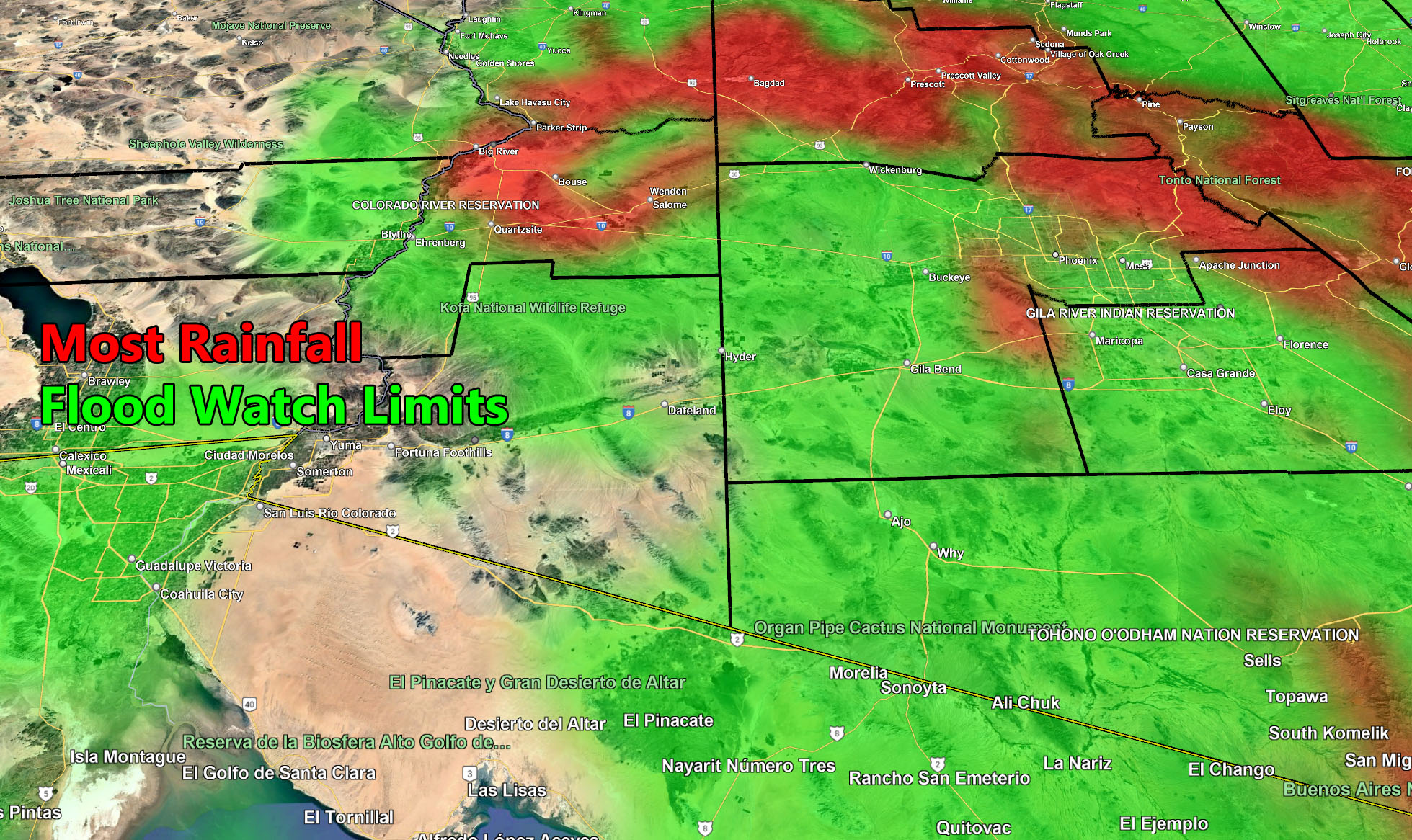
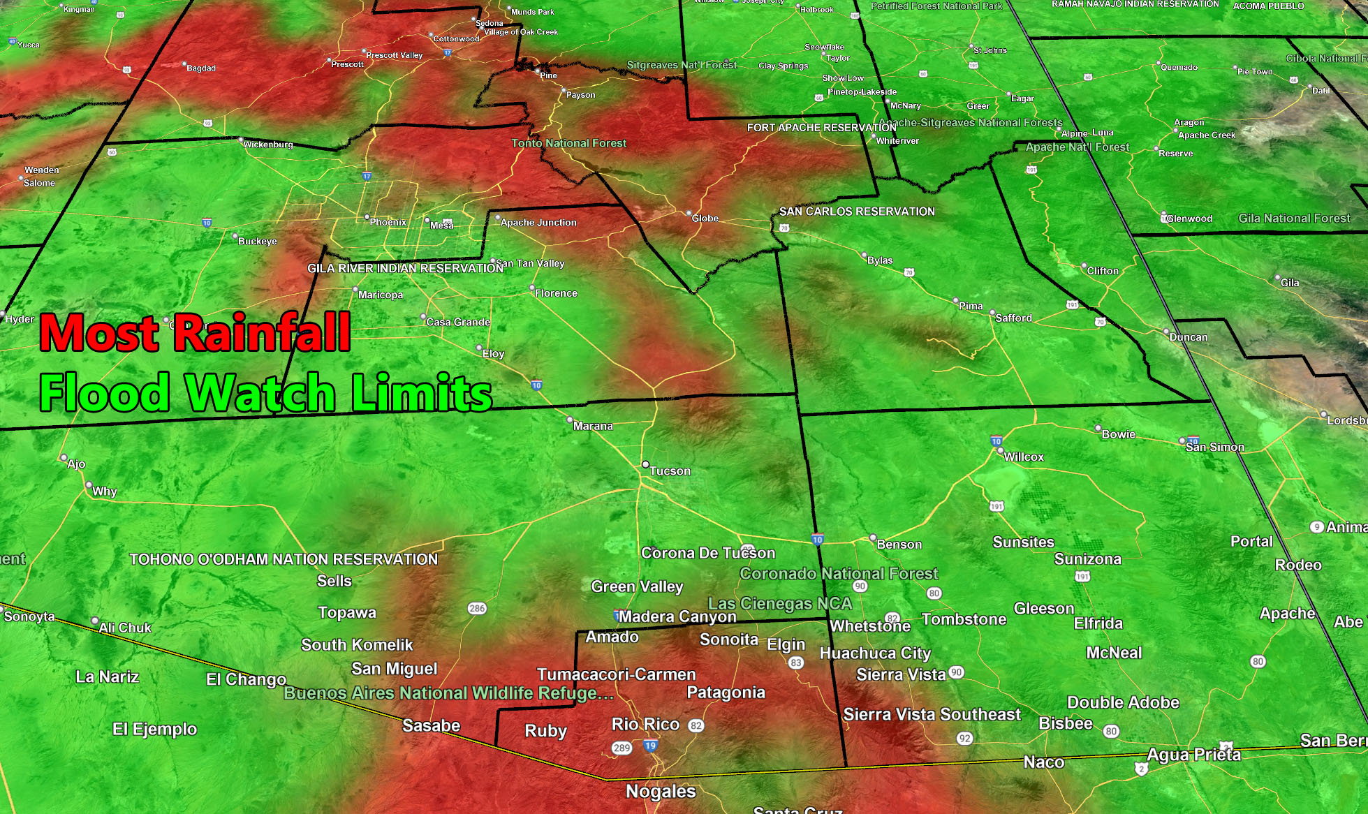
As per the previous update, the map looks to be bang on ,with the western extent of the moisture plume being the San Diego, Riverside, and San Bernardino Mountain and Desert zones, including Imperial Valley. The eastern extent across the Western half of New Mexico, with Arizona taking the brunt of this system later Sunday and going through Monday.
Instability and upper divergence (lift) with the system during this period also will bring a chance of thunderstorms. Severity of these storms will be projected within the 12 hours before they hit.
As always, stay tuned to Arizona Weather Force for the latest official updates on this system …
Four zoom-in maps have been created for this alert, and you may view them below –

Raiden Storm
Master General Meteorologist