Arizona Weather Force has issued a Weather Advisory effective Tuesday, July 1st, 2025, for the following zones;
Issued Sectors:
Arizona Sector
Issued Zones: Maricopa and Pinal County …
Date Issued: June 30th, 2025 at 10:00am PDT
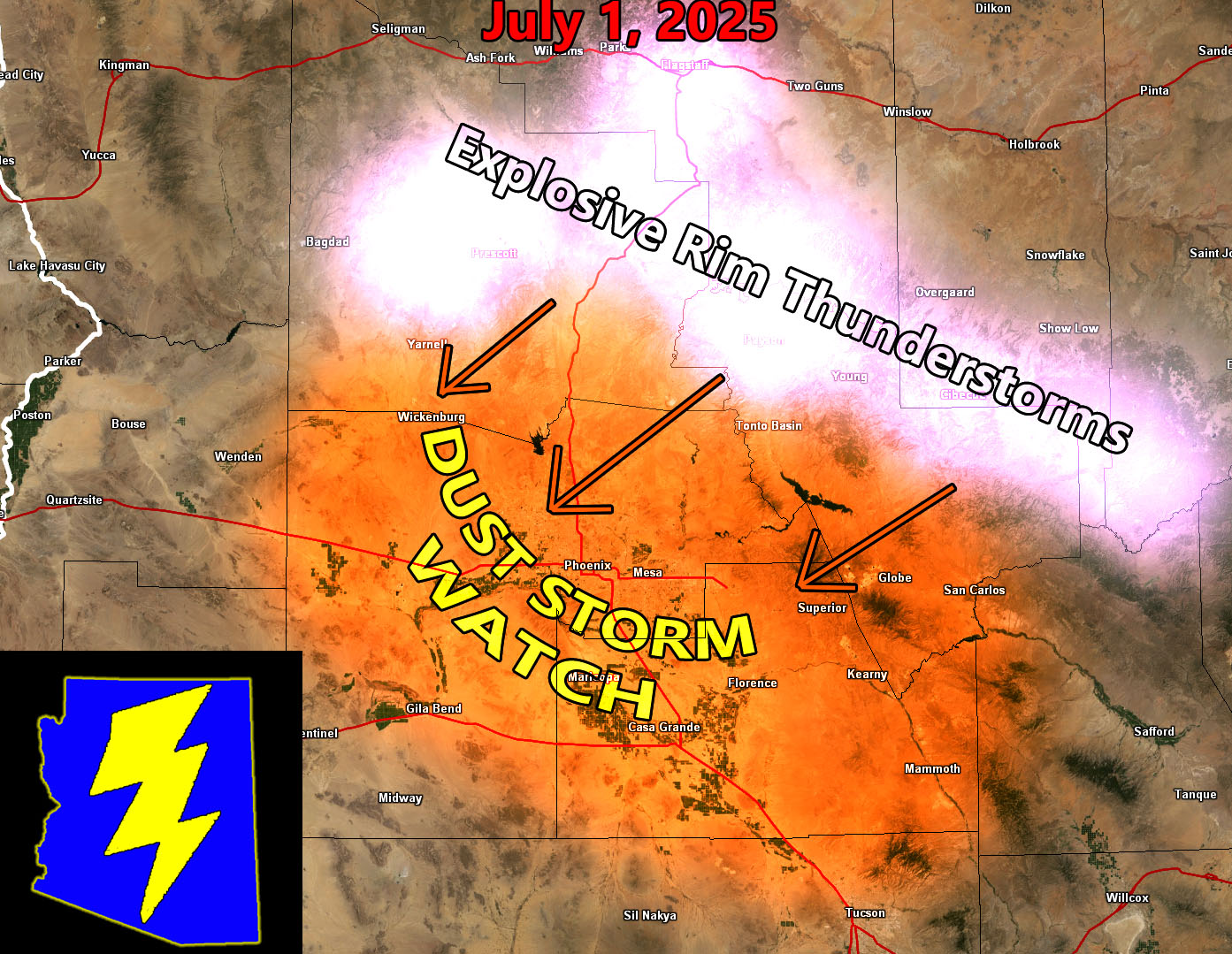
Watch Discussion: Increasing monsoon moisture in the area will be present, with a taste of it today with isolated shower/thunderstorm activity in Southeast Arizona. Deeper moisture will be available on a northeast to southwest flow for your Tuesday. Instability will be increased in the higher and lower terrain. The high terrain, Prescott, Flagstaff, Mogollon Rim zones will have explosive thunderstorm activity during the afternoon. This will shove outflow southward from them and eventually into the low terrain of both Maricopa and Pinal County, including Phoenix, possibly affecting airport operations at times during the evening hours. With this outflow boundary in the area, we could even have pop-up thunderstorms in the Dust Storm Watch zones, which is usually what happens with higher instability days and outflow moving through. Additional watches/advisories are to be issued on Tuesday morning outlining this event.
A Dust Storm Watch is issued here at Arizona Weather Force when outflow from thunderstorms moving near or overhead produces a dust storm that would reduce visibility to near or at zero. Dust Storm Watches could contain pop-up thunderstorms as well. Weather Alerts at Arizona Weather Force are private, issued ahead of time to the public by AZWF as the lead-time is extremely important to you.
Raiden Storm
Master General Meteorologist