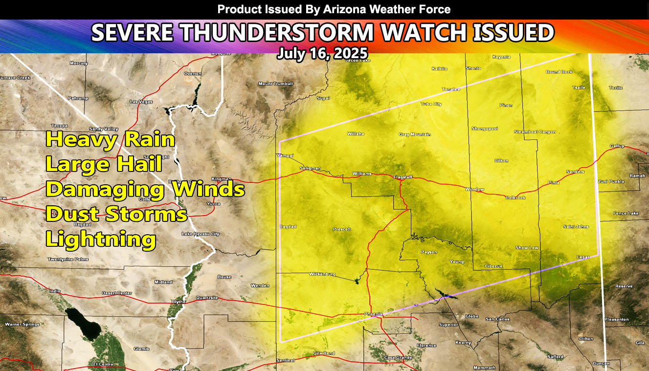
Arizona Weather Force has issued a Severe Thunderstorm Watch effective Wednesday, July 16th, 2025, for the following zones;
Issued Sectors:
Arizona Sector
Issued Zones: Coconino, Apache, Navajo, Yavapai County … Northern half of Gila County … Northern, Central, and Western half of Maricopa County …
Date Issued: July 16th, 2025 at 8:55am PDT
Watch Discussion: A disturbance that moved through Southeastern Arizona yesterday will move into the watch area this afternoon, evening, and tonight. Storm development will rapidly develop across the High Terrain, including the reservations, Flagstaff, and the White Mountain areas, and become rapidly severe. A northeast to southwest flow will bring these through Prescott this evening, and furthermore from Payson to New River, Phoenix, Surprise, Buckeye evening and night. Damaging winds are expected along with large hail in spots, and flooding. Yesterday was Tucson’s storms that sent dust into Maricopa County … today the wording is storms along with damaging winds, especially that North and Western half of the Phoenix Metro this evening and tonight.
A Severe Thunderstorm Watch is issued at Arizona Weather Force when conditions are possible for severe thunderstorms, covering over 50% of the watch zone, with damaging winds of over 50 mph and large hail in the stronger storms. Severe Thunderstorm Watches at Arizona Weather Force are private, issued ahead of time to the public by AZWF as the lead-time is extremely important to you.
Raiden Storm
Master General Meteorologist