Arizona Weather Force has issued a Severe Thunderstorm Watch effective Monday, July 28th, 2025, for the following zones;
Issued Zones: Southern Apache County … Greenlee, Graham, Cochise, and Santa Cruz County … Eastern Pima County …
Date Issued: July 28th, 2025 at 10:40am PDT
Watch Discussion: A disturbance moving out of Mexico will move into Southeastern New Mexico this afternoon and evening. Thunderstorms as a result will start forming in the high countries of the Northern half of the watch zone and then move south and westward off into the lower terrain zones of Safford zones, Cochise County, and eventually into Eastern Pima County to Santa Cruz County. According to the flow, it looks very similar to earlier in the season where these same storms created a dust storm in Tucson’s Metro areas during the evening and night hours. This same system ironically brought a haze to the Phoenix/Pinal zones the next morning, so if that is going to happen, a dust storm will hit Tucson this evening, with a haze in the morning on Tuesday for Phoenix/Pinal zones.
Thunderstorms in the box zone this afternoon and evening can produce large hail, damaging winds, and flooding in the focus spots …
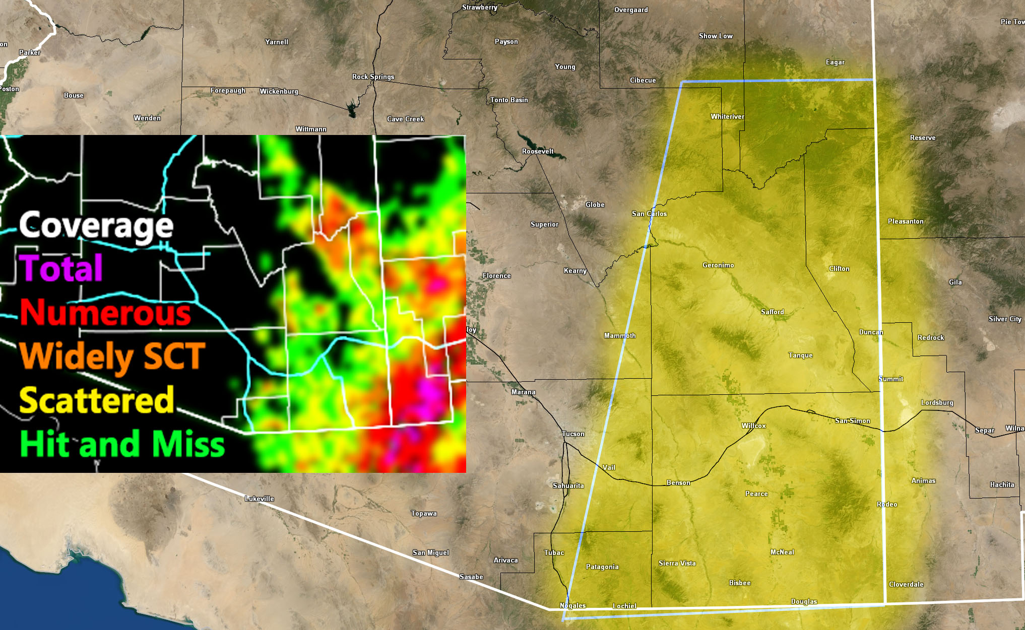
Using the new Monsoon Whiner Avoidance Model System”, or M-WAMS for July 28th 2025, we can see the focus spots being in two spots, Southeast Cochise County, Southern Apache County, Greenlee County, and Northeast Graham County …
A Severe Thunderstorm Watch is issued at Arizona Weather Force when conditions are possible for severe thunderstorms, covering over 50% of the watch zone, with damaging winds of over 50 mph and large hail in the stronger storms. Severe Thunderstorm Watches at Arizona Weather Force are private, issued ahead of time to the public by AZWF as the lead-time is extremely important to you.
Raiden Storm
Master General Meteorologist