Arizona Weather Force has issued a Long Range Weather Watch effective August 10th through August 25, 2025 with the increased monsoon flow.
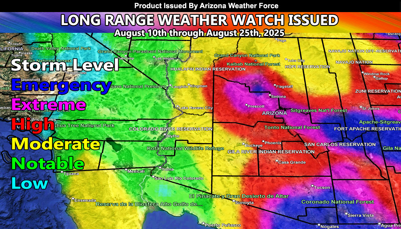
Tropical activity will be on the increase during the watch period. Arizona Weather Force’s Long Range Storm Risk Model is showing high levels of storm activity, a first for this season across most of the state. Storm activity looks to be linked with the heatwave this week, which is known as a monsoon heat-blast. These usually happen when a ridge of high pressure builds in, the nominal four corners ridge. Given the long range model, it looks as if moisture will be entrained inside the ridge, bringing storms off the higher terrain, and at times into the low terrain zones such as Phoenix, Pinal, Tucson, and even extending west through the Kingman forecast areas.
Phoenix stands at a high storm level risk, Tucson at Extreme, and extreme south to southeast Arizona in the emergency levels, which will bring more flooding and damage to these zones.
Raiden Storm
Master General Meteorologist