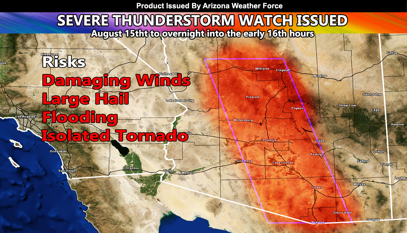
Arizona Weather Force has issued a Severe Thunderstorm Watch effective Friday, August 15th, 2025 and overnight into the early August 16th hours, for the following zones;
Issued Zones: Flagstaff/Williams, Yavapai, Pinal, Maricopa, Santa Cruz County … Western sections of Cochise and Gila County … Eastern half of Pima County, including Tucson
Date Issued: August 15th, 2025 at 9:25am local
Watch Discussion: As stated in my August forecast, I said it would act similar to the 2001 season where at this exact time a multi-storm event hit. Last day in this three day event for the low elevations, and it could be very similar, of not worse than last night’s activity, with more widespread storms expected. Given storms forming over the High Terrain north of Phoenix, across south and east of Tucson, severe outflow boundaries will develop and head in different sections, the one heading northward from Tucson will interact with the one coming down I-17 and Gila County to convergence this evening and overnight for the Metro Maricopa County zones again … In this, large hail, damaging winds, flooding, and even an isolated tornado risk exists.
A Severe Thunderstorm Watch is issued at Arizona Weather Force when conditions are possible for severe thunderstorms, covering over 50% of the watch zone, with damaging winds of over 50 mph and large hail in the stronger storms. Severe Thunderstorm Watches at Arizona Weather Force are private, issued ahead of time to the public by AZWF as the lead-time is extremely important to you.
Raiden Storm
Master General Meteorologist