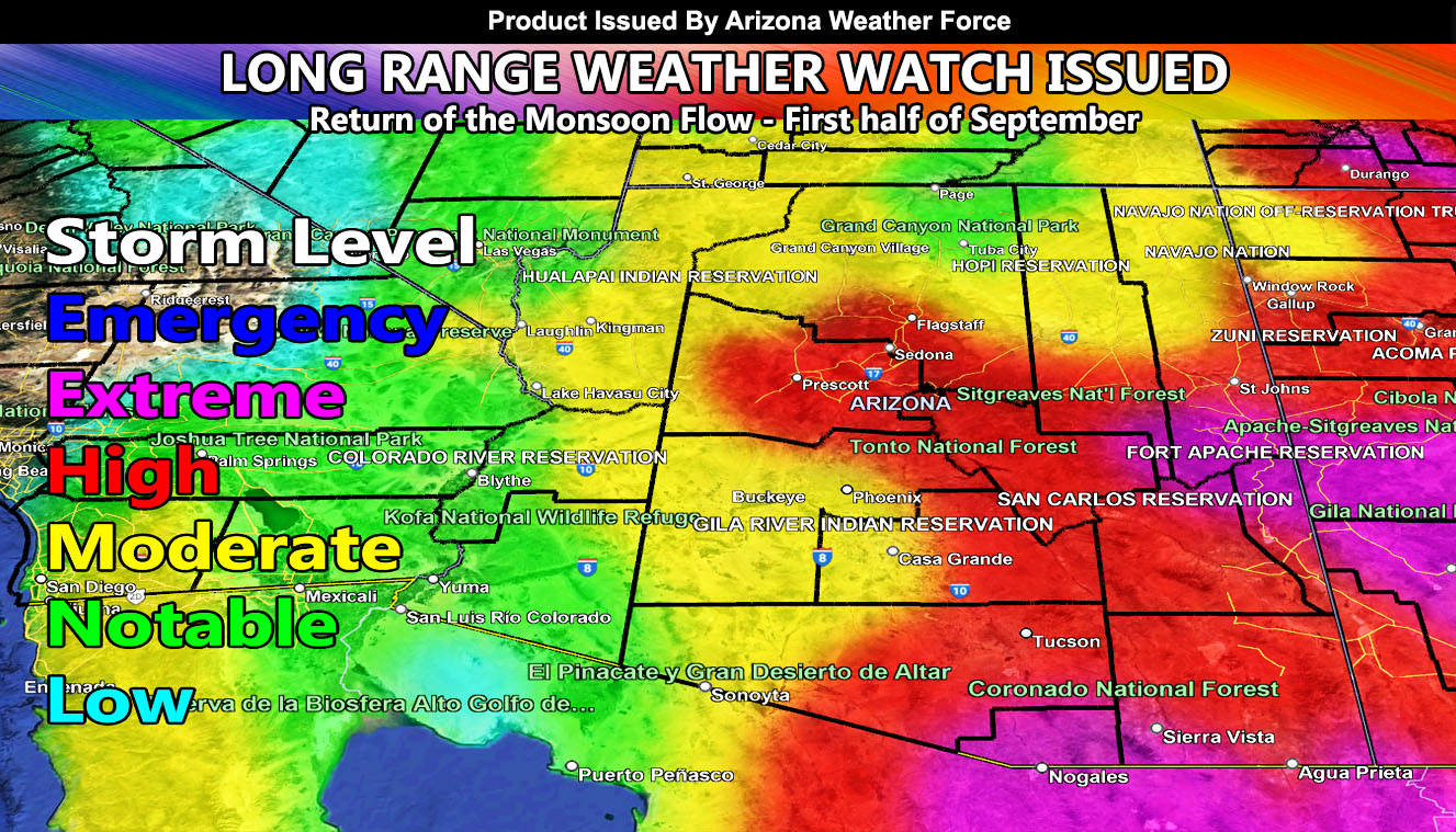
Arizona Weather Force has issued a Long Range Weather Watch effective the first into second week of September with the increased monsoon flow.
Remember, the monsoon dates go to September 30th, and this will prove September can be an active month as well. Tropical activity will be on the increase during the watch period. Arizona Weather Force’s Long Range Storm Risk Model is showing high levels of storm activity, the second for this season across most of the state. Storm activity looks to be linked with the heatwave this weekend into this next week, which is known as a monsoon heat-blast. These usually happen when a ridge of high pressure builds in, the nominal four corners ridge. Given the long range model, it looks as if moisture will be entrained inside the ridge, bringing storms off the higher terrain, and at times into the low terrain zones such as Phoenix, Pinal, Tucson, and even extending west through the Kingman forecast areas, and yes, even further west to the Colorado River Valley.
Phoenix stands at a higher storm level risk again with Tucson, and extreme south to southeast Arizona, which will bring more flooding and damage to all of these zones.
Arizona Weather Force will have daily updates for the app/email system between 9-10am and noon for social media.
Raiden Storm
Master General Meteorologist

