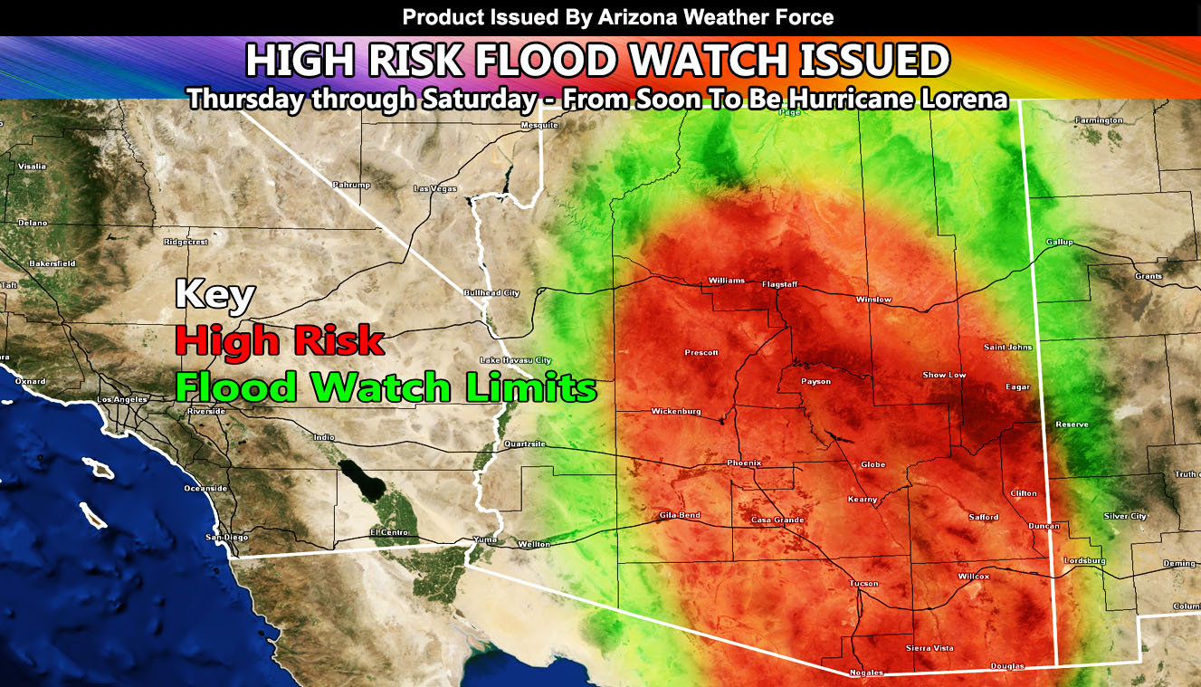
Arizona Weather Force has issued a High Risk Flood Watch, effective Thursday through Saturday of this week.
Back on August 30th, here at Arizona Weather Force, a forecast was released for the chance that either Kiko or Lorena (whichever made the name first) would influence the weather in Arizona. Today was just a taste. Simple storms off the high terrain. Now, Thursday through Saturday is when the real focus happens, and as I stated before, prepare for it. As Lorena turns north through Baja, Mexico, the influence of the system itself will affect the state, in the form off both deep tropical moisture and upper level dynamics.
There is a real chance this will push the monsoon numbers up, being the strongest flood event this season for many of you. So, I would take this warning seriously if I were you and continue to monitor the latest forecasts from Arizona Weather Force in the coming days.
Here was the forecast I released on August 30th on this update so that you know I’ve been watching it closely –
Link – https://arizonaweatherforce.com/2025/08/30/eastern-pacific-hurricane-dynamics-to-revamp-monsoon-across-arizona-week-of-september-1st-2025-powerful-storms-expected/
Raiden Storm
Master General Meteorologist