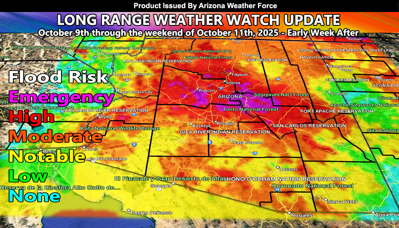
Calculations have been made for a preliminary estimation on where the strongest flood risk will be due to the influence of future Hurricane Priscilla. An upper-level low will park west of California, which will draw this system due north, and fast toward the forecast area.
Keep in mind, even if the center of the future system does not hit, the position southwest of Arizona will stream deep tropical moisture into the area, which is looking more likely on how my model is behaving.
Given this is a week out, monitoring of the system will continue as we move through yet another ‘Raiden Storm Pattern’. A Raiden Storm Pattern is a forecast pattern that is not seen elsewhere at the time of publishing, and means that I am taking over the forecasting for such patterns … and for you to keep posted to the latest forecasts from this weather service as they are made.