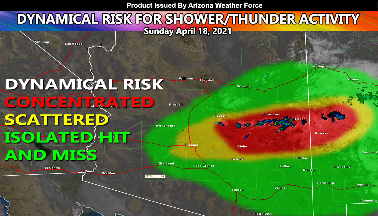
Showers are already happening in Gila County eastward to Eager through Mt. Baldy Resort this morning and the activity is expected to increase throughout the day with the heating of the Sun, even into the Maricopa County forecast areas so read on for details …
A small, but potent area of upper-level dynamics is moving in from the north as we speak, a reason for the gusty winds across the Phoenix area at this time. The center of the system at the time of this write-up is coming out of the northeast over Gila County and will center on Phoenix by this afternoon. As it does so, the area of clouds you see outside there now will lift due to the small area of upper divergence and give the valley a chance of showers and even isolated thunderstorm activity. This is not a big event, however, it is worth a mention for those that do get it. It will be hit and miss, meaning some of you will see it, others will not, similar to a pop-up shower/storm in the summertime during outflow-induced monsoon activity. The most concentration of thunderstorms will be GILA COUNTY where I expect numerous lightning strikes to occur today.
Your monsoon outlook will be out in a month or so as June through September is the typical timeframe for such.
Arizona Weather Force is now on MeWe – Link – https://mewe.com/p/arizonaweatherforce
As always, stay tuned to Arizona Weather Force for official forecasts and updates on weather across Arizona and if it says ‘like page’ below, hit the button and get future updates.
Remember: Micro-climate alerts will be issued over the premium email alert system. FB groups have been shut down from posting because FB sees my multi-posting as spamming and their ‘robot’ is preventing me from continuing. emailed custom weather alerts can be signed up for on the AZWF website if you need them – http://arizonaweatherforce.com/azwf-supporter-monthly-bundle-member-sign-up-form/

