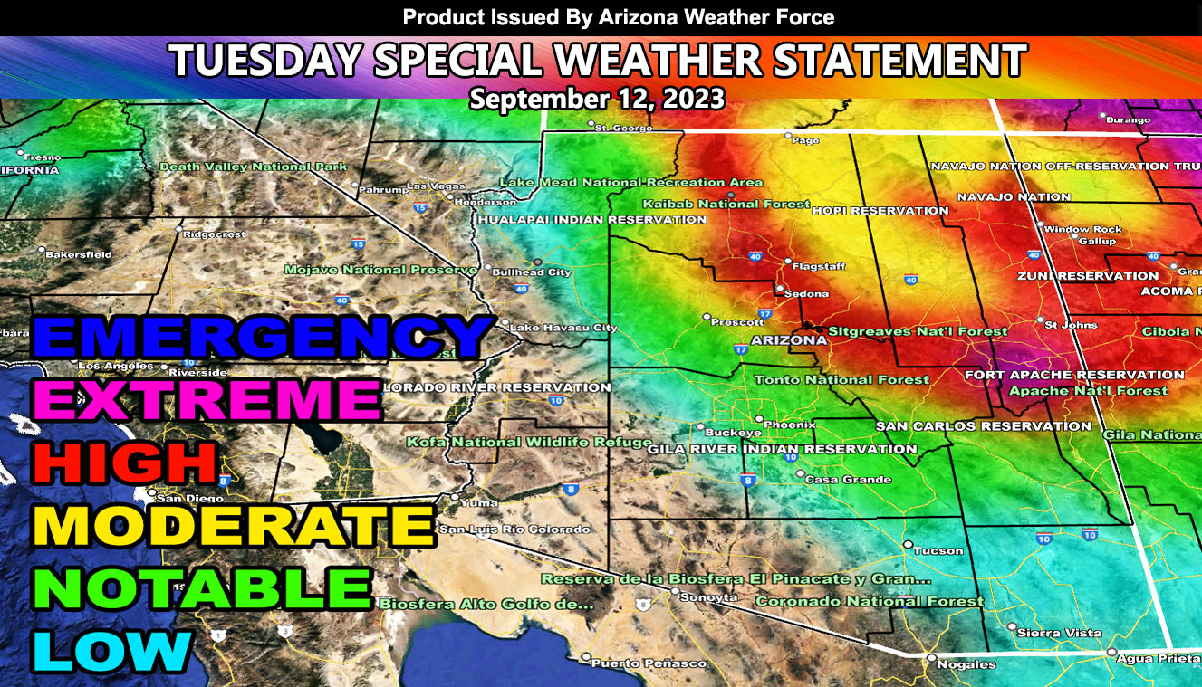
Arizona Weather Force has issued a Special Weather Statement for Former Major Hurricane Jova, which has weakened to a Tropical Storm, but will bring mid and upper-level moisture to the Northern half of Arizona through the next few days, but the most will be expected on Tuesday, September 12th.
The moisture has brought thunderstorms to the higher terrain, but the increase will be expected on Tuesday as a Pacific Jet Stream combines with the southern tropical moisture plume. Flooding, Large Hail, and Damaging Winds will be expected from the Northwest CO River Valley around Kingman to the Grand Canyon, Flagstaff, the Navajo Nation and the Mogollon Rim from Prescott through Eastern Arizona.
Most of Southern Arizona will not see too much and will not be the focus of this forecast, but you can see something in Southeast Arizona during the passage, but again, not the focus. The focus is the Northern half of Arizona so do not forget that wording …
As we move through the rest of September, another system is possible to renew showers and thunderstorms toward the third week, but more so along October when the fall storms of El Nino start to affect the state.
Master General Meteorologist – Raiden Storm
Get these alerts over the new Android and Iphone app and/or e-mail service by becoming a full member subscriber today and never miss an update from this office. Remember, you cannot just make an account on the app and get notifications. You must select your zones and then go through the payment process.
Click here to learn more.

