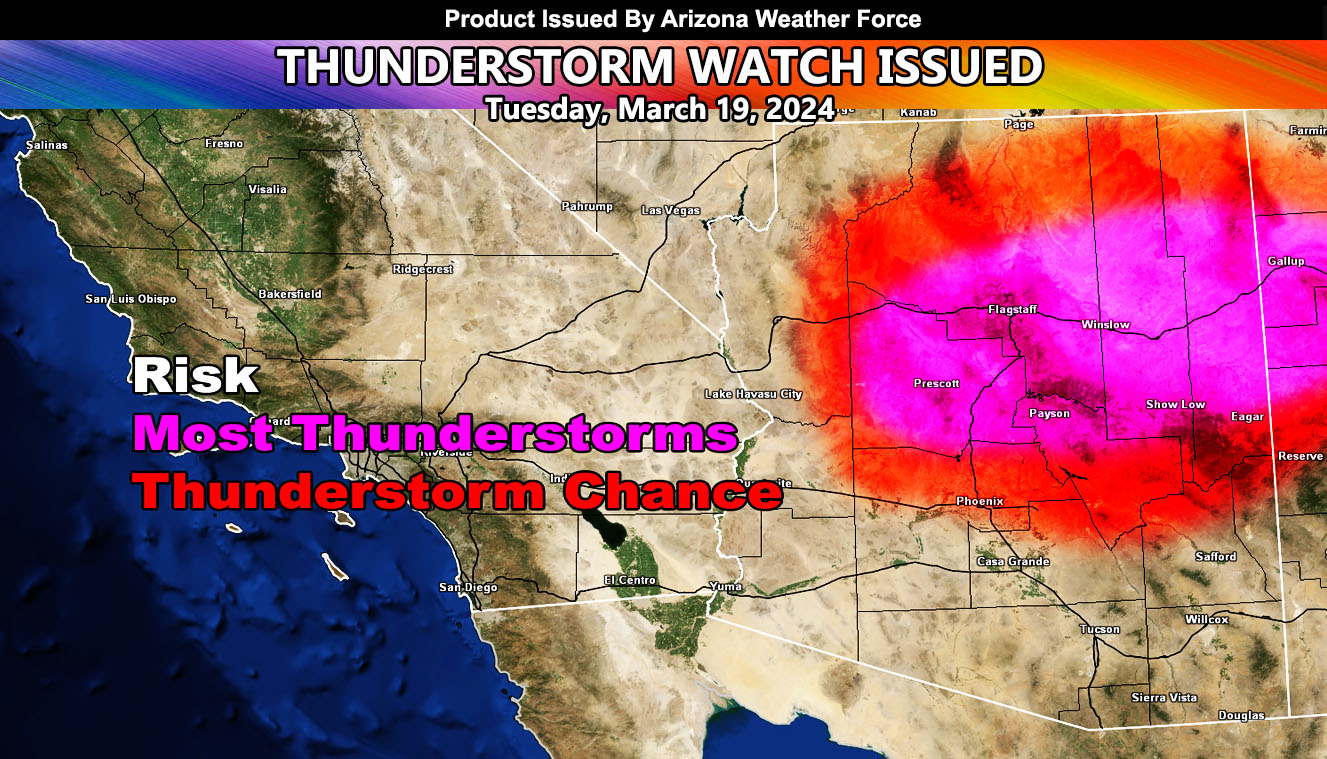
Arizona Weather Force has issued a Thunderstorm Watch effective for a large area of Arizona, for the following areas;
All of the higher elevations of the rim zones, including Alpine, Show Low, Strawberry/Payson, I-17/Flagstaff-Sedona-Cottonwood-Camp Verde, and Prescott … Gila County … Apache and Navajo County … Central to Northern half of Maricopa County, outside chance San Tan Valley …
A cutoff low that brought severe thunderstorms to the region yesterday across both Southern California and Arizona will start to shift eastward as the ridge of high pressure to the north weakens in response to the incoming weekend west coast storm. This will allow the cutoff low to move directly over Arizona today, and with it, strong upper divergence (lift) profiles. With the higher sun angle of March, rapid thunderstorm development is expected.
The center of this is certainly going to hit Prescott, Payson, Show Low, and Winslow with a direct hit, which is why in the graphic provided you are in the magenta shade. There is a chance that pop-up cells will happen across Maricopa County and San Tan as well, so you were given the notification.
A Thunderstorm Watch means that thunderstorms are expected in or around the watch zone, which can have a hail, wind, funnel cloud/tornado, and heavy rain risk.
– Raiden Storm –
https://www.arizonaweatherforce.com
Master General Meteorologist – is the Owner and CEO of AZWF, a consulting meteorologist with over 26 years’ experience for over 50 companies, including energy, agriculture, aviation, marine, leisure, and many more areas. He has certs from Mississippi State for broadcast met and Penn State forecasting certs MET 101, 241, 341 and 361 as a meteorologist, but before then was completely self-taught, barely learning a thing from the schools that he did not already know.
NOTE: Alerts are posted on here, be it a tornado watch, etc, and these alerts are issued from this office and nowhere else. At times, which is often, you will see an alert forecast posted on here that you do not see elsewhere.

