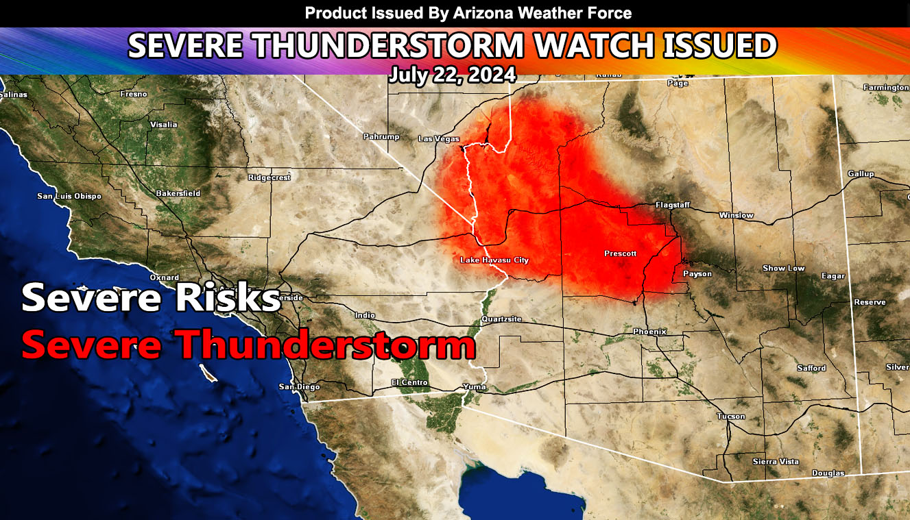
Arizona Weather Force has issued the Severe Thunderstorm Outlook for July 22, 2024.
Zones Issued For: Yavapai County – Mohave County – including Lake Havasu to Kingman –
Discussion: The ridge of high pressure remains to the northwest of the forecast area today and will remain there for most of the week. Given that, a healthy northerly flow is in progress. Like yesterday, storms will form along the rim and move southwestward across the main watch zone. Although not as powerful as yesterday, severe thunderstorms capable of damaging winds, large hail, and flooding will all be likely.
Storms will try to develop over or near the Havasu zones as well as the Kingman zones today.
TUESDAY: We will try to get the Maricopa, Pinal, and Pima metro zones back into the forecast for severe weather, but today, you may just get the outflow winds.
THURSDAY: A stronger northeast flow would bring a stronger scenario to the Phoenix and Pinal Forecast Zones.
As always, we take it one day at a time with these events.
– Raiden Storm –
https://www.arizonaweatherforce.com
Master General Meteorologist – is the Owner and CEO of AZWF, a consulting meteorologist with over 26 years’ experience for over 50 companies, including energy, agriculture, aviation, marine, leisure, and many more areas. He has certs from Mississippi State for broadcast met and Penn State forecasting certs MET 101, 241, 341 and 361 as a meteorologist, but before then was completely self-taught, barely learning a thing from the schools that he did not already know.
NOTE: Alerts are posted on here, be it a tornado watch, etc, and these alerts are issued from this office and nowhere else. At times, which is often, you will see an alert forecast posted on here that you do not see elsewhere.