The 2025 Monsoon Season has started as of June 15th. This season will start of on the slower side, but quickly move in the direction of the 2021 season as we move through July and August.
Typical of a monsoon season, July and August reign as the peak months. There are signs in the atmosphere this year that are similar to the start of the 2021 season. 2021’s season had a slower start through June, which is what we are seeing now. A few disturbances moving across Mexico out of the Gulf will be what will help kick off the first impacts toward the end of the month. As stated in the previous forecast, end month will see a notable change in the mid-level winds, which is the exact definition of a monsoon pattern. When people say monsoon, it does not mean the thunderstorms and flooding. A monsoon pattern is the pattern at which the mid and upper level winds switch from normal west to east to east to west, a reversal of the wind pattern is the definition of monsoon.
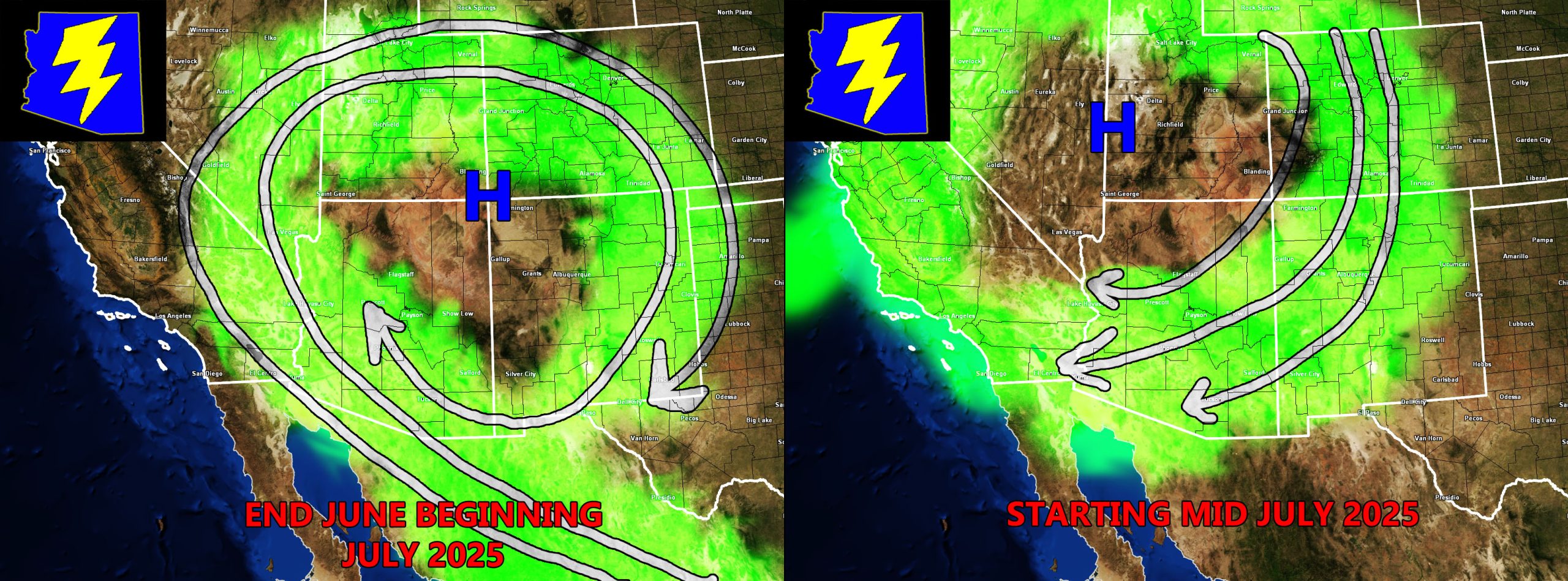
Signs of an active July, especially mid-month, are coming from where the ridge of high pressure will set up. The ridge will set up shop in the four corners region, which brings a healthy flow of monsoon moisture out of Mexico. This is the usual pattern for storms, but there is another pattern that favors the low terrain that looms on the horizon.
When a ridge of high pressure shifts to the northwest over Nevada and Utah in response to a large trough of low pressure in East-Central Canada, the flow in the upper levels will me out of the northeast, and quite fast at that. This flow usually builds storms across the Higher Terrain and Mogollon Rim locations. With the northeast to southwest flow, these storms then move southwestward into Tucson, Pinal, and the Phoenix forecast zones. The instability from the low terrain then clashes with the cold outflow boundaries and storms fire in the valleys as a result.
The same ridge placement was responsible for an active July and August for the 2021 season. This is what we are looking at now. This does not happen every year, as a ridge placement like this would be every three to five years. Ridge placement in July and August along with an active Eastern Pacific Hurricane Season will make for the active monsoon to come.
Raiden Storm
Master General Meteorologist