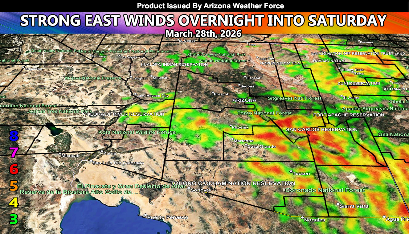
Arizona Weather Force has issued a High Wind Warning for overnight into Saturday …
Use the images within this post for your area. A backdoor dry cold-front will move through the area overnight tonight and into Saturday. This will create a strong gradient at the surface pressure level for strong east winds to develop. Target zones will be Tucson, San Tan Valley, Graham County, and stretching along I-10 through Maricopa and La Paz County as well. Wind gusts from 40-60 mph will be likely during the warning period.
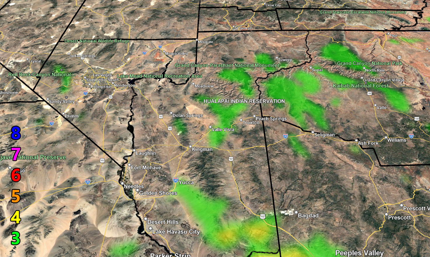
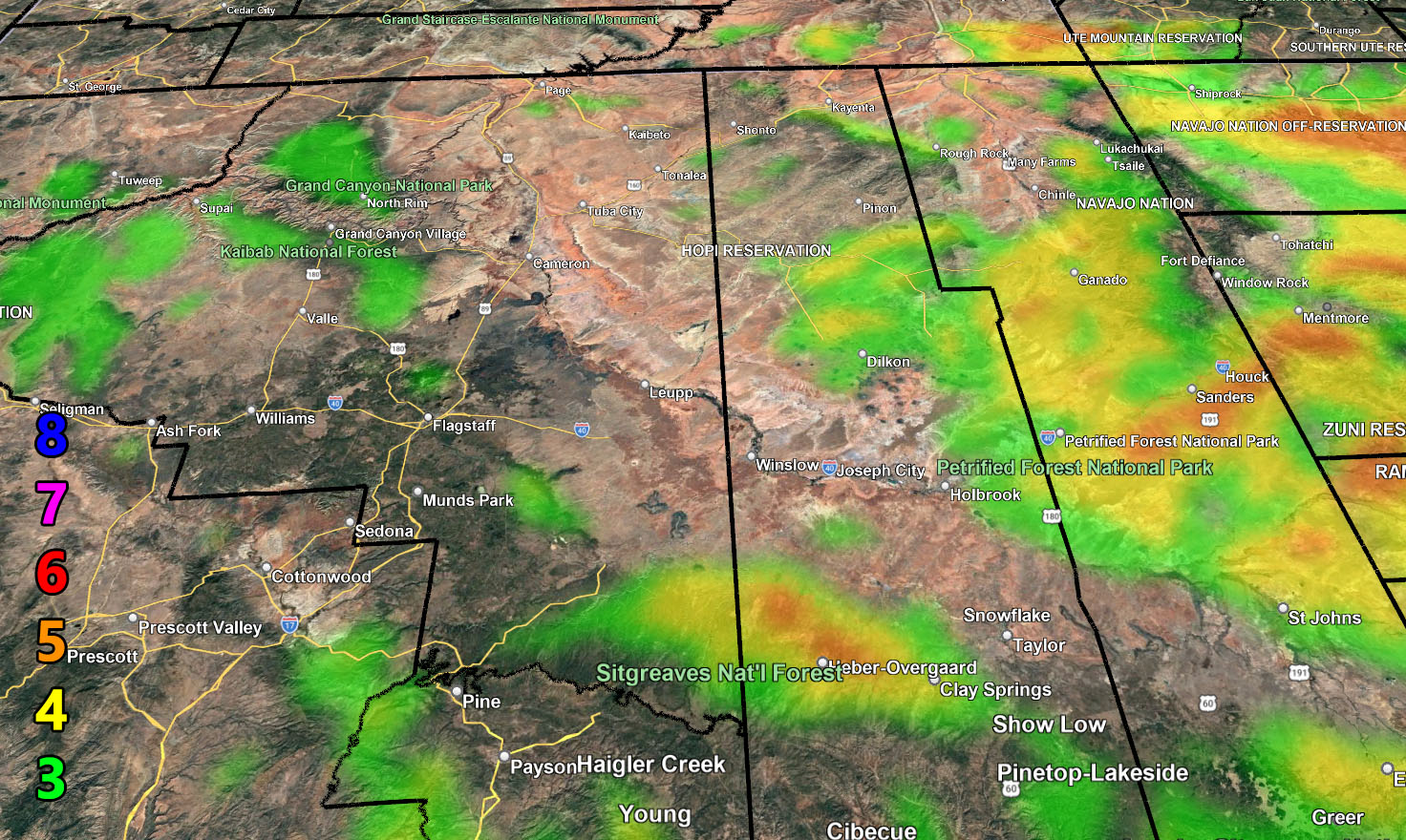
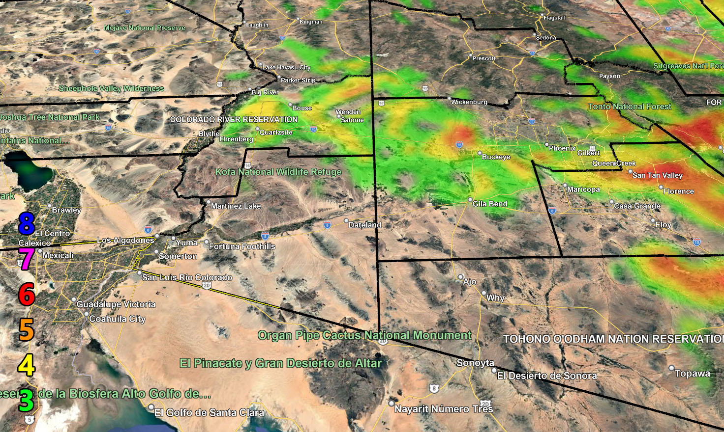
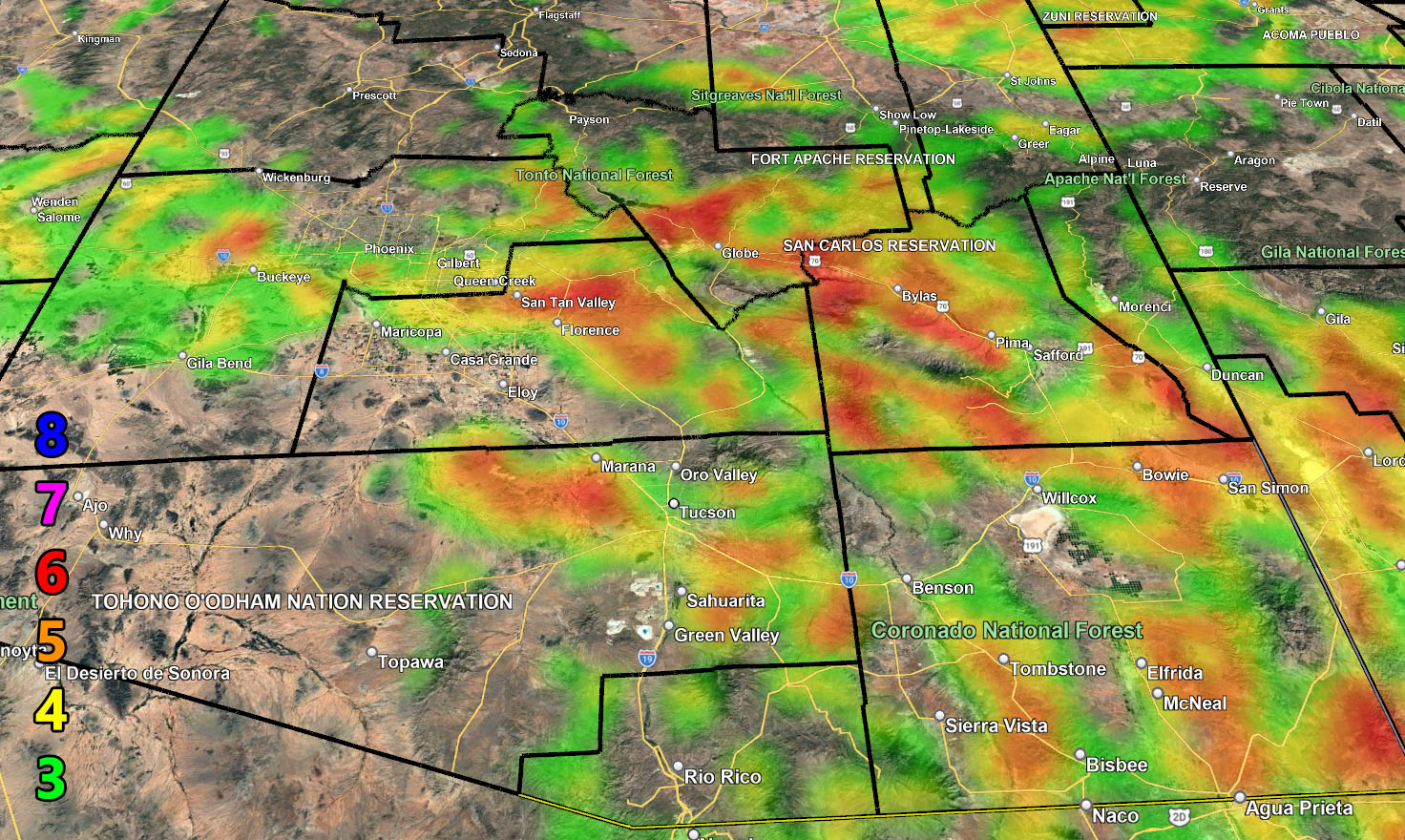
Here are your zoom in maps
WIND
Raiden Storm Wind Gust Intensity Scale –
8. Extensive widespread damage.
7. Trees are broken or uprooted, building damage is considerable. – High Profile Vehicle Roll-Over CERTAIN.
6. SOME Trees are broken or uprooted, building damage is possible. – High Profile Vehicle Roll-Over Likely, Do NOT recommend Traveling in this zone. This zone also is the starting zone where trees and powerlines will fall and damage cars and even kill people near or in them!
5. Slight damage occurs to buildings; shingles are blown off of roofs. HIGH WIND WARNING CRITERIA – High Profile Vehicle Roll-Over Possible if weight is not corrected.
4. Twigs and small branches are broken from trees, walking is difficult.
3. Large trees sway, becoming difficult to walk. POWER SHUTDOWN THRESHOLD DURING FIRE WEATHER / WIND ADVISORY CRITERIA
Raiden Storm
Master General Meteorologist