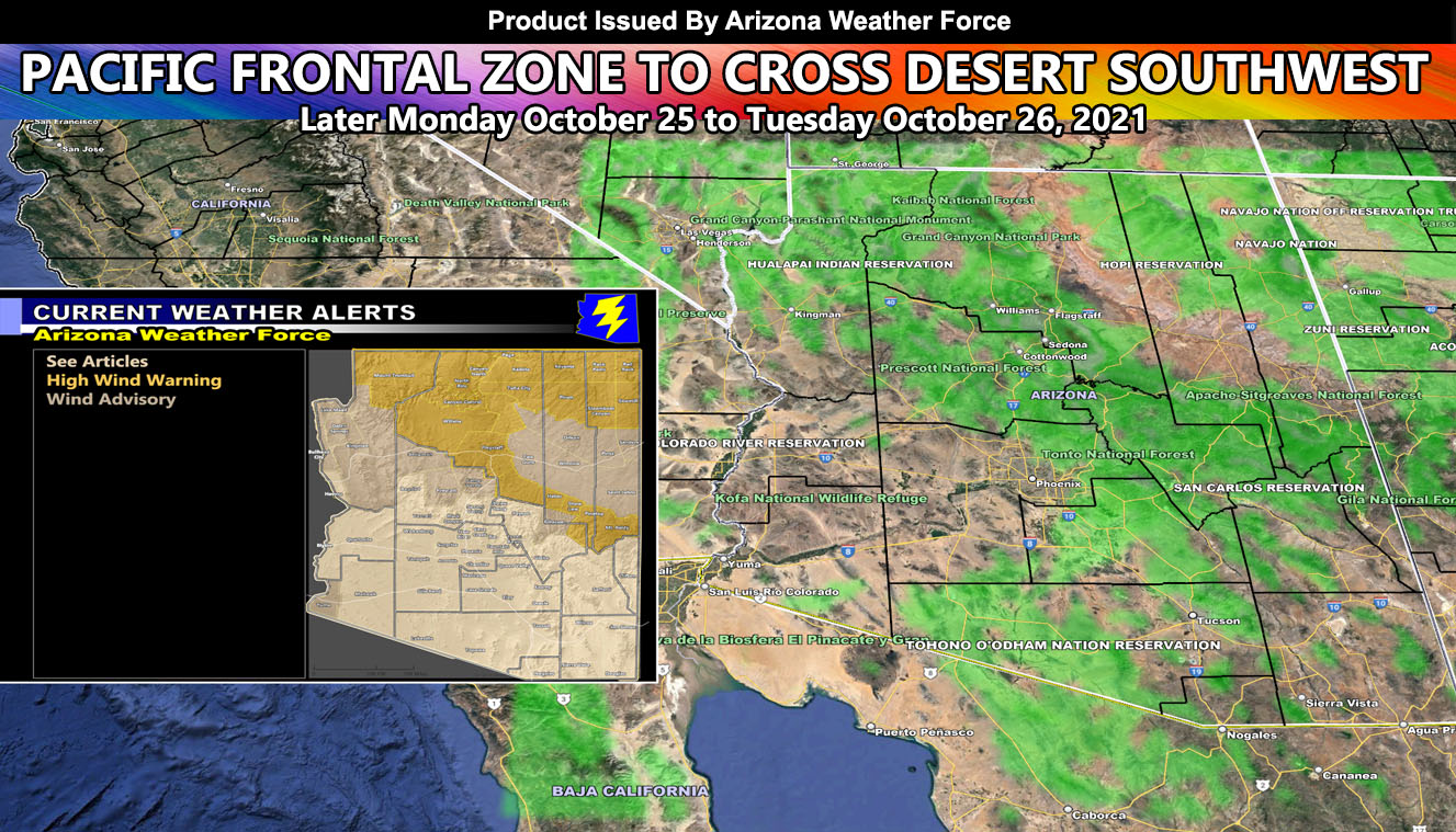
A Pacific front will move through Arizona later on Monday into Tuesday, bringing rain for some, wind for others, a combination of both, and very high snow levels so for details and see the AZWF zoom in models by reading on ….
There is not much to say about this one. The frontal zone will vanish in terms of precipitation over Southern California’s Riverside County Mountains, leaving the metro areas mainly dry. Until Monday night, the southwest flow bringing some rain to the East/Northeast Maricopa County areas while leaving the rest of the county dry, the most rain will fall across the Mogollon Rim once again, as well as the stronger winds. There are no winners in the focus spots here, Flagstaff will probably end up having the combination of higher winds and higher rainfall amounts.
Snow-levels will be above 9,000 FT so winter alerts will not be issued. Use the images below
NOTE: Micro-climate alerts for smaller areas that do not contain metros like Phoenix or Tucson are NOT posted on the main Arizona Weather Force Facebook Page, which can be found by clicking here. They however ARE posted on the main Arizona Weather Force GROUP where members post photos and videos. ALL alerts issued from this office are posted there and you can find it by clicking here
ALTERNATIVE PREMIUM SERVICES: You can be a premium member and get your own control panel for your area to receive micro-climate alerts by email when issued. This is a great way to not wait for social media. We all know what happened at Facebook, but this website will always work to send emails. Usually $20 a season for the start, it is $13 for service now through November 30th, a great deal. On November 1st, it drops to $6 to finish the month. On December 1st, the Winter Tier begins and it pushes back to $20. So if you want service for these events for the rest of the Fall Tier until November 30th, CLICK HERE TO JOIN THE SERVICE …
Now for your AZWF model images …
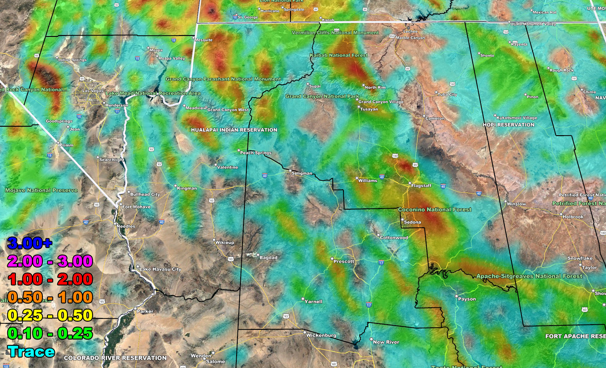
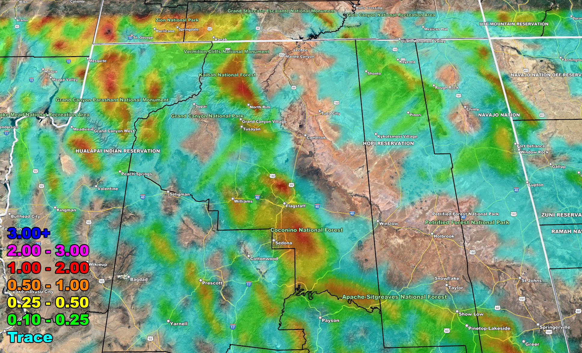
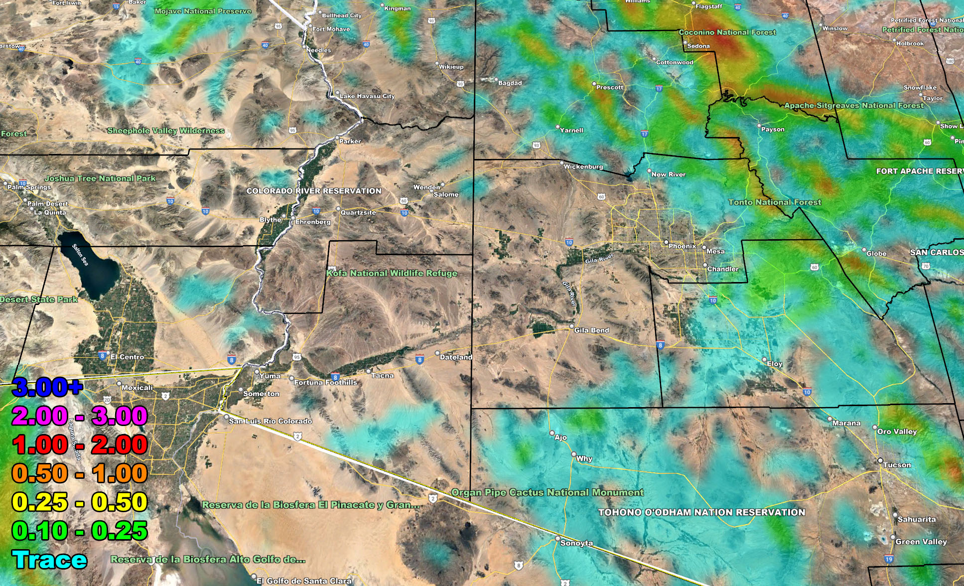
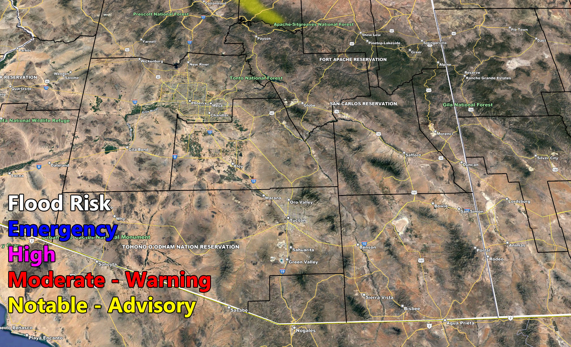
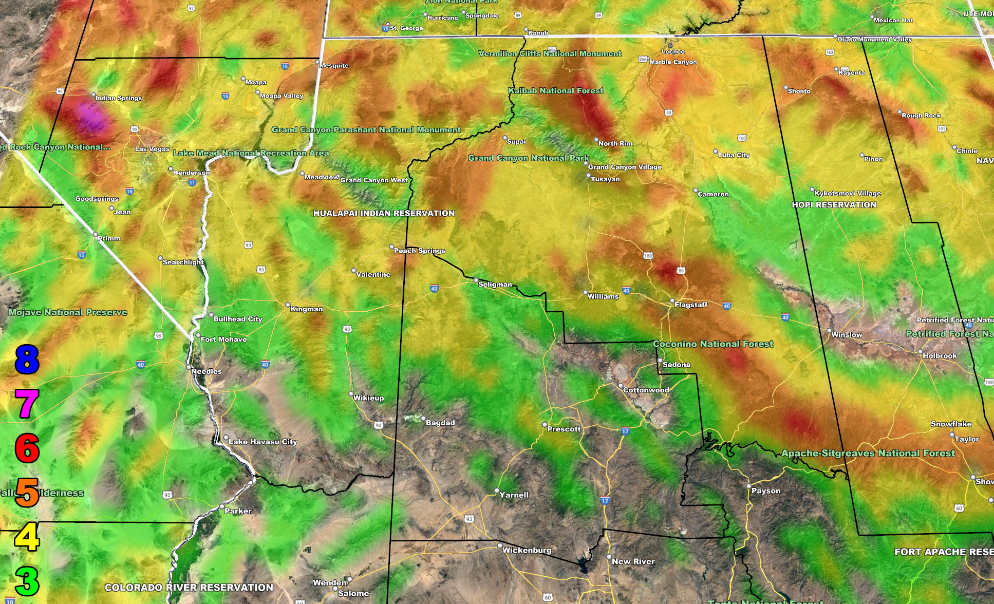
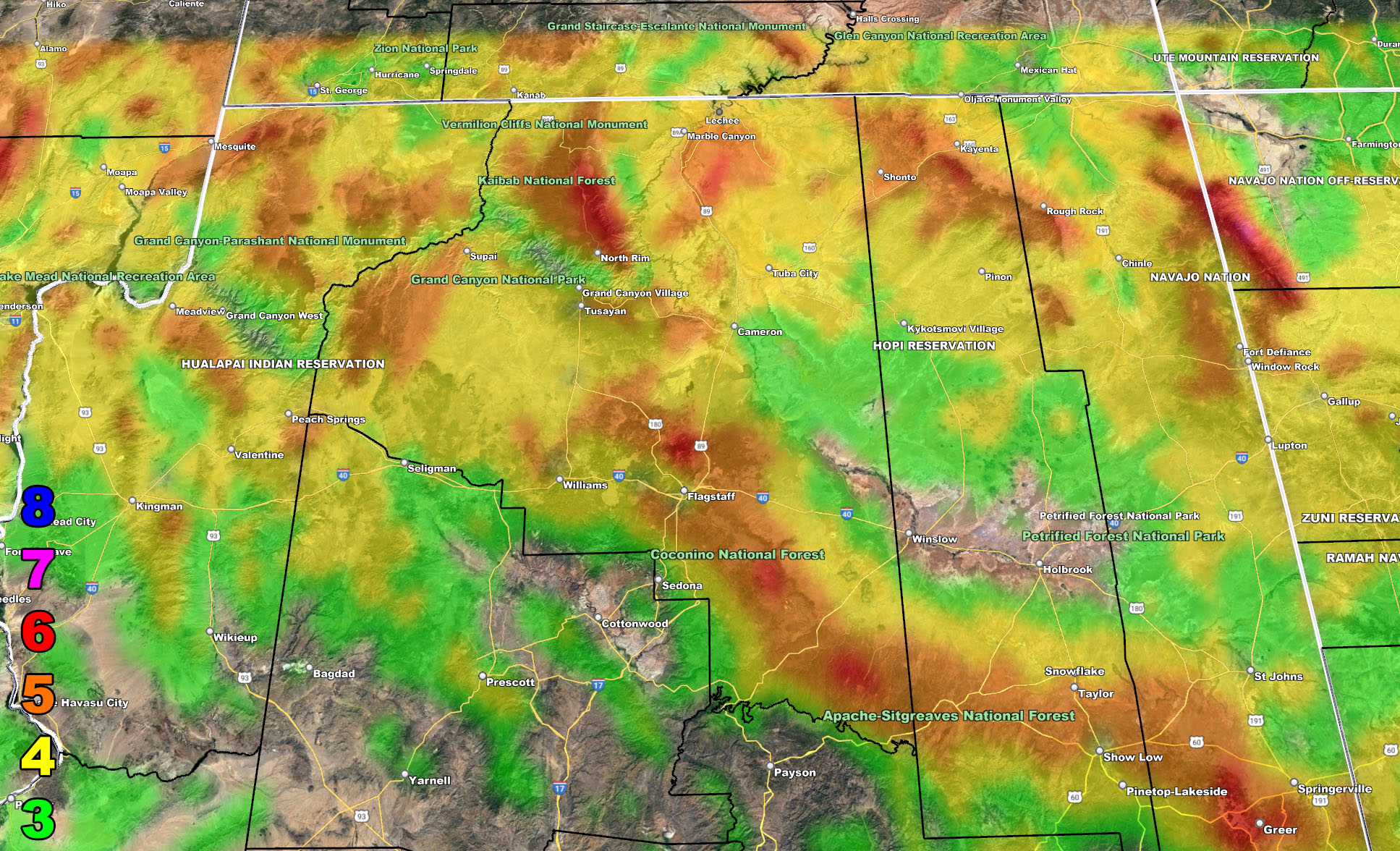
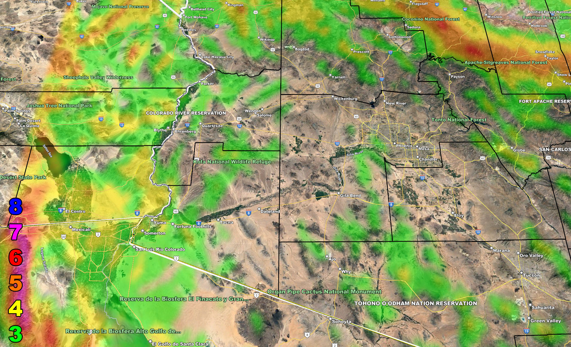
I control all the counties in Arizona so there is a lot to say for various areas. The best I can do is let the images below speak for themselves. They are separated into two rows of four. Four zones that I control. If you are in Arizona, you are in one of these. Each is identical so zone 1 is the same on all the rows and so on. Here is the key to the rows below. They are extremely detailed. Zone 1 is NW AZ, 2 is NE AZ, 3 is SW AZ including Phoenix, and 4 is SE AZ including Tucson.
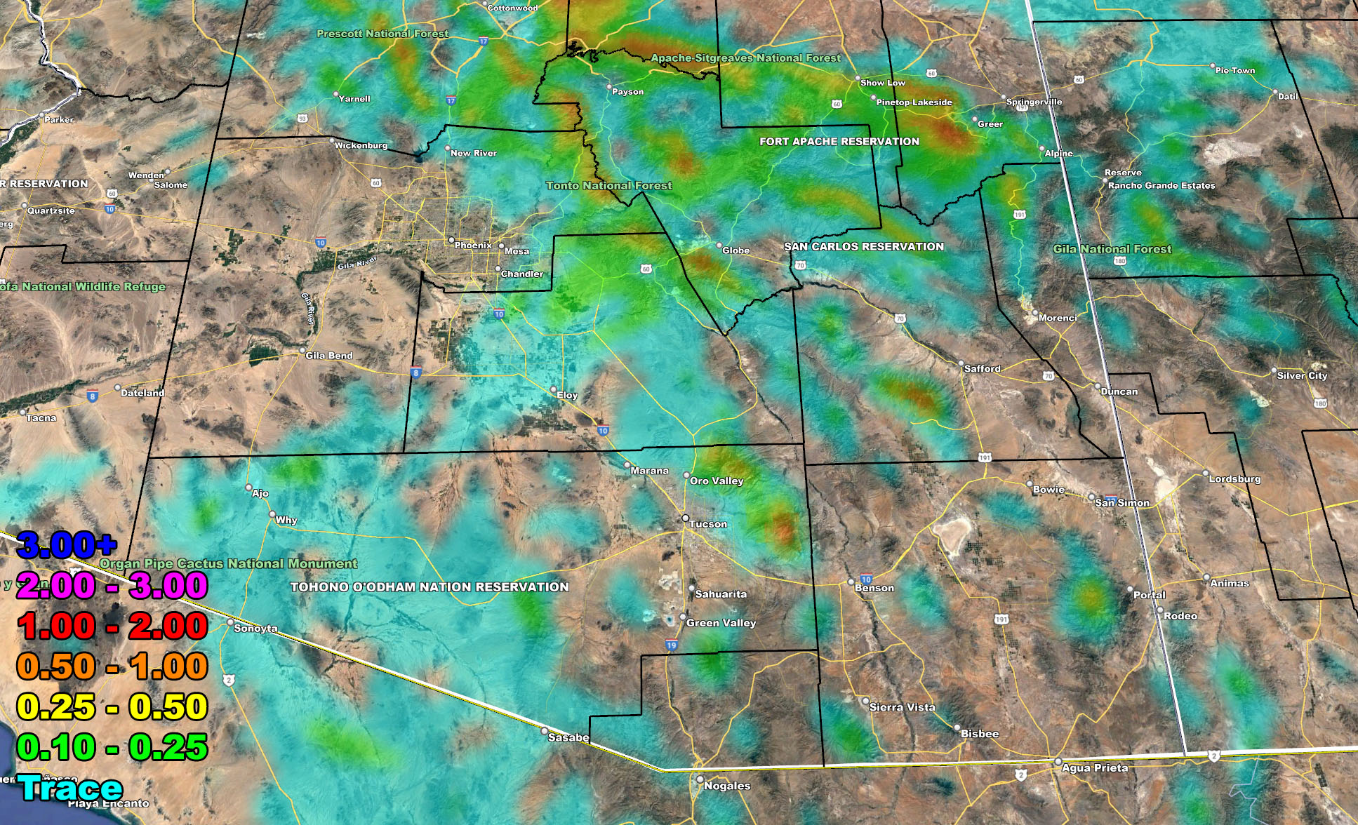
Row 1 – Rain Amounts
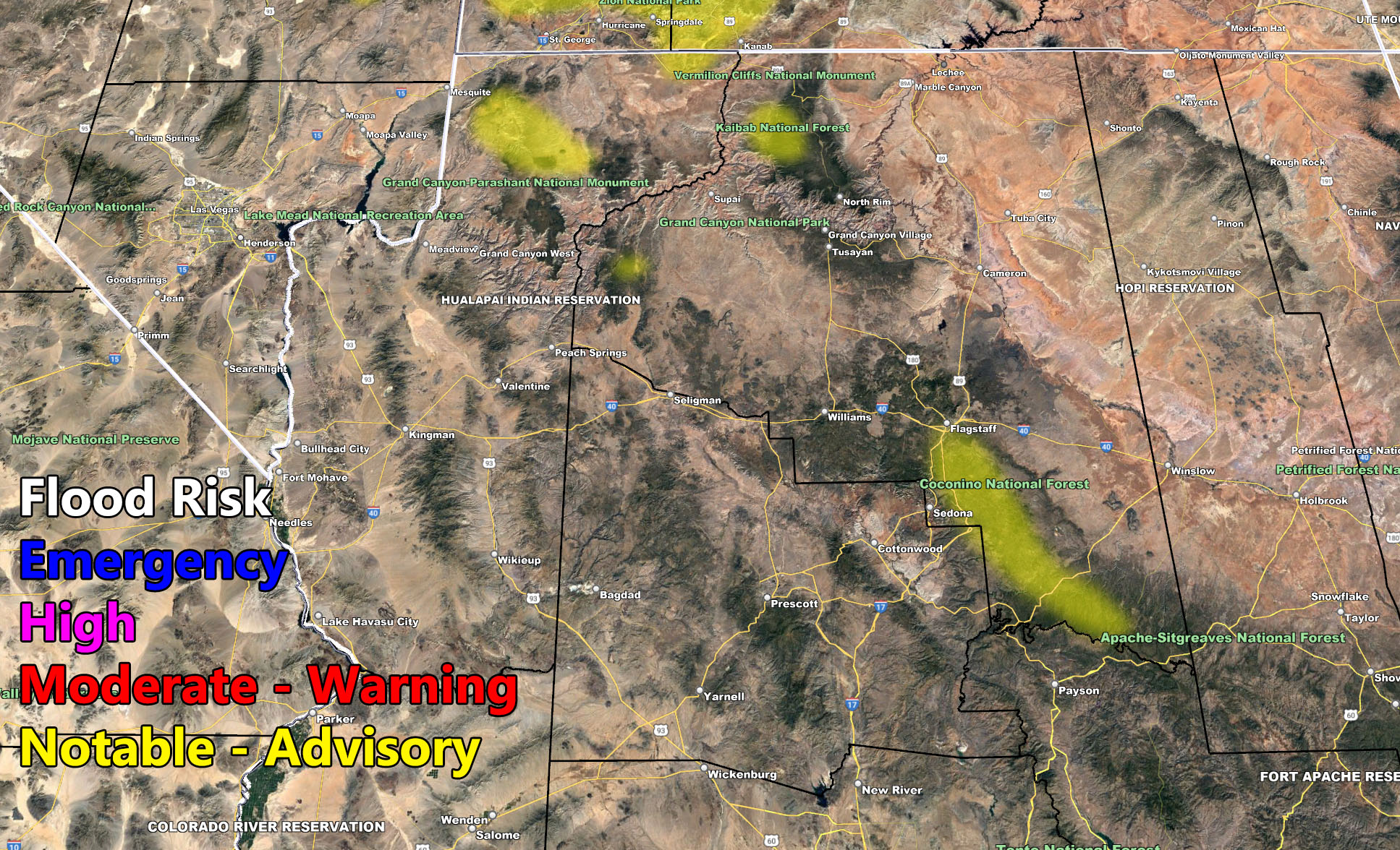
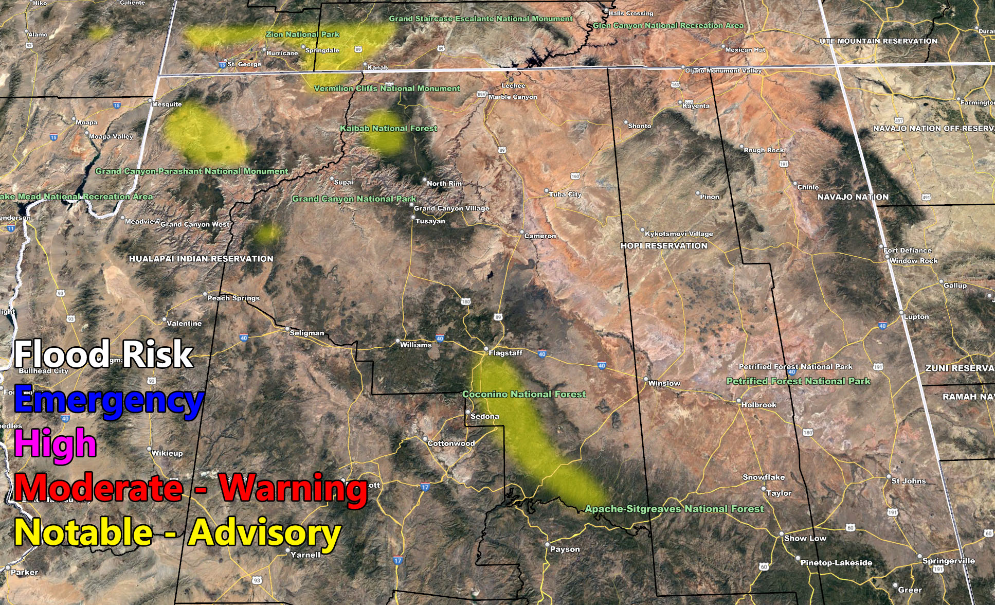
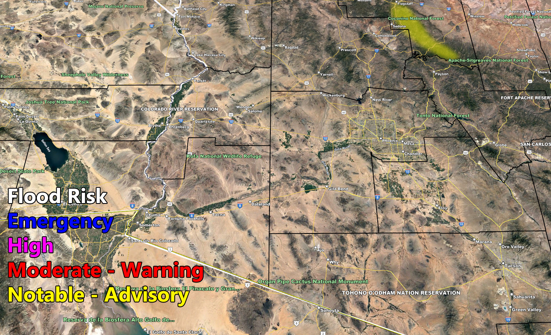
Row 2 – Flood Risk
Row 2 – Wind Gust Risk
NOTE: You also can get e-mailed alerts/articles because if you do not want to miss my social media posts, and/or I issue a product not on my social media accounts, being a supporting website member is the way to go. Click here if you are interested in reading more.
Row 1 – Rain Amounts
Row 2 – Flood Risk
Row 3 – Wind Gust Risk
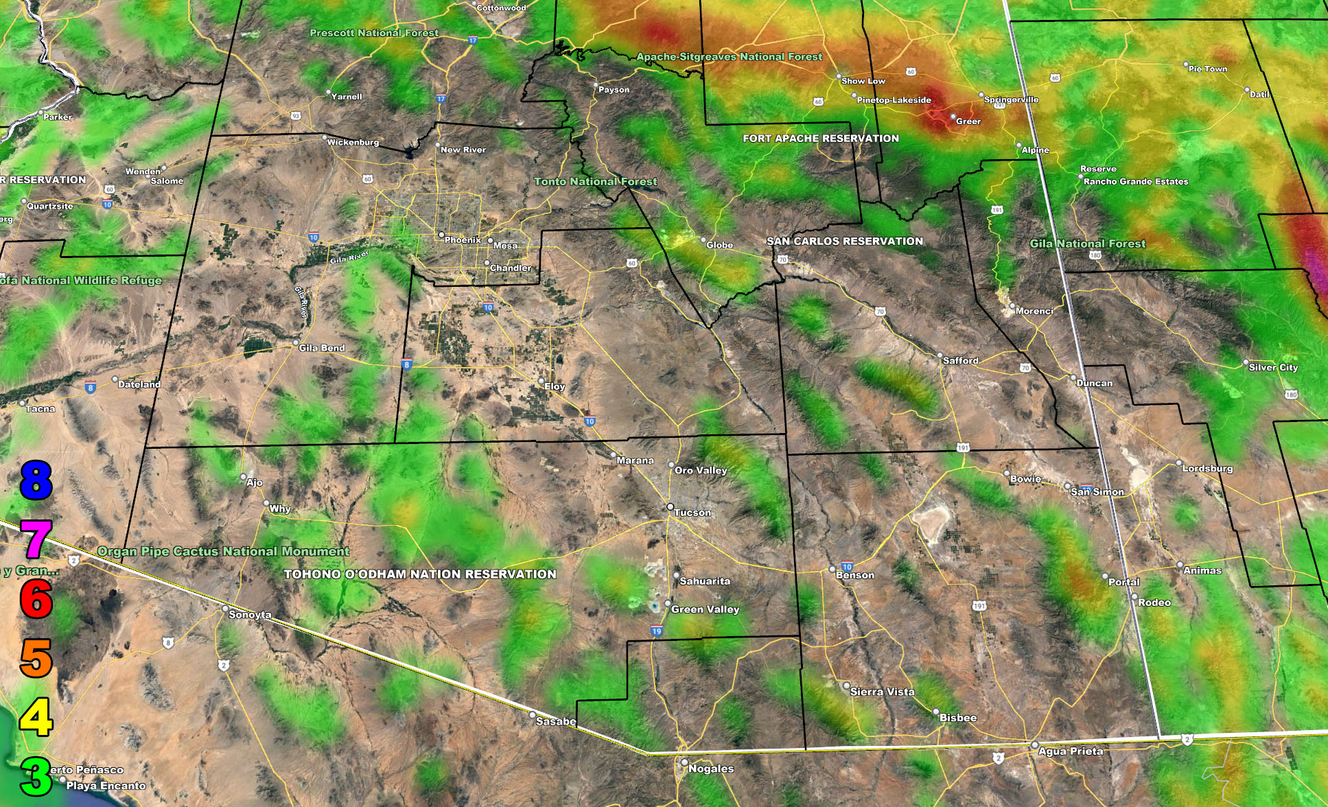
Martin Wind Gust Intensity Scale – Use for Wind Images Below
8. Extensive widespread damage.
7. Trees are broken or uprooted, building damage is considerable. – High Profile Vehicle Roll-Over CERTAIN.
6. SOME Trees are broken or uprooted, building damage is possible. – High Profile Vehicle Roll-Over Likely, Do NOT recommend Traveling in this zone
5. Slight damage occurs to buildings, shingles are blown off of roofs. HIGH WIND WARNING CRITERIA – High Profile Vehicle Roll-Over Possible if weight is not corrected.
4. Twigs and small branches are broken from trees, walking is difficult.
3. Large trees sway, becoming difficult to walk. WIND ADVISORY CRITERIA
MAIN WEBSITE: Don’t forget. If you hear rain or anything is coming to the area. BOOKMARK THE MAIN WEBSITE BY CLICKING HERE. The stream has the latest alert links, a map of alerts and where, and articles. That is 100% free to view. There should be no reason you shouldn’t be informed.
As always, stay tuned to Arizona Weather Force for official forecasts and updates on weather across Arizona and if it says ‘like page’ below, hit the button and get future updates. If it says liked, don’t hit it because that’s unfollowing and you won’t get updates at AZWF page on your feed