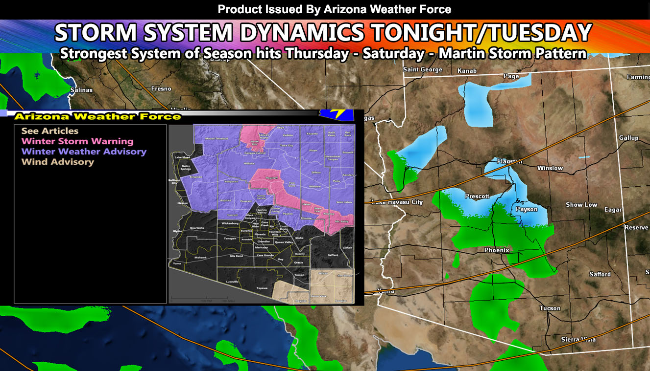
A storm system will cross the state starting tonight, mainly Tuesday, and kicking out Wednesday before the strongest system of the season thus far hits on Thursday and lasts until Saturday so read on for details as this is a map only article for rain, snow, and wind for tonight/Tuesday’s system as it is not the main focus …
FACEBOOK PAGES TO JOIN!
ARIZONA WEATHER FORCE MAIN: Arizona Weather Force Office Main Page For updates
A system that will affect the Southern California Weather Force forecast area today into tonight will also affect Arizona. All the rain, snow, and wind models have been updated here and in the AZWF premium member section.
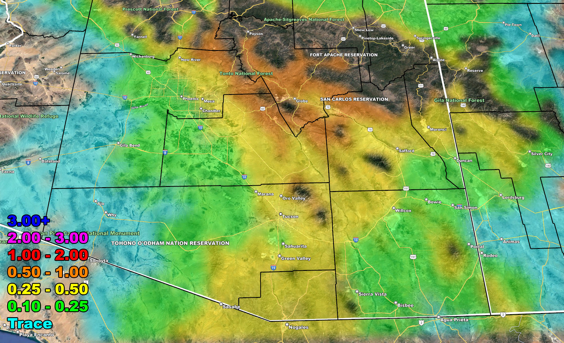
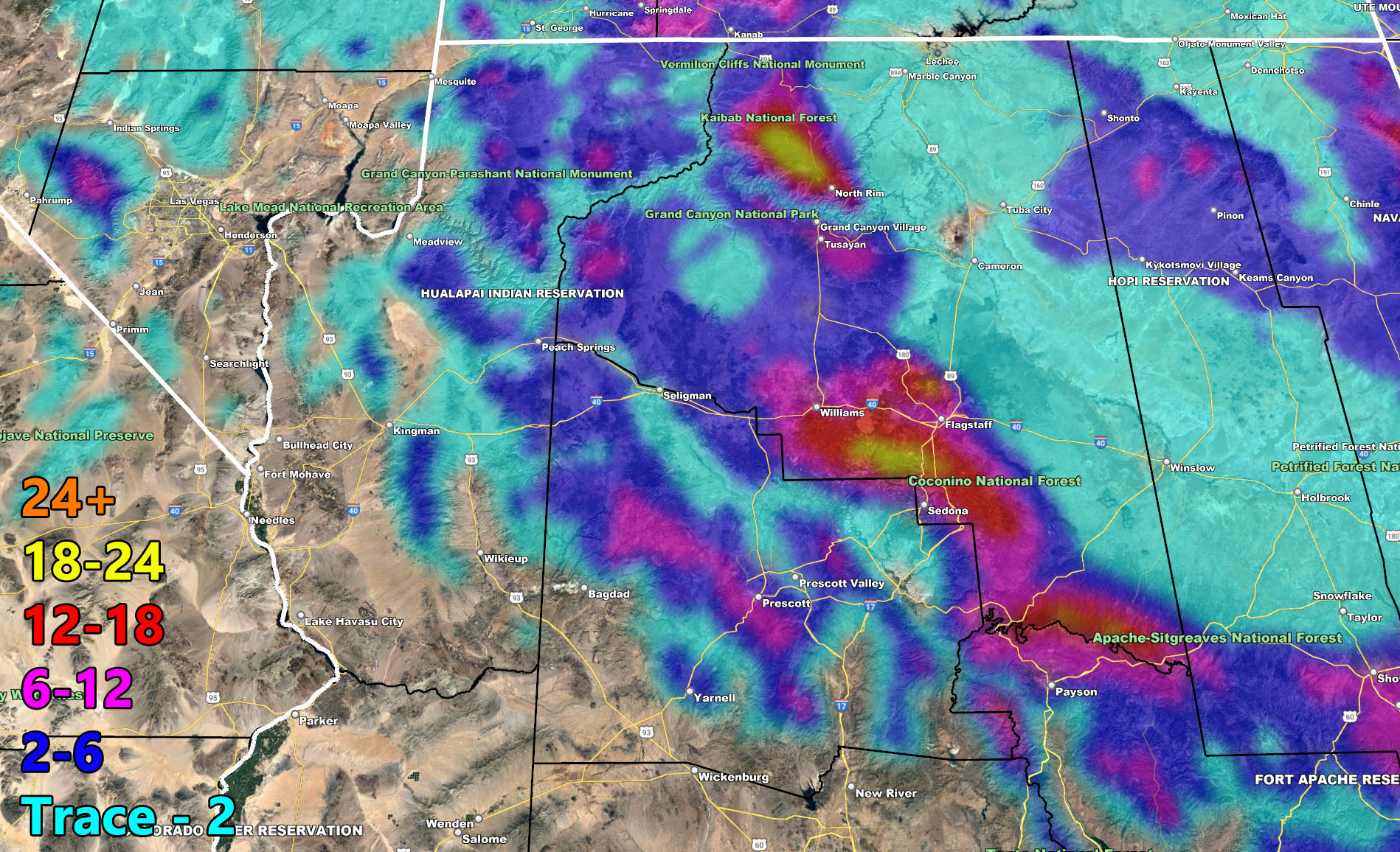
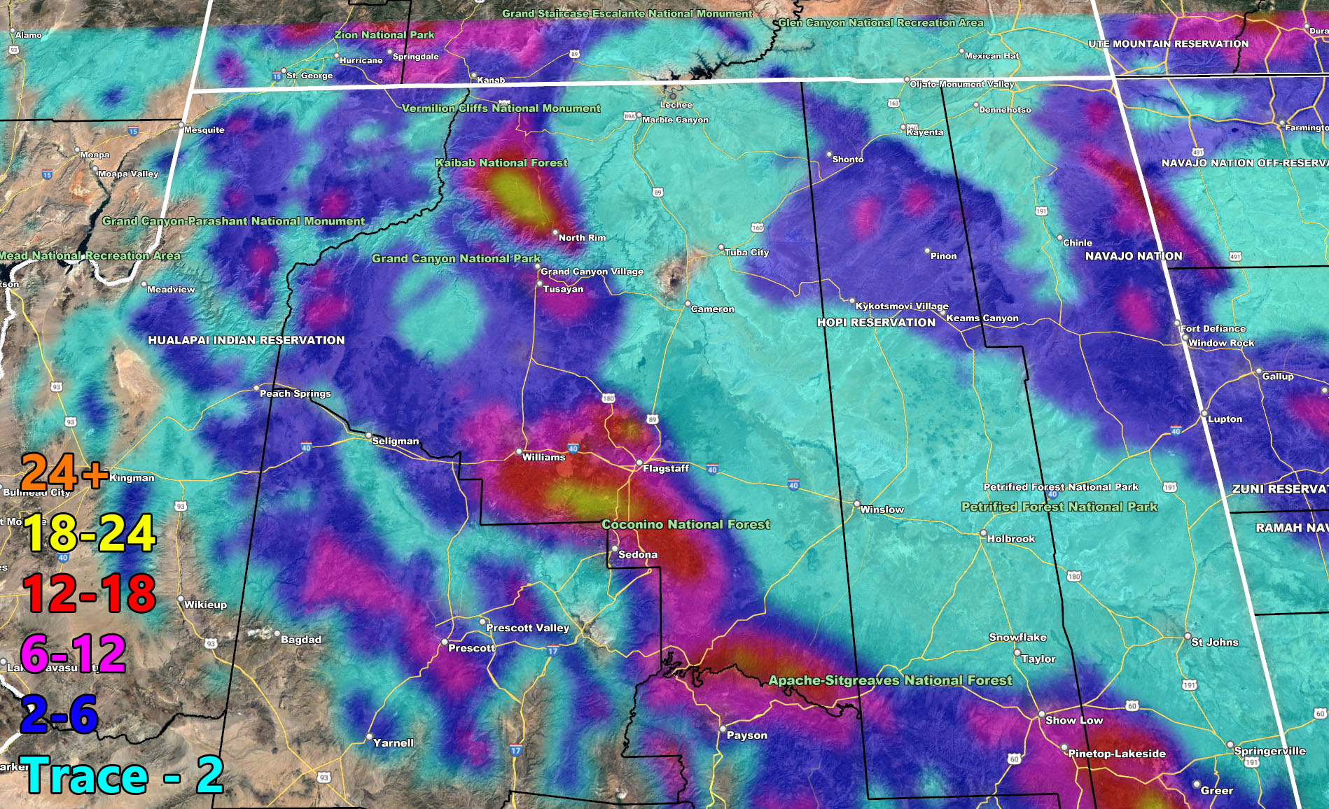
There isn’t much to say about this system. Really no key-points. It is a typical system that will work on orographic lifting so the closer you are to the foothills/mountains the more precipitation you will see Use the maps below for rain, snow, wind. Every adult should know where they are on a map.
NEXT STORM: The storm on Thursday, Friday, and into Saturday morning is the MAIN FOCUS I need to focus on and do a write-up about it. It will be the most dangerous system to hit Los Angeles in many years all due to the pattern it has. The track pattern is an upper level low to southwest of both Southern California and Arizona. As this moves east, it will scoops up an atmospheric river into Arizona Thursday, Friday, and departing Saturday. This is a long duration event and does have the dynamics for thunderstorms as well, given the upper-level divergence.
Please keep scrolling below for these images valid TONIGHT INTO TUESDAY … NOT ANY OTHER DAY … READ WHAT I PUT …
A Martin Storm Pattern means that the pattern was predicted before apps or government/private sources, and since my last name is Martin, like a person who discovered a comet, it is only fair this coming pattern is the Martin Storm Pattern of December 2021. There will be MANY Martin Storm Patterns due to my ability to go longer range in weather.
These maps in this article are also on the Member Section GPS where you can see where you on within them, even while driving during the day/night of the valid event – If you like the GPS feature, consider getting a membership this season. AZWF Members, click below to enter…
Click Here for the GPS Member Section
CURRENT AZWF MEMBERS: I CANNOT provide one-on-one emails about your accounts. You have a troubleshoot section. That is ALL I can and will provide. You also have a password reset option in the contact us tab on this website. I simply CANNOT have a ton of e-mail asking about accounts when storm events are in progress. I am VERY and I mean VERY BUSY and it is YOUR responsibility to get into your account, read the troubleshoot and how-to sections, checkmark the right zones to receive e-mail and maintain your account. That is NOT my job … Be responsible and READ … You’re adults, read EVERYTHING I put … It is not rocket science as I made this process extremely easy. You pay for an account, you wait for the e-mail to welcome as I do it MANUALLY not AUTOMATICALLY, read the e-mail, hit the troubleshoot/how-to section, set your account up in the zone area to receive email alerts, get to know how to use the GPS feature, and that is it. Please understand this, I simply cannot do one-on-one when storms are in progress or coming. You pay for your account, NOT ME … I only provide the tools for its worth. To troubleshoot, here is the link to get situated.
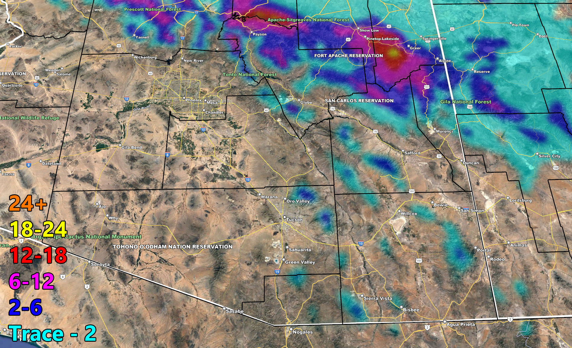
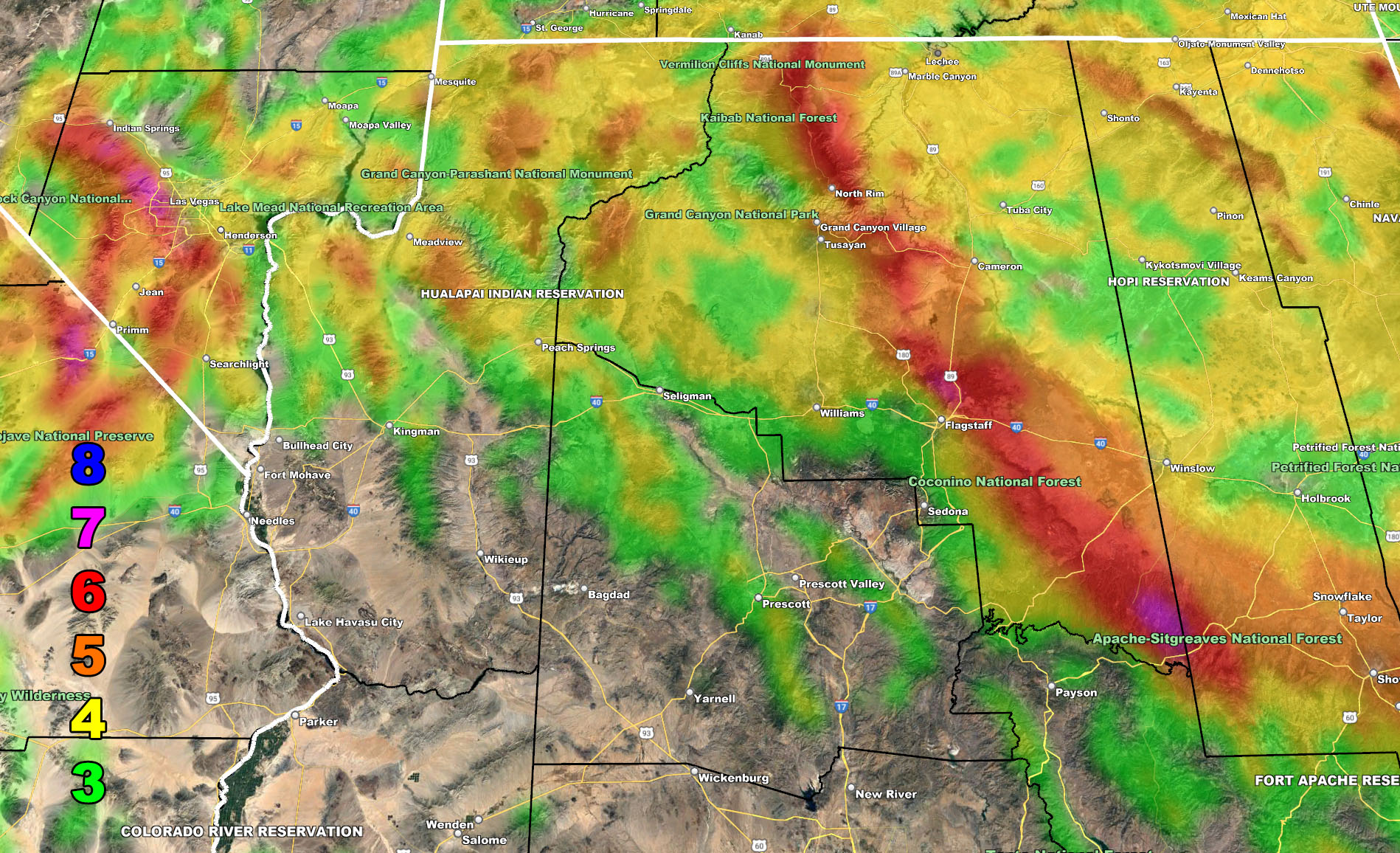
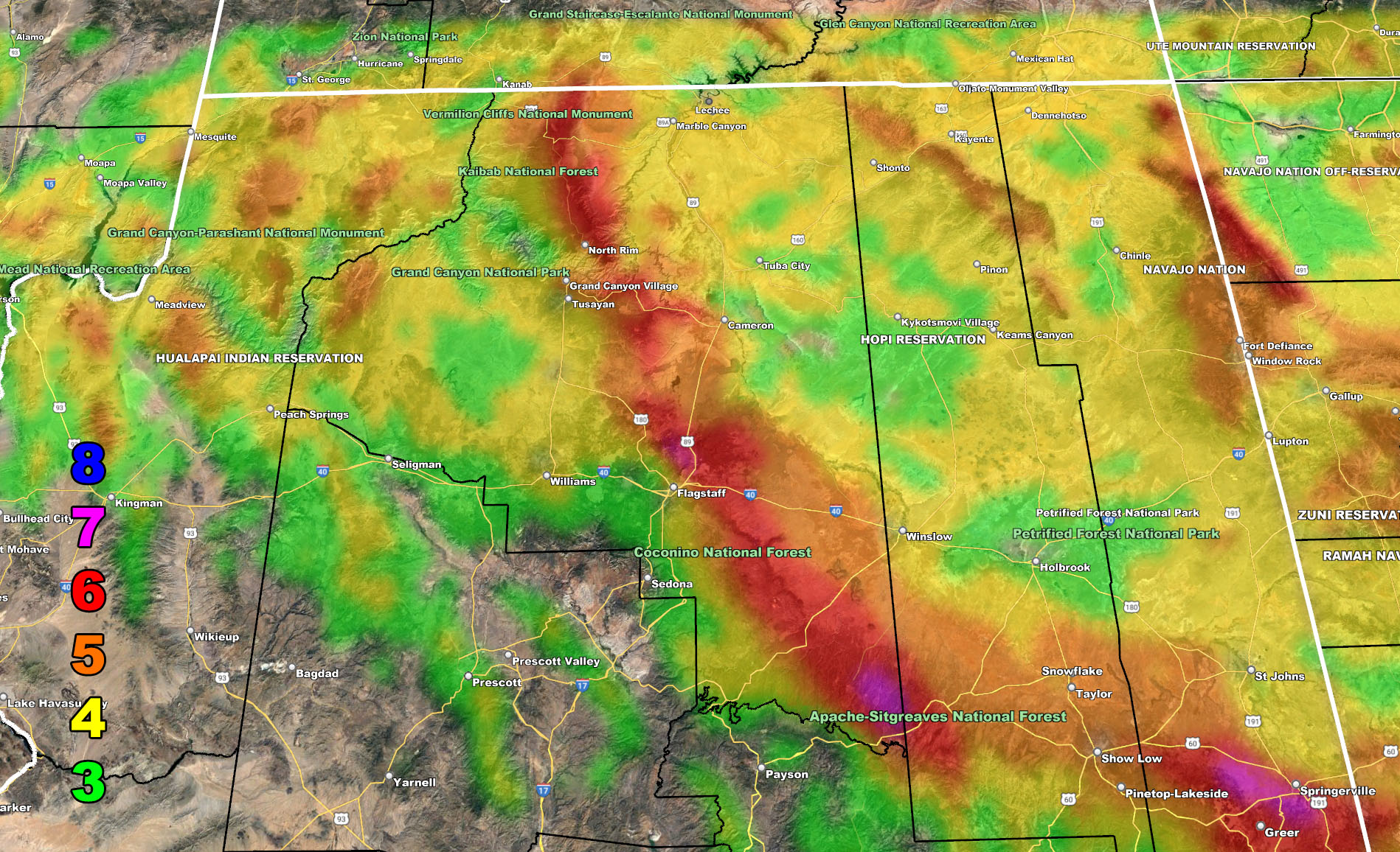
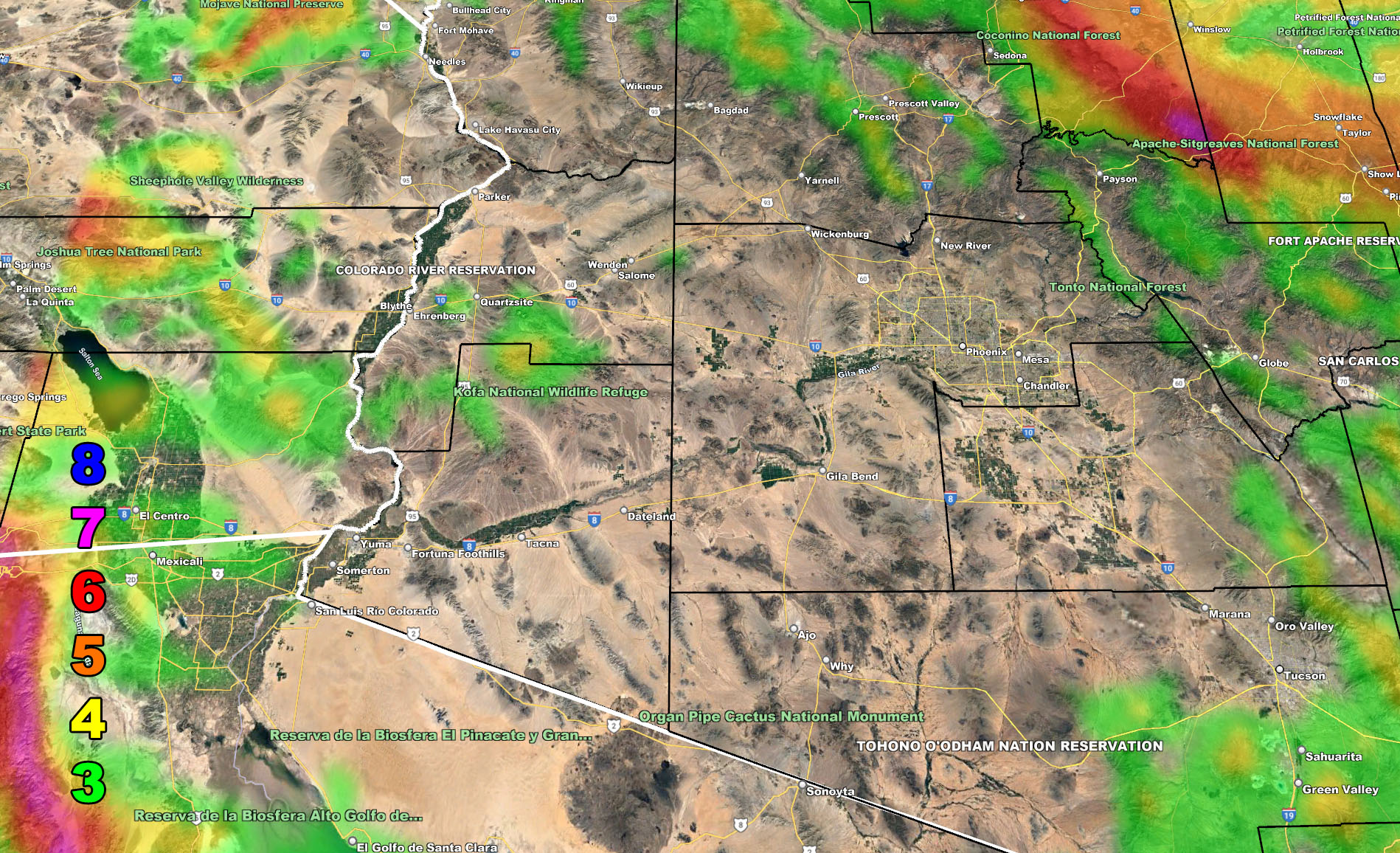
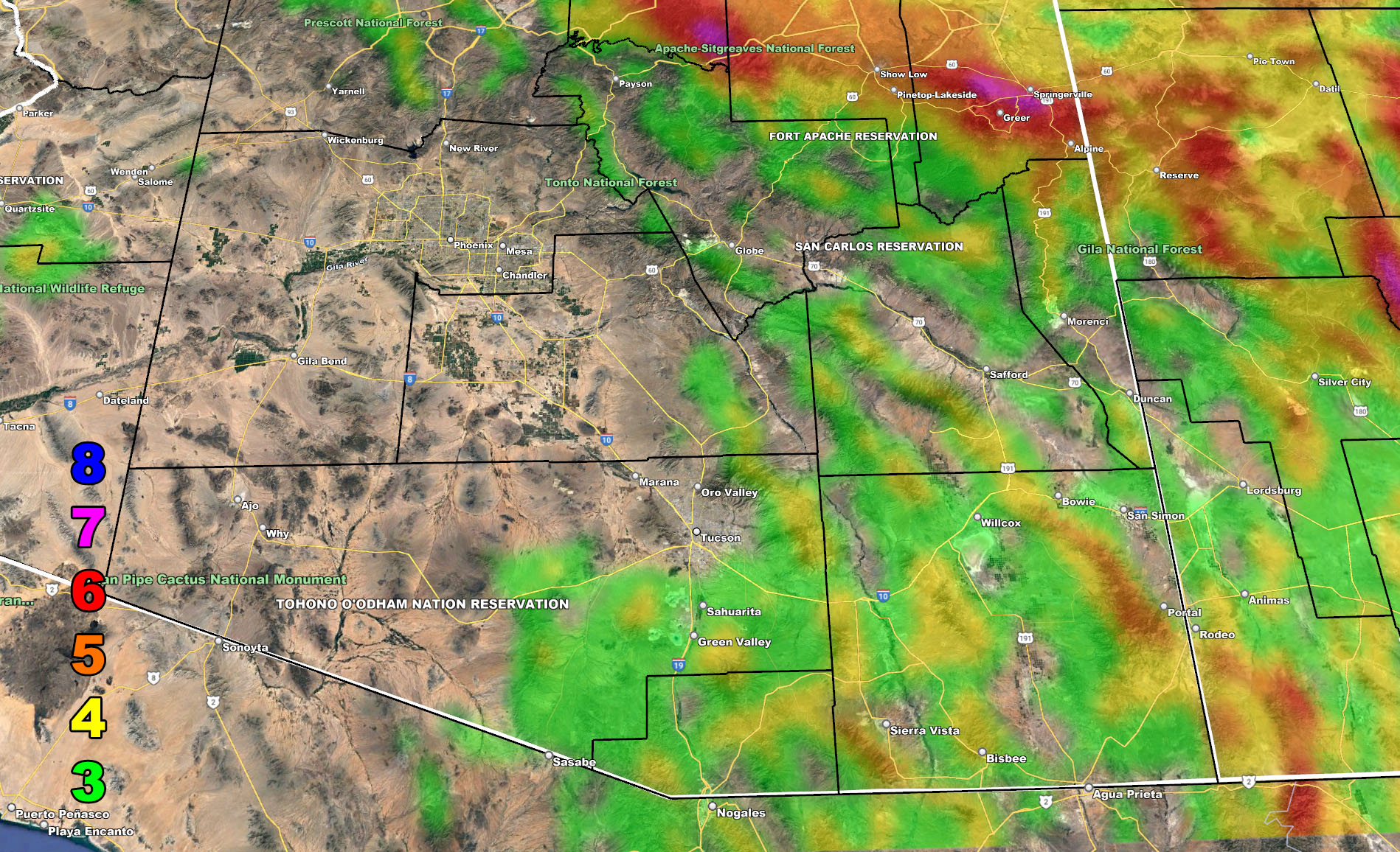
Below are the AZWF models in the form of rain, snow, and wind, snow-levels, or whatever is available for this forecast. They are clickable. Image 1 is NW AZ, 2 is NE AZ, 3 is SW AZ, and 4 is SE AZ –
Rain Forecast – Valid Tonight into Tuesday
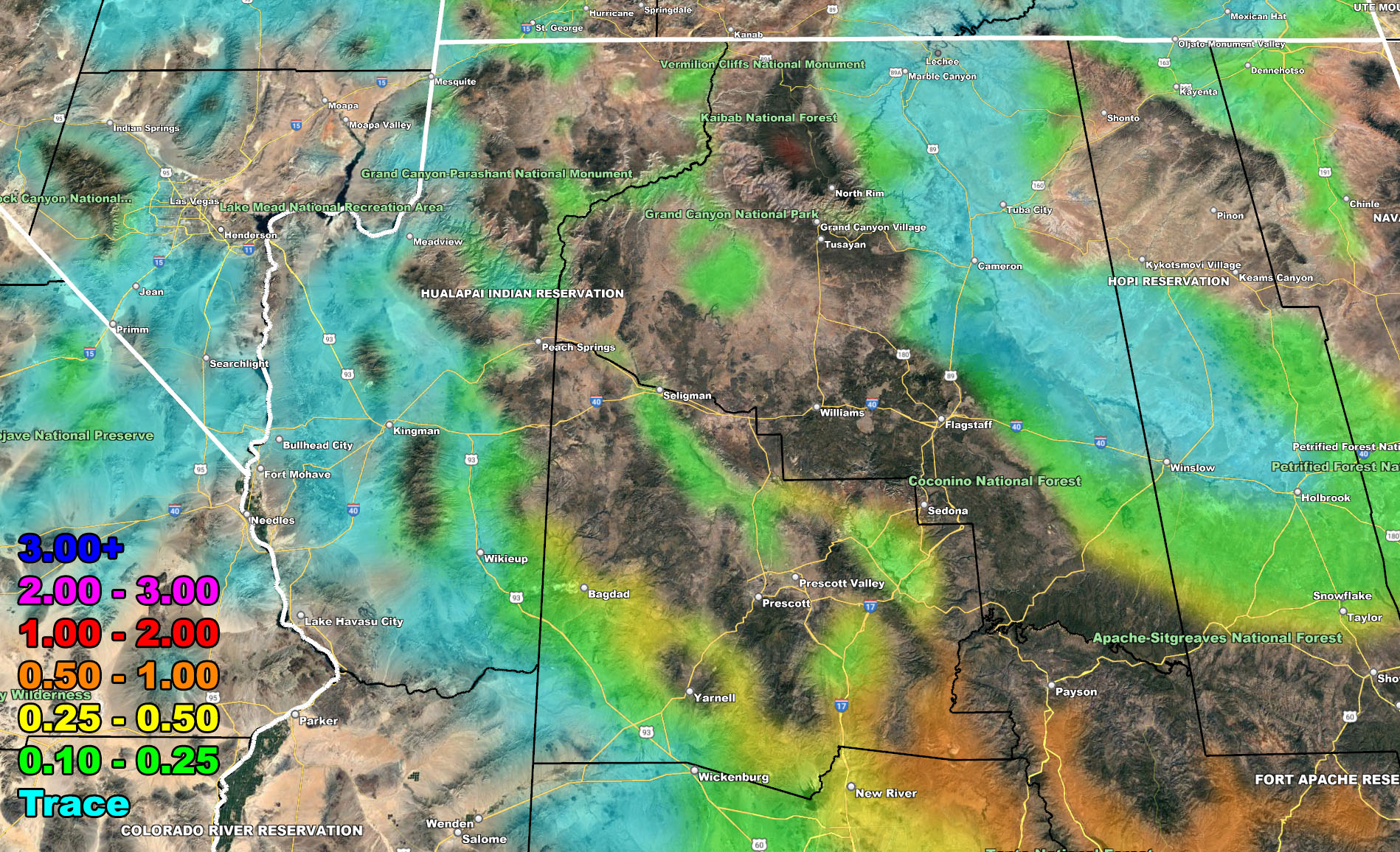
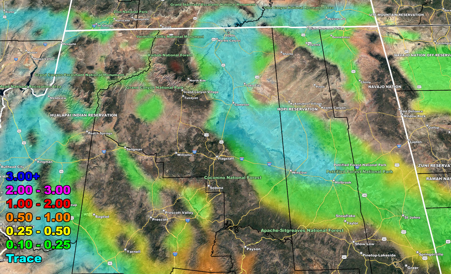
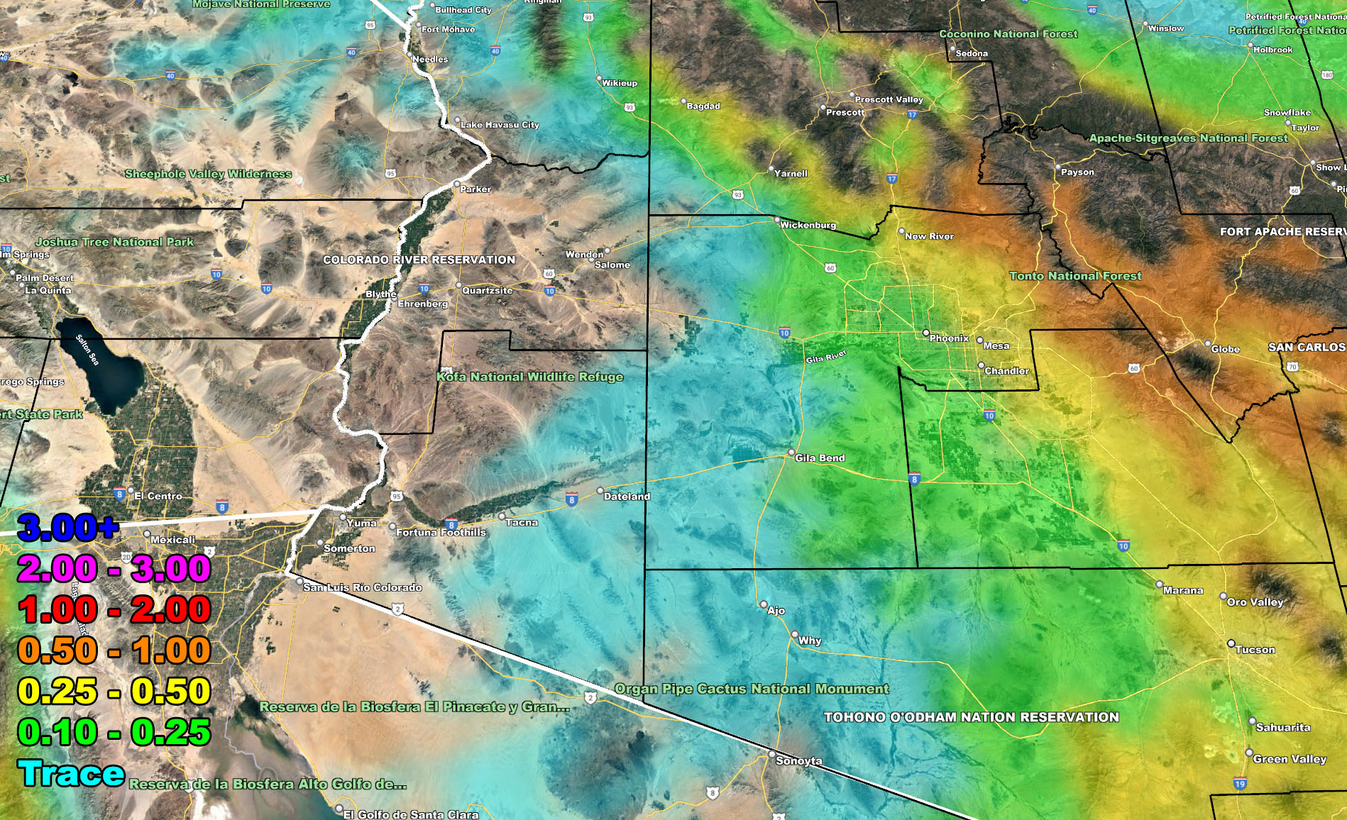
Snow Forecast – Valid Tonight into Tuesday
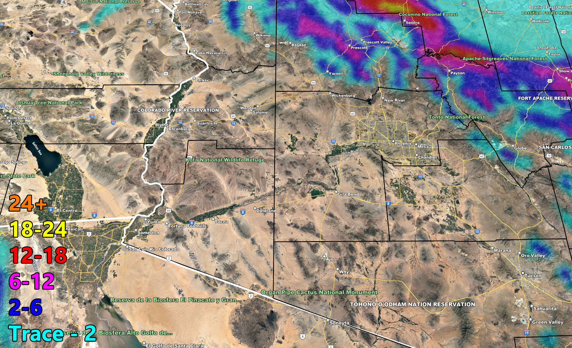
Wind Forecast – Valid Tonight into Tuesday
FACEBOOK PAGES TO JOIN!
ARIZONA WEATHER FORCE MAIN: Arizona Weather Force Office Main Page For updates
These maps in this article are also on the Member Section GPS that is open to the public until this storm has passed, then it goes to members only. If you like the GPS feature, consider getting a membership this season.
Click Here for the GPS Member Section
LONG RANGE: With the ridge shoved west to north of Hawaii, the door remains open for storm after storm through the end of the month for the region so stay tuned for updates …
If you are NOT receiving the e-mails and are a full member, your account is either expired or you need to troubleshoot. To troubleshoot, here is the link to get situated.
NOTE: You also get e-mailed alerts/articles because if you do not want to miss my social media posts, and/or I issue a product not on my social media accounts, being a supporting website member is the way to go. You get your own control panel with hundreds of zones to choose from to receive my custom alerts from. Click here if you are interested in reading more.
MAIN WEBSITE: Don’t forget. If you hear rain or anything is coming to the area. BOOKMARK THE MAIN WEBSITE BY CLICKING HERE. The stream has the latest alert links, a map of alerts and where, and articles. That is 100% free to view. There should be no reason you shouldn’t be informed.
As always, stay tuned to Arizona Weather Force for official forecasts and updates on weather across Arizona and if it says ‘like page’ below, hit the button and get future updates. If it says liked, don’t hit it because that’s unfollowing and you won’t get updates at AZWF page on your feed